Map size in jpg-format: 46.6843MiB
Click to open in high resolution (open in new tab).
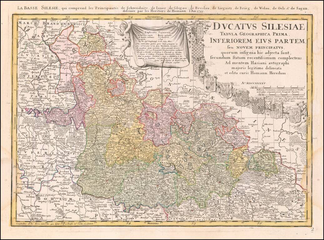
From The First Official Survey of Silesia
Detailed map of Lower Silesia, with title cartouche including coat-of-arms of Schweidniz, Iaver, Glogau, Breslau, Lignitz, Brieg, Wolau, Oels and Sagan, with early pencil notes next to each coat of arms.
The map was originally published separately in about 1736 and was later issued in the Homann Heirs Atlas Silesiae Id Est Ducatus Silesiae Generaliter Quatuor Mappis Nec Non Specialiter XVI Mappis Tot Principatus Repraesentantibus Geographice Exhibitus of 1750.
The map is based upon land surveys by Johann Wolfgang Wieland, and corrected by M. v. Schubarth.
The Atlas Silesiae was a large scale atlas of Silesia, Poland, which incorporated general maps and 16 more detailed regional maps.
During the reign of Karl VI (1711 – 1740), a detailed survey of Silesia was undertaken by the engineer lieutenant Johann Wolfgang Wieland, which was completed in 1732. In 1735, Homann Heirs were assigned to publish the maps in an atlas. The maps were revised beginning in 1736 by Matthäus von Schubarth.
While the project was completed and the maps of Breslau, Brieg and Sagan were ready for publication, Friedrich II of Prussia (1740 – 1786) objected to the printing of the atlas, which delayed publication until 1750.
Homann Heirs was a German publishing firm that enjoyed a major place in the European map market throughout the eighteenth century. Founded in 1702 by Johann Baptist Homann, the business passed to his son, Christoph, upon Johann’s death in 1724. Christoph died in 1730, aged only 27, and the firm was inherited by subsequent Homann heirs. This altered the name of the company, which was known as Homann Erben, or Homann heirs. The firm continued in business until 1848.
If you are a student, write to us in telegram: @antiquemaps and indicate what material you need and for what work you need a map in high detail. We are ready to provide material on special terms. For students only!


![[Hand Drawn Prussian Military Encampment at Opole, Poland] Special Grund-Riss Des Kaeyserl Feldl Lagers bey Oppeln in Ober Schlesien](/map/small/59726.jpg)