Map size in jpg-format: 24.6284MiB
Click to open in high resolution (open in new tab).
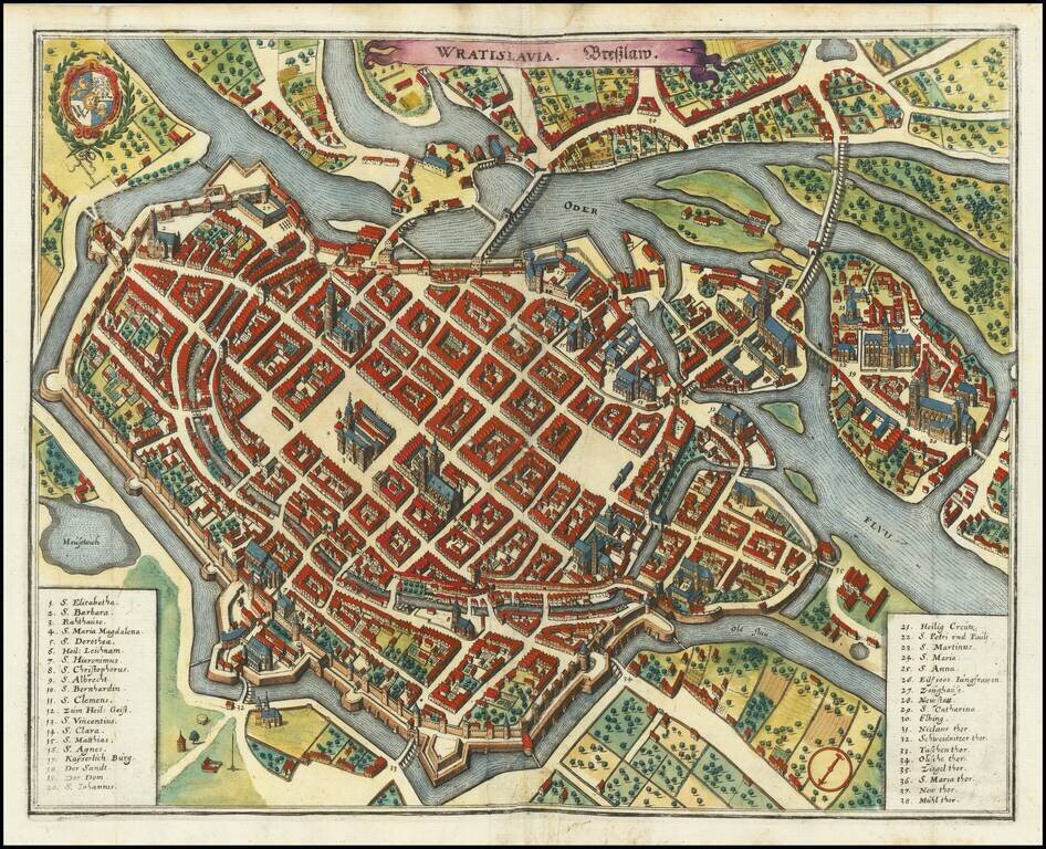
A detailed antique town plan of Wroclaw, once known as Breslau, in Poland. The map shows fortified walls, city gates, important public buildings, squares, and more. A key names thirty-eight important places in Worclaw. The coats of arms of the city of Worclaw are shown in the upper-left corner.
Mathaus Merian (1593-1650) was the father of engraver Matthäus the Younger, and of the painter, engraver, and naturalist Maria Sibylla Merian. He was born in Basel, Switzerland and trained in engraving in Zurich. After a time in Nancy, Paris and Strasbourg, he settled in Frankfurt. While there, he worked for Johann Theodor de Bry, the publisher and son of the travel writer. In 1617, he married Maria Magdalena de Bry, Johann Theodor’s daughter. In 1623, Merian took over the de Bry publishing house upon the death of his father-in-law. Merian’s best known works are detailed town views which, due to their accuracy and artistry, form a valuable record of European urban life in the first half of the sixteenth century
If you are a student, write to us in telegram: @antiquemaps and indicate what material you need and for what work you need a map in high detail. We are ready to provide material on special terms. For students only!


![[Hand Drawn Prussian Military Encampment at Opole, Poland] Special Grund-Riss Des Kaeyserl Feldl Lagers bey Oppeln in Ober Schlesien](/map/small/59726.jpg)