Map size in jpg-format: 20.2324MiB
Click to open in high resolution (open in new tab).
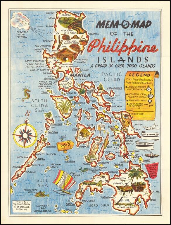
Lively pictorial map of the Philippines, drawn by John G. Drury of the 2145th Ordnance Battalion.
This is one in a series of Mem-o-Maps published at the end of World War II. The maps were intended as souvenirs for the military. Military personnel could fill in banners "came in on good ship" and "departed on good ship", their name and organization etc.
Pictographs mark various memorable spots and wildlife (including larger-than-life insects).
If you are a student, write to us in telegram: @antiquemaps and indicate what material you need and for what work you need a map in high detail. We are ready to provide material on special terms. For students only!
![[Martin Behaim Globe / Book] Pars Globi terrestris Ao. 1492 a Martino Behaim Equite Lusitano Norimbergae confecti Delineavit Christoph. Theoph de Murr 1778 (bound with:) Diplomatische Geschichte des Portugesischen berühmten Ritters Martin Behaims](/map/small/68828.jpg)
![Il Disegno Della Terza Parte Dell' Asia [Gastaldi's Wall Map of SE Asia with extra panels!]](/map/small/30554hbp.jpg)
![Chinae, olim Sinarum regionis nova descriptio. auctore Ludouico Georgio. [English Edition!]](/map/small/71123.jpg)