
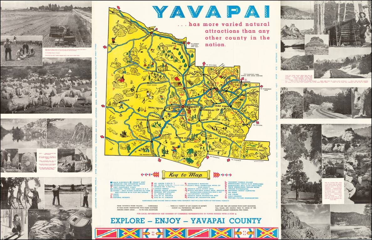
Lively promotional map of Yavapai County, Arizona, produced by the Yavapai Board of Supervisors. Centered on Prescott, Arizona, the map illustrates landmarks, tourist attractions, roads nd railroads, and is surrounded by photographs promoting the...
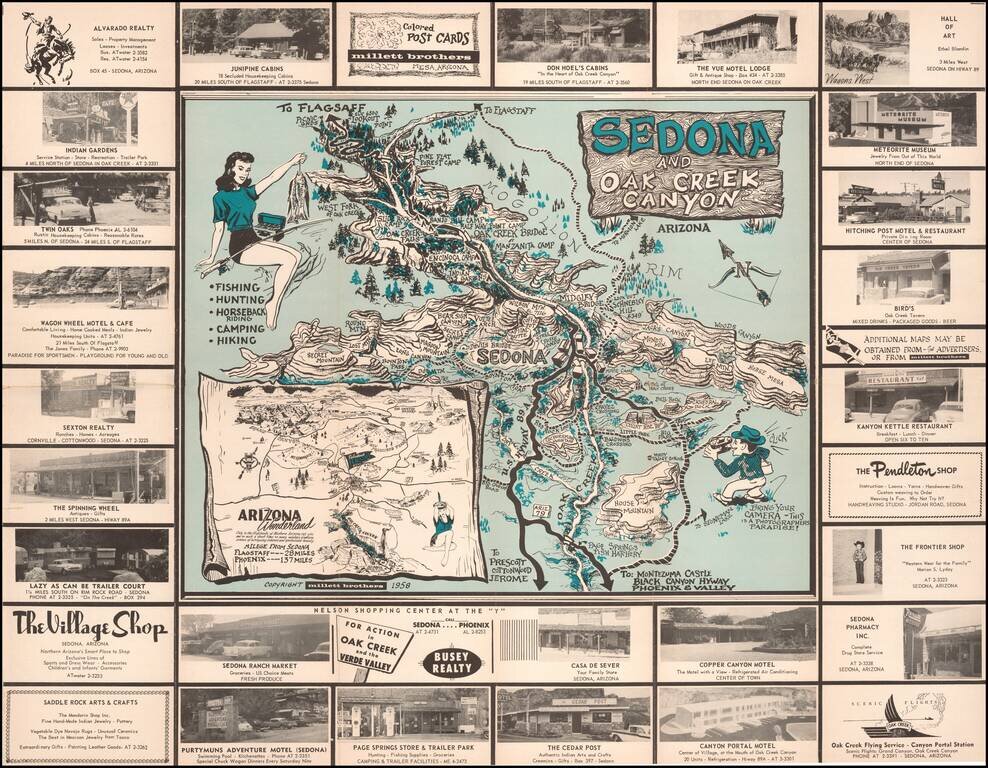
Bring Your Camera -- This is A Photographers Paradise! Rare pictorial promotional map, advertising Sedona and the Flagstaff area. The Sedona side provides a marvelous whimsical look at Sedona and Oak Creek Canyon, with its tourist attractions and...
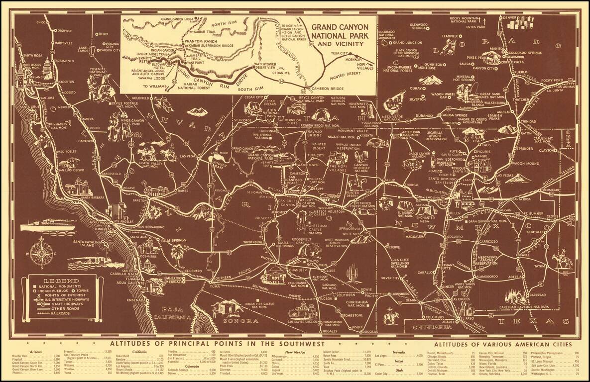
Scarce pictorial map of the American Southwest, published by Fred Harvey. The map provides a detailed pictorial image of the American Southwest, with an inset of the Grand Canyon. The verso includes a table of Indian Signs and Symbols, along with...
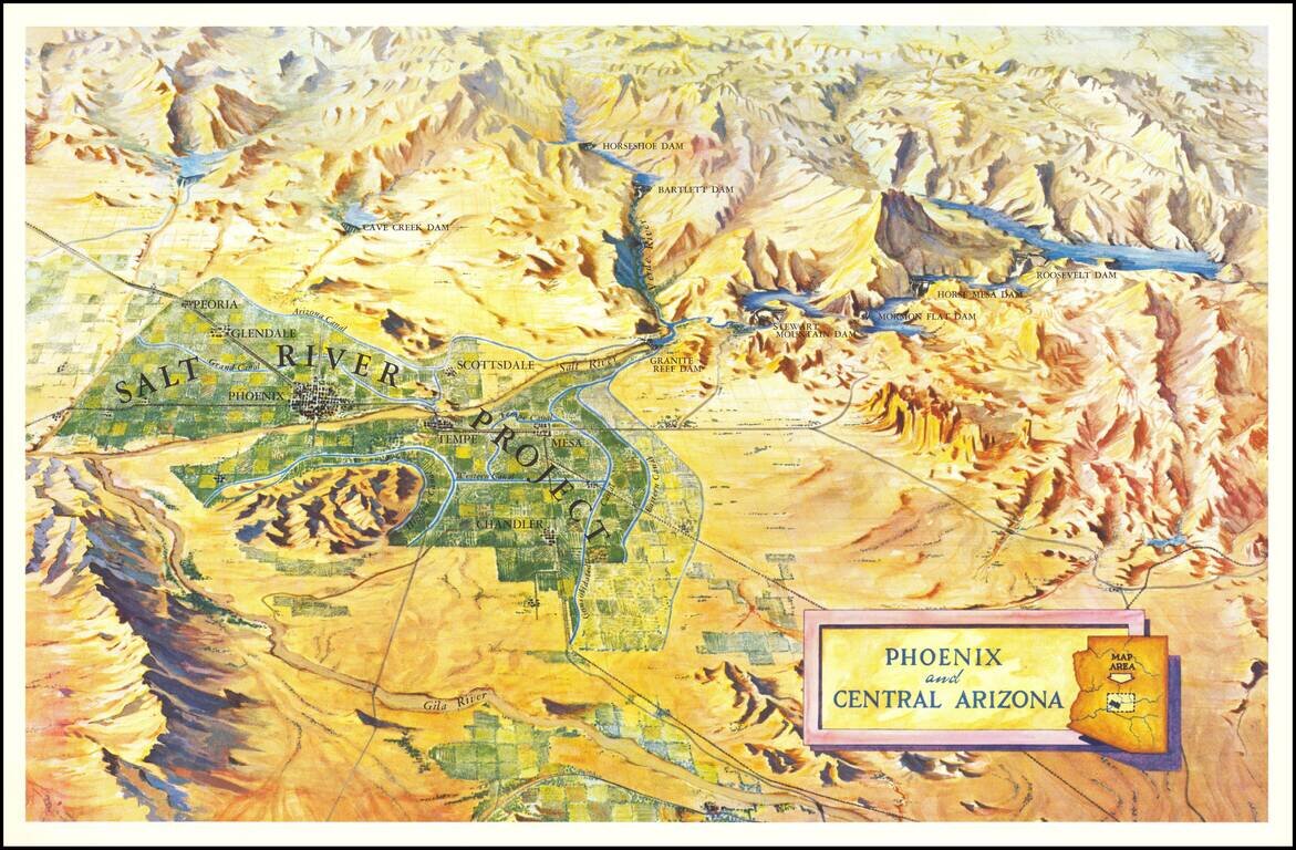
Scarce birdseye view style map of the area around Phoenix, highlighting the Salt River Project and the lands irrigated by the various canals in the area. The map shows a number of important early dams, including: Granite Reef Dam (built 1906-1908)...
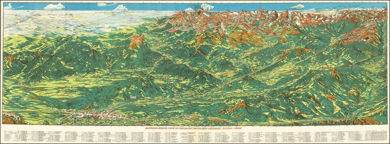
Fine example of Ralph Carlyle Prather stunning view of the Rocky Mountains from Estes Park. At the upper left the view begins Estes Park and the Stanley hotel at the lower left and Fort Colllins and Loveland, with Mount Olympus above. The town of...
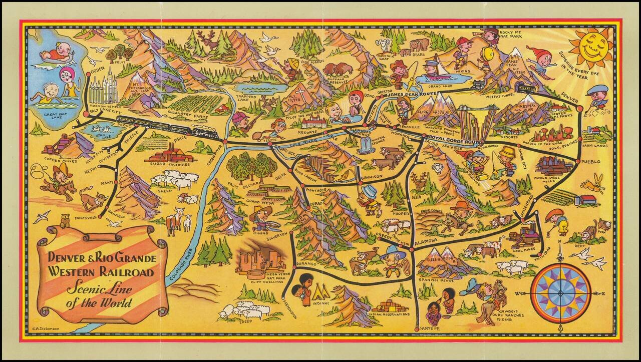
Scarce early Denver & Rio Grande Western Railroad promotional brochure, illustrated with a fine pictorial map of Colorado by Charles E. Dietemann (1902-1973). Focused on the rail lines of the Denver & Rio Grande Western, the map provides...
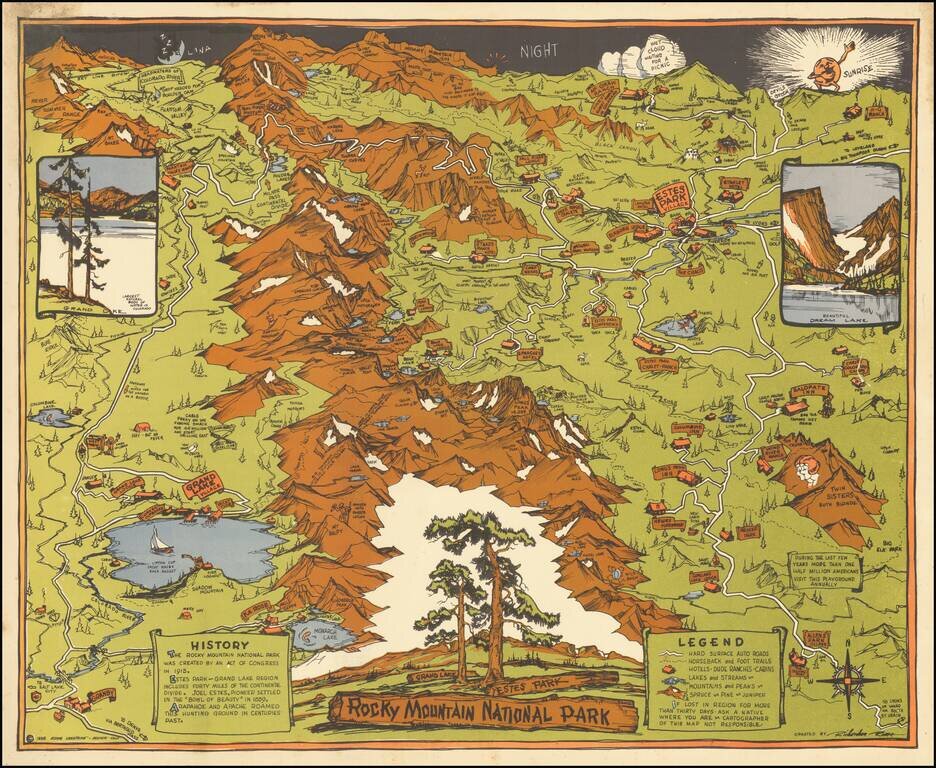
Striking Pictorial Map of Rock Mountain National Park, published by the Rocky Mountain Motor Company. In the foreground is Allens Park Village, Meeker Park, Granby and Reservoir. At the top of the map are the Headwaters of the Colorado River, Red...
![[Tracing Route Map of Colorado] Colorado -- Explore the West with Scenic Guides](/map/small/69878.jpg)
Scarce folding map of Colorado, published to promote Weldon F. Heald's Scenic Guide to Colorado. The map was issued to promote Healds' travel book, highlighting natural points of interest and other details and emphasizing the major routes through...
![[Southwest Colorado] Tourist & Sportsman Guide and Map to Southwestern Colorado](/map/small/66559.jpg)
The Vacation Land That's Really Different . . . Whimsical pictorial map of Southwestern Colorado, illustrating the regions the roads, passes, towns and major peaks. The map is surrounded with ads for local businesses, focused on the sportsman's...
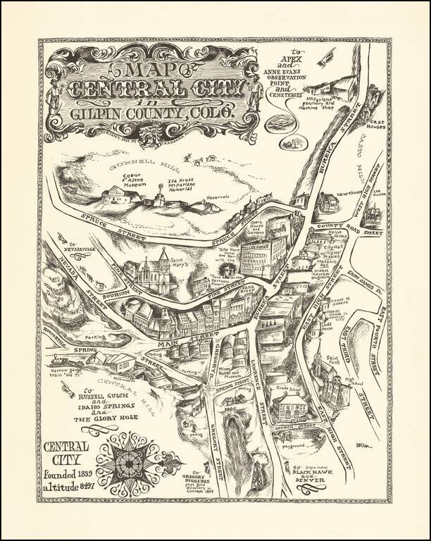
An Early Barbara Remington Illustration Attractive pictorial map of Central City, Colorado, drawn by Barbara Remington. The map is oriented with west at the top, showing the town spreading out along Eureka and Main Streets. Includes a decorative...
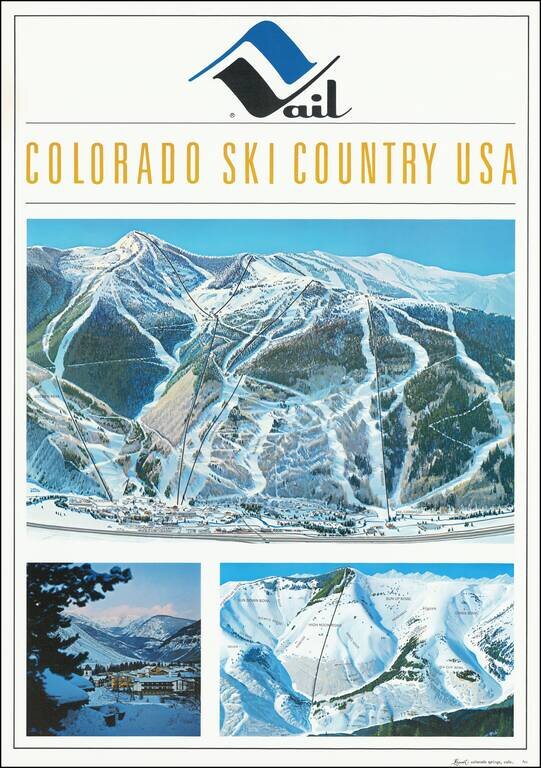
Fine early Hal Shelton Poster, promoting Vail, Colorado. Iconic promotional poster of Vail, published shortly after the addition of Gondola #2. The top image is a large traditional trail map, identifying ski lifts, trails, bowls, etc. with the...
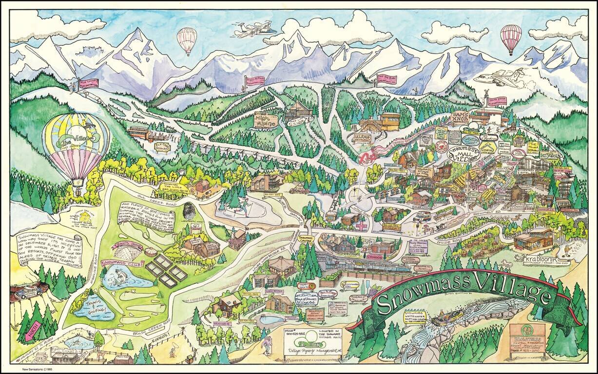
Decorative pictorial map of Snowmass Village, Colorado, drawn by artist James Giattino. The map promotes the recreational industries of Snowmass, both summer and winter. The ski mountain can be seen across the top, highlighting the four peaks...
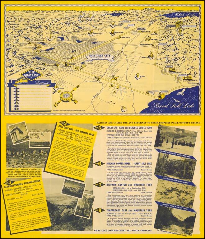
Fine promotional view map of Salt Lake, published for The Grayline. The Legend identifies 8 different tourism lines within the city.
![A Hysterical Map Of Lake Tahoe Wild and Woolly Nevada With Its Wide Open Places [With Original Envelope!]](/map/small/68358.jpg)
Hysterical Tahoe With Original Mailing Envelope! Fine example of this rare pictorial map of Lake Tahoe, "Drawn in Broken English by Jolly Lindgren." This comic pictorial map is full of puns and comic vignettes related to Lake Tahoe. The Legend...
![Las Vegas Fun Tour Map [on sheet with:] Las Vegas City Fun Map](/map/small/69008.jpg)
Rare vintage pictorial map of Las Vegas and the Las Vegas Region printed front-to-back on a 1947 promotional pamphlet for the city. The main map features the region around Las Vegas in George Ramsey's characteristic red, yellow, blue, and green color...
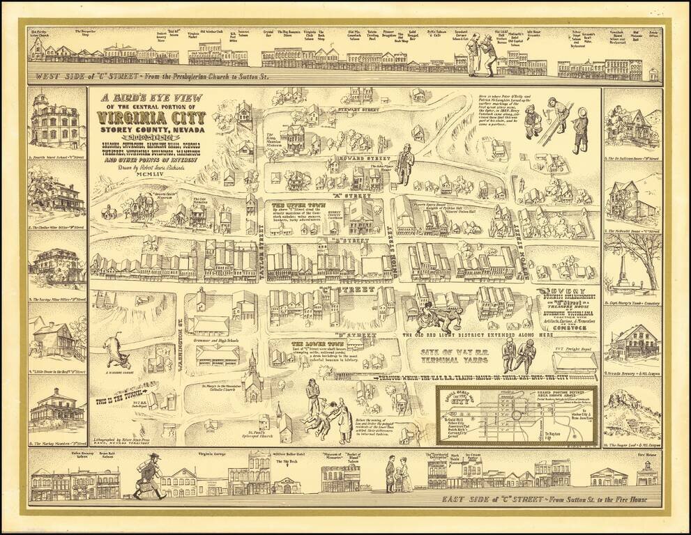
Finely executed pictorial map / birds eye view of Virginia City, drawn by Robert Lewis Richards and lithographed by the Silver State Press in Reno. The map is a fine combination of historical vignettes and meticulous recreation of Virginia City during...