Map size in jpg-format: 44.2095MiB
Click to open in high resolution (open in new tab).
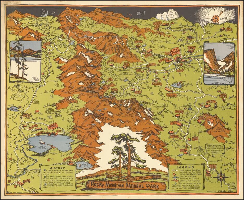
Striking Pictorial Map of Rock Mountain National Park, published by the Rocky Mountain Motor Company.
In the foreground is Allens Park Village, Meeker Park, Granby and Reservoir. At the top of the map are the Headwaters of the Colorado River, Red Mountain, Mount Baker, Hagues Peak, Mummy Mountain and McGraw Ranch.
Pictorial map, with vibrant colors. North is oriented to the right side of the map. Shows roads, horseback and foot trails, hotels and campsites, lakes and Estes Park village. Includes history of Rocky Mountain National Park and legend.
If you are a student, write to us in telegram: @antiquemaps and indicate what material you need and for what work you need a map in high detail. We are ready to provide material on special terms. For students only!
![Mexique par Th. Duvotenay…1843 [Republic of Texas]](/map/small/67925.jpg)
