
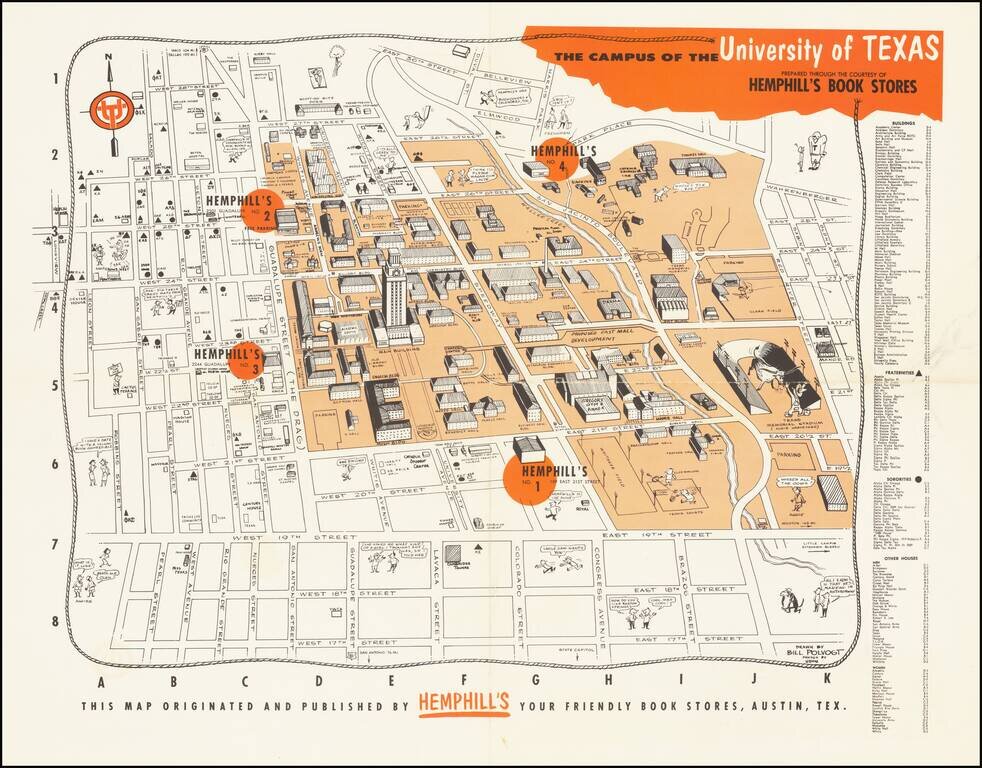
Whimsical map of the campus of the University of Texas at Austin, published in Austin by Hemphill's Bookstore. The map provides a fun-filled look at the University of Texas circa 1960. It shows the location of a new Hemphill’s book store and...

Decorative pictorial map of East Texas, published by the East Texas Chamber of Commerce.
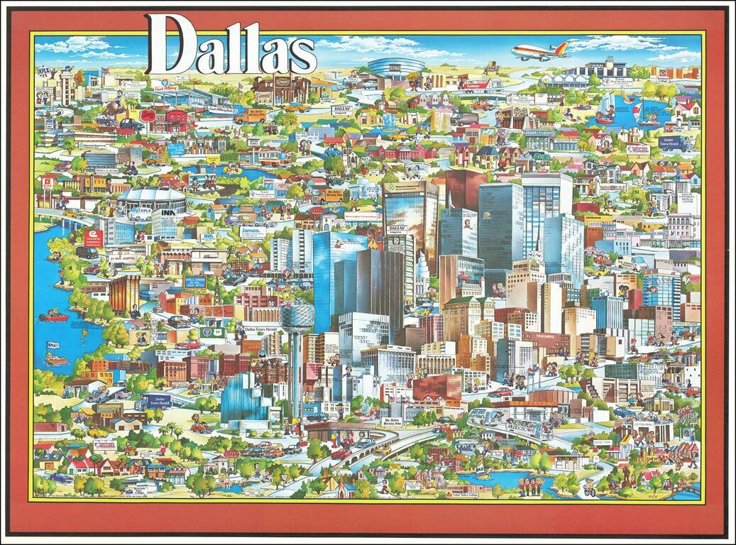
Richly embellished advertising oriented pictorial map / birdseye view of Dallas, Texas, published by Archar Inc. of Canada. Packed with advertising for local businesses, the images shows buildings, tourism and other landmarks, recreational...
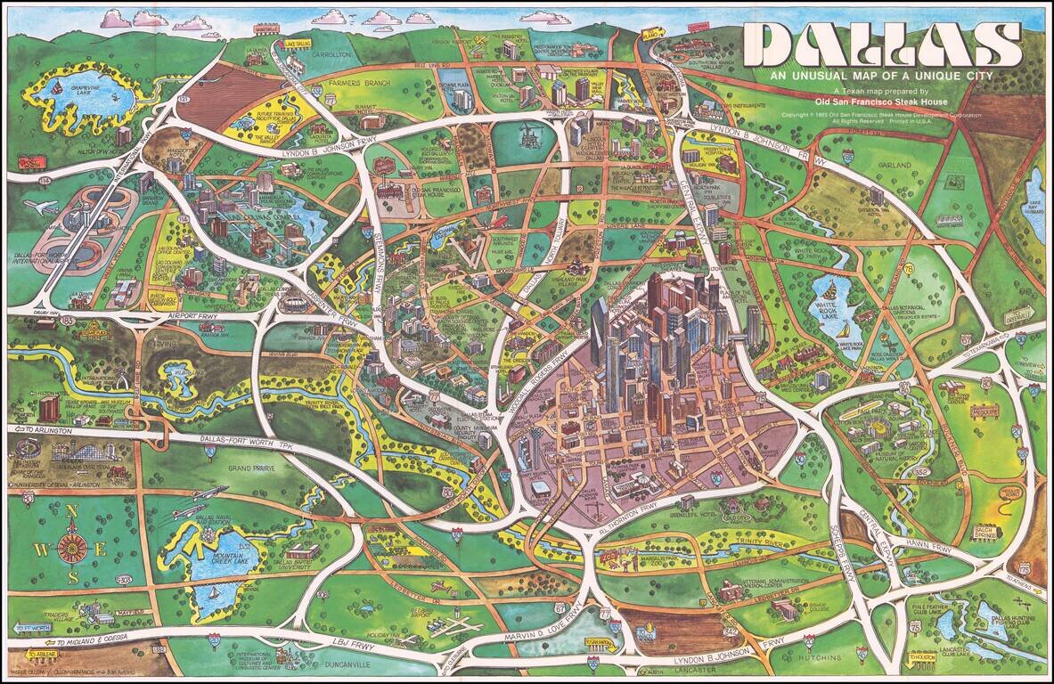
Elaborate pictorial map of Dallas, published by the Old San Francisco Steak House. The map extends to Grapevine Lake, Addison Airport, and famous Southfork Ranch. Love Field and Southwest Airlines Muse Air are shown at the center, with the Dallas...
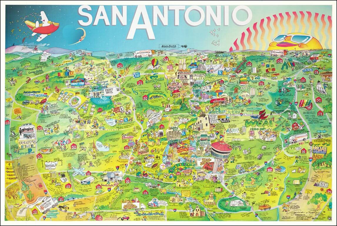
This is a bright whimsical pictorial map of San Antonio, published by Vaughan Company of Round Rock. The map presents a wide array of late 1980s advertisements and tourist attractions in and around San Antonio. Notes around the map paint an interesting...

Rare pictorial map of the Mormon Trail, published by American Pioneer Trail Association. The map includes lively historical vignettes focusing on the early history of the West, Mormon Battalion and Mormon Settlers. "Issued by American Pioneer Trails...
![[With Original Envelope!] A Geographical Map of the Century of Progress Exposition Held in Chicago, Illinois 1933 Faithfully executed and drawn in a carnival spirit by Tony Sart '33](/map/small/69226.jpg)
Rare large map of the Chicago World's Fair in two parts, published by Tony Sarg in 1933. David Rumsey notes: Two pictorial maps on one sheet, a panorama view of exposition grounds, whimsical sea monsters, whales, planes, and boats in the water....
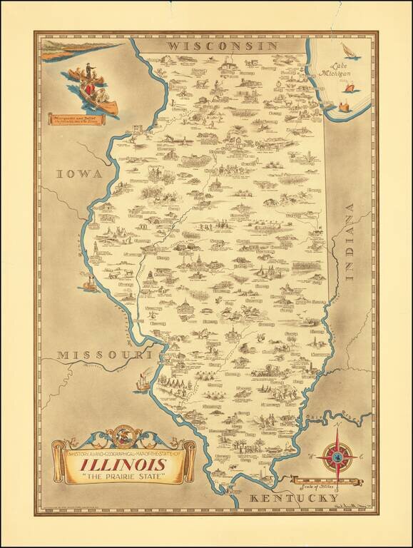
Scarce pictorial map of the Illinois, by the prolific illustrator Karl Smith. The map is filled with historical vignettes, telling the story of Illinois's history. Color vignette on upper left illustrating "Marquette and Jolliet the first white men...
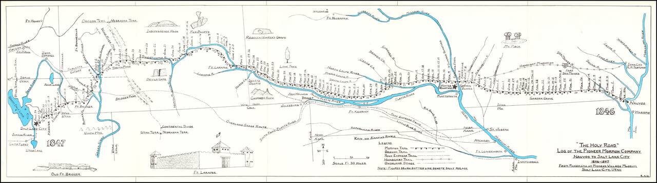
Rare historical / pictorial map of the Mormon Route from Navoo to Salt Lake, drawn by Robert A. Hanson. The map was likely published by the Western Cover Society, a California based society which published the Western Express. Hanson's maps were...
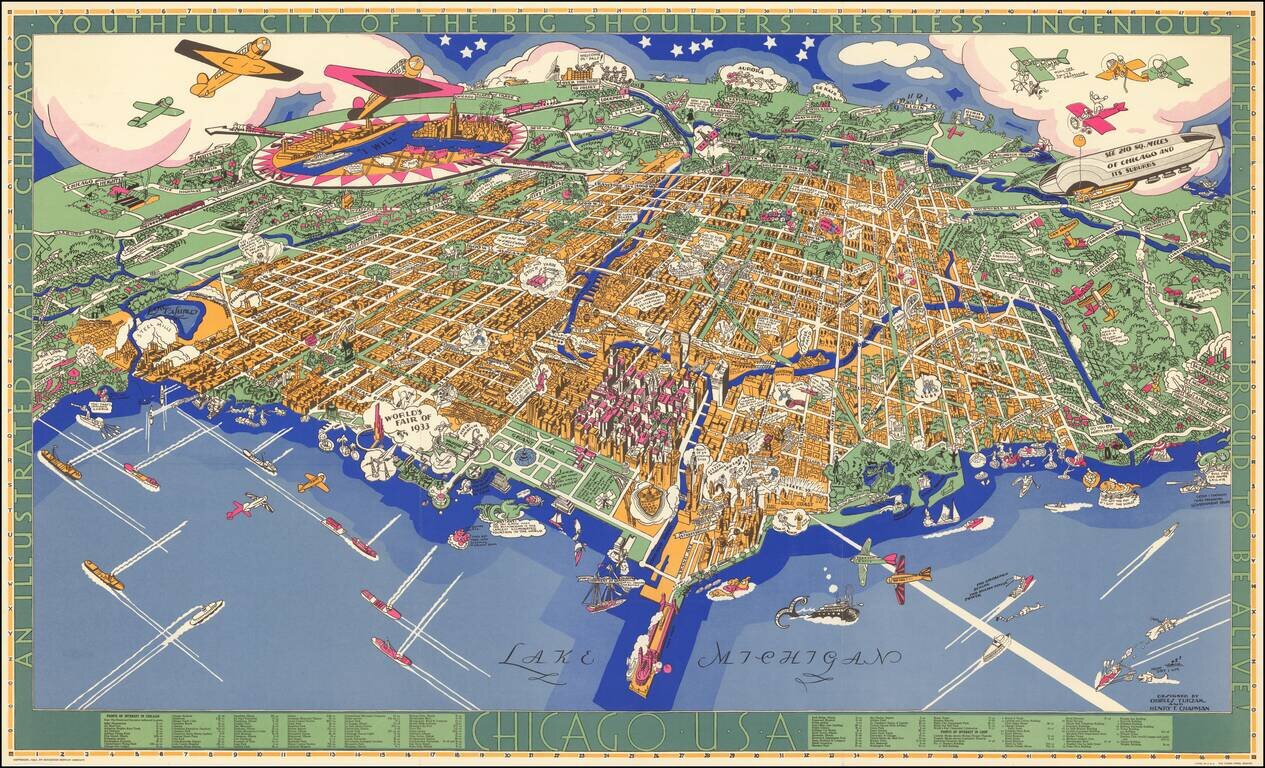
Charles Turzak's Iconic View of Chicago. Nice example of Charles Turzak's remarkable pictorial map of Chicago, with original pictorial folder. This beautiful map of Chicago by Chicago illustrator Charles Turzak, published two years before the...
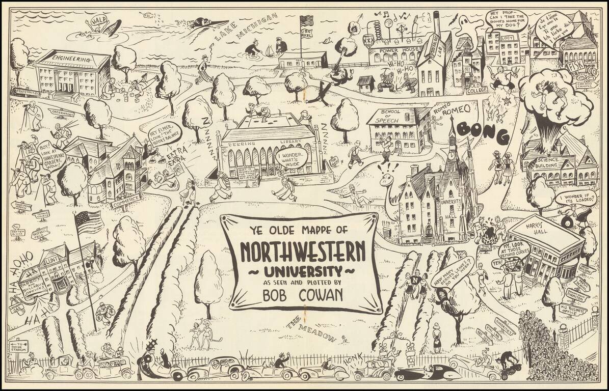
Rare Pictorial of Northwestern - Only Traced Example. This is a vintage pictorial map of Northwestern, providing a humorous portrayal of the prestigious Evanston university. The campus is easily recognizable, portrayed from the west with Lake Michigan...
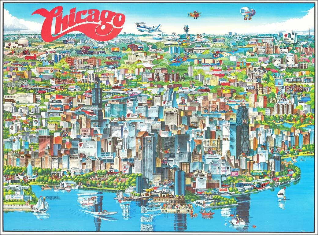
Richly embellished advertising oriented pictorial map / birdseye view of the Chicago area, published by Archar Inc. of Canada. Packed with advertising for local businesses, the images shows buildings, tourism and other landmarks, recreational...
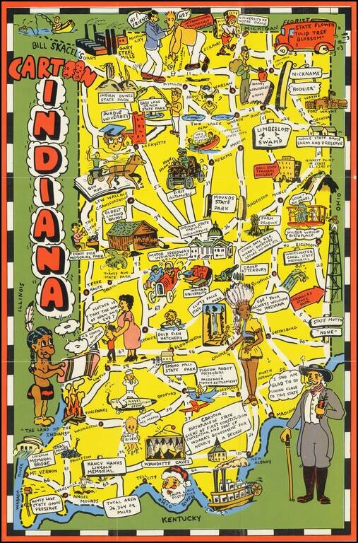
Scarce pictorial map of Indiana. The map provides a whimsical image of Indiana's tourists and other important sites, with roads and distances noted. On verso: photos of scenic views, landmark and text.
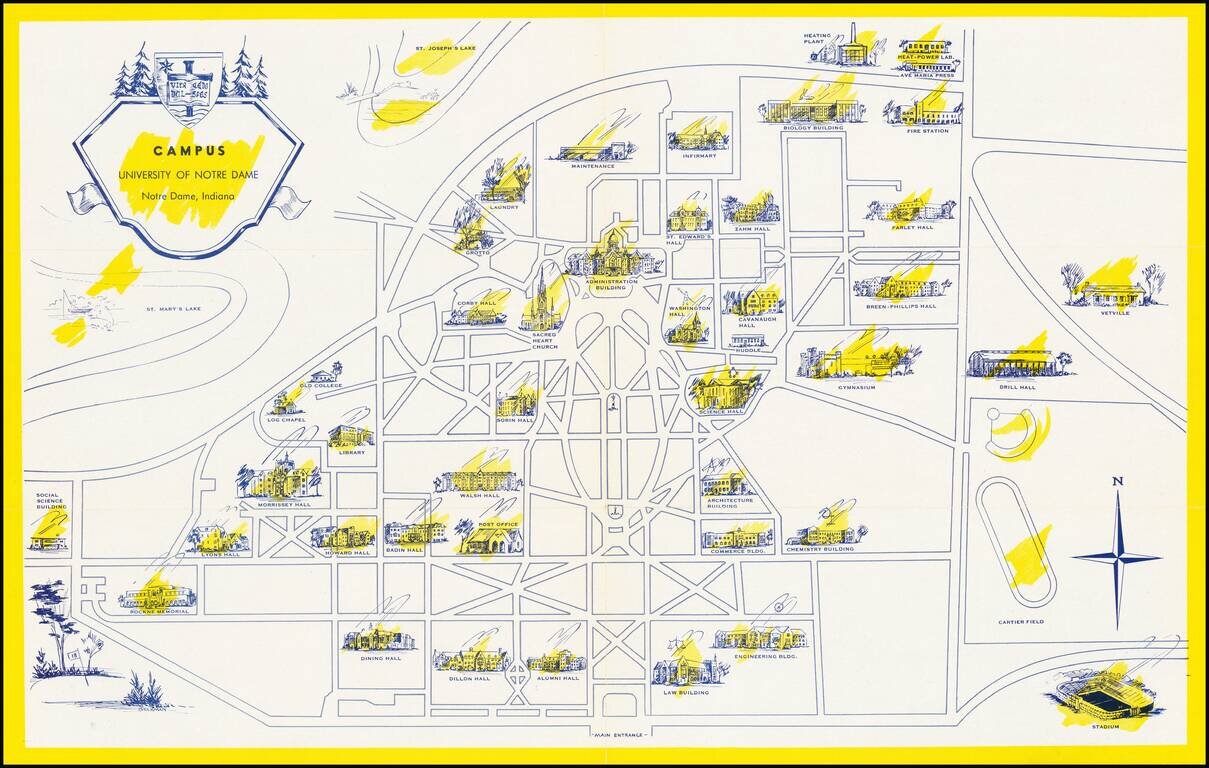
Scarce pictorial map the University of Notre Dame campus in South Bend, Indiana. The recto shows the campus with important buildings, including Notre Dame Stadium (opened in 1930), scattered around the grid of pathways and roads. On the verso, the...
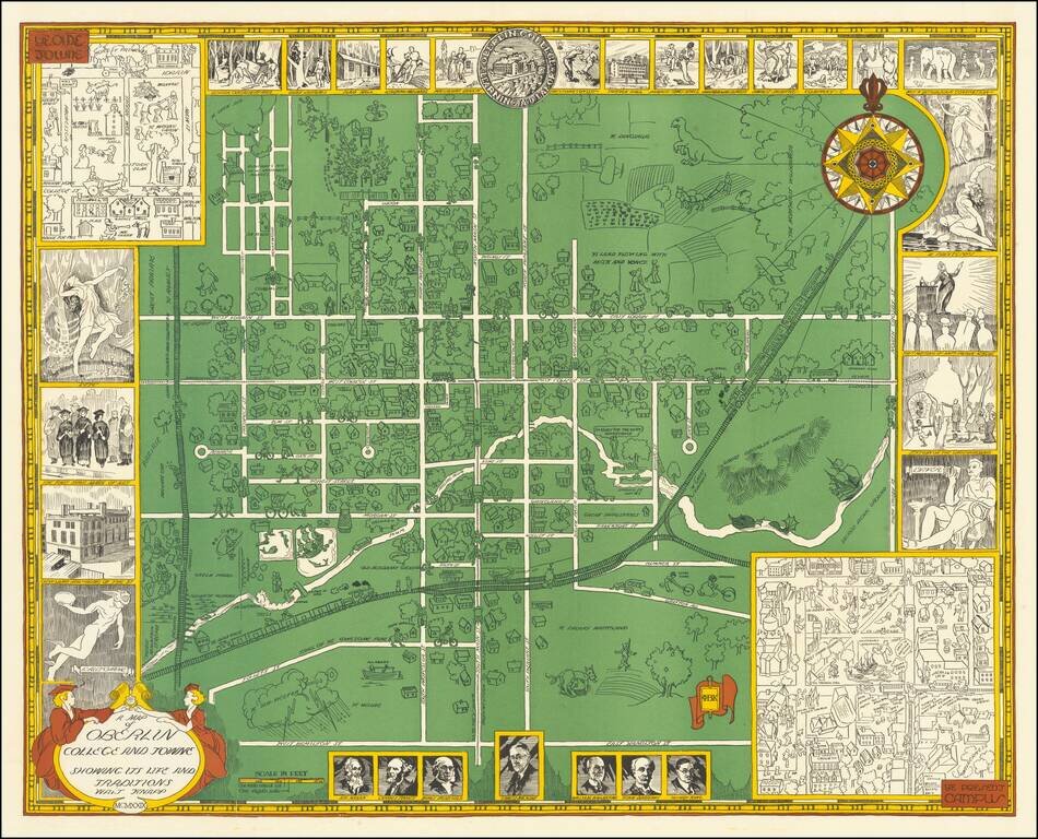
Rare vintage pictorial map of Oberlin College and the town of Oberlin, Ohio. The map was made by Walter Knapp in 1929, during the Golden Age of Pictorial Mapmaking, and it relies on many of the themes embodied in that movement. The map includes...
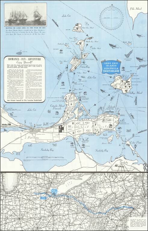
Lively pictorial map of the Lake Erie and Peninsula Vacationland, near Port Clinton Ohio, between Toledo and Cleveland on Lake Erie. The main map focuses on recreational opportunities on Marblehead and Catawba Island Peninsulas, with Port Clinton....