
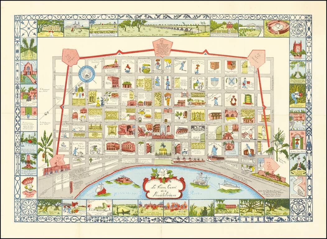
Scarce map of New Orleans, drawn by Myro Zimmerman Barnes in New Orleans in 1942. Includes a fabulous whimsical look at the city, with block by block vignettes of history, costumes and other clever caricatures.
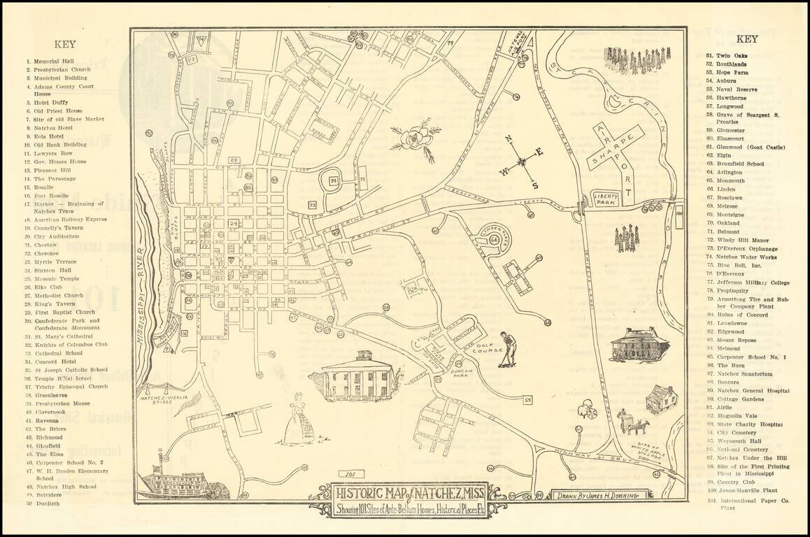
Scarce Pictorial map of the Natchez, Mississippi area, illustrating historical sites, extending frrom the Mississippi River to Sharpe Airport. On the verso, a key with points illustrating on the map is given.
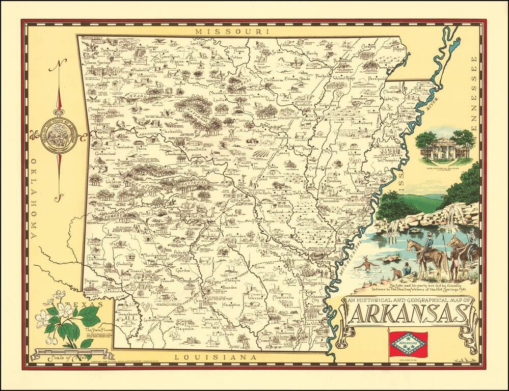
Rare pictorial map of Arkansas, drawn by Karl Smith. The map shows historic sites, locations of significant events, cities and towns, Indian settlements, agricultural products, industry, parks, historical trails, rivers, and recreational activities....

Scarce vintage pictorial map of Kentucky, celebrating the state's agricultural industries, produced by Karl Smith, one of the 1930s' prominent makers of state pictorial maps. The map features an exhaustive list of Kentucky's 120 counties at the time,...
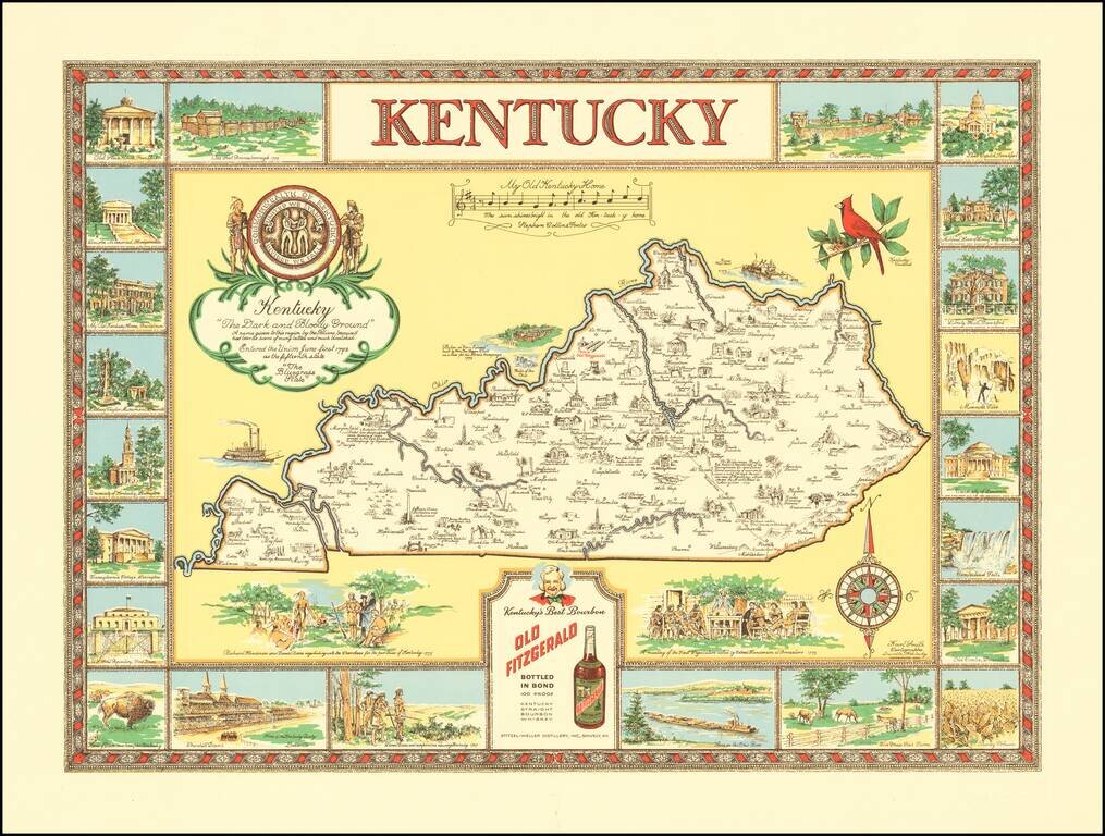
"The Dark and Bloody Ground" Rare pictorial map of the Kentucky, one of a number of different pictorial maps of Kentucky by the prolific illustrator Karl Smith. The map illustraes landmarks and historical events in the decorative panels which make up...
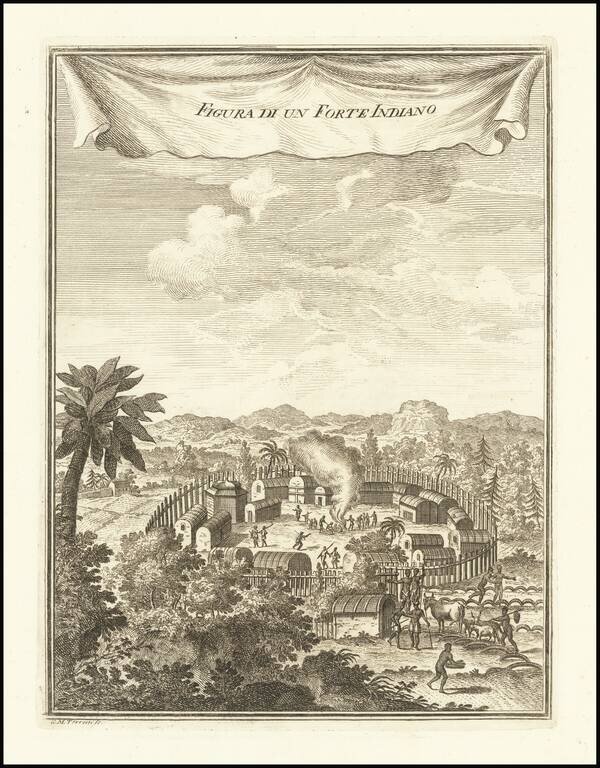
A Pomeiooc Village in Virginia Interesting view of a native American settlement, based upon De Bry. Includes dwellings, domestic animals such as oxen and donkeys [?], palisades, guns or muskets, and council fire. This image is derived from Theodor...
![[Governor of Virginia] The Right Honble William Anne, Keppel, Earl of Albermarle, Viscount Bury, Baron of Ashford, Groom of the Stole, Governour & Captn General of Virginia, Colonel of the Coldstream Regiment of Fort, Lt. General of His Majesty's Forces,](/map/small/60432.jpg)
William Anne, Governor of Virginia Rare mezzotint portrait of William Anne Keppel, Second Earl of Albermarle and Governor of Virginia. Lieutenant-General Willem Anne van Keppel, 2nd Earl of Albemarle KG KB PC (1702 – 1754) was a British diplomat...
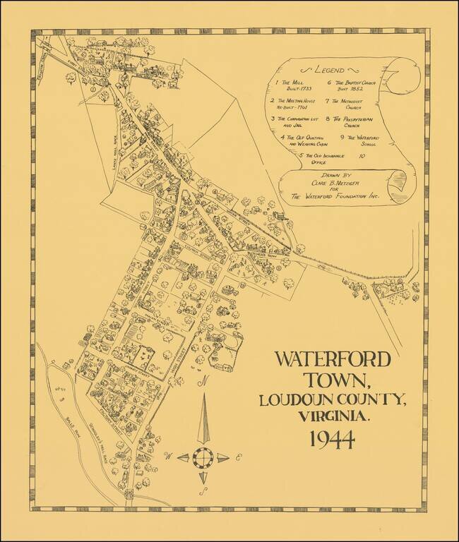
Interesting pictorial map of Waterford Town, Virginia, drawn by Clare B. Metzger for The Waterford Foundation. The present map is based the official map of the town, commissioned in 1875. The Acts of 1875 provided that the Waterford council should...

Lively pictorial map of Williamsburg, illustrating the town following its restoration "through the generosity of . . . John D. Rockefeller, Jr. and members of his family." The main map provides a fine overview of the town, with buildings named.
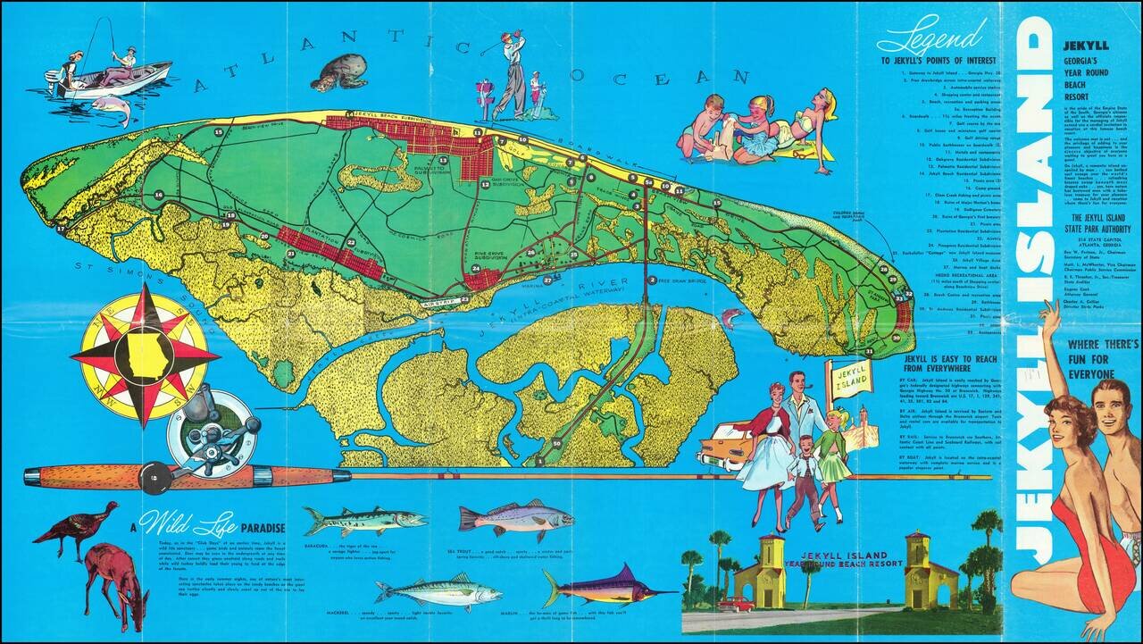
Pictorial map of Jekyll Island, Georgia, illustrating the island and its recreational activities. The map highlights the island's fishing, wildlife and golf activities, with photos on the verso.
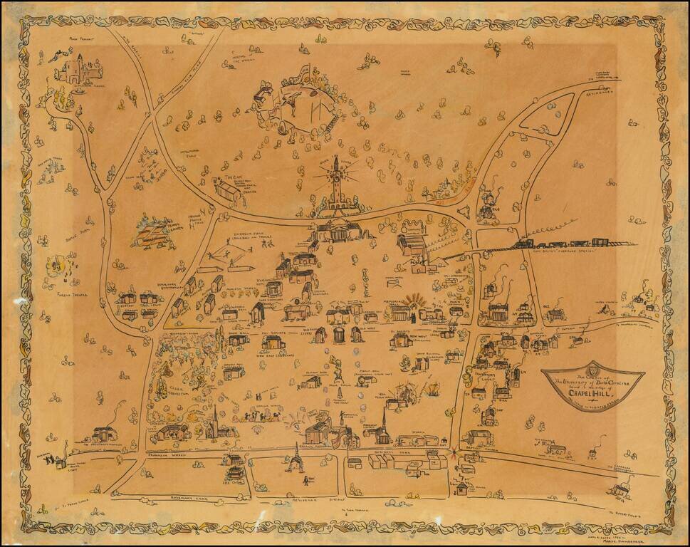
Impressive manuscript pictorial map of the University of North Carolina at Chapel Hill, drawn by Mary C. Dirnberger in 1933. The view is oriented with south at the top, at the bottom of the map it is bounded by Rosemary Street, at the top (south) of...
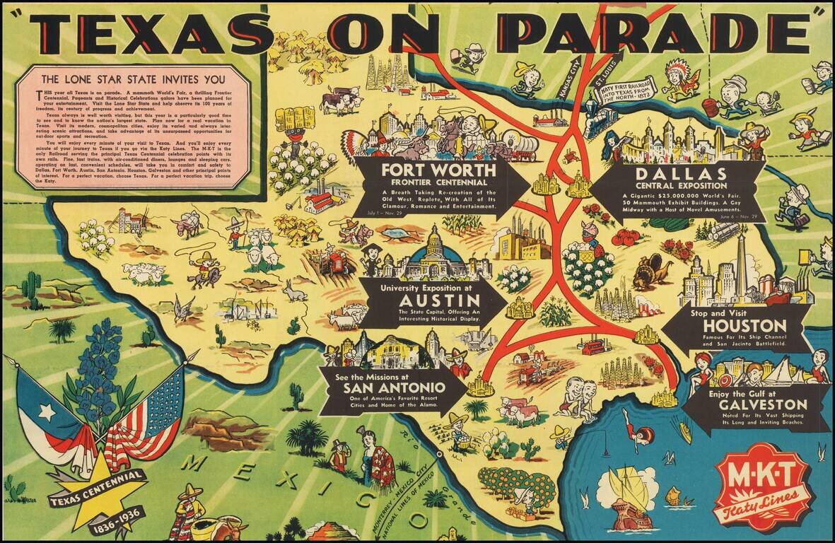
Rare Texas Centennial Pictorial Map, published by the MKT Katy Lines. The map highlights six destinations, Dallas, Houston, Austin, Galveston, San Antonio, and Fort Worth. The lively pictorial maps shows regional vignettes featuring the commerce and...
![[Original Texas Pictorial Map Artwork]](/map/small/65261.jpg)
Pictorial Artwork by Texas Artist Dick Spencer Lively hand drawn pictorial map of Texas, drawn by Dick Spencer. The map is drawn in an birdseye view style and is centered on Houston, Austin and San Antonio, with the Randolf (Army) Field at the...
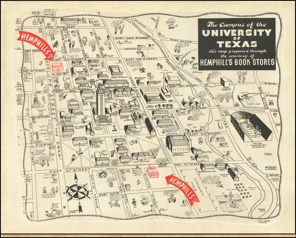
Whimsical map of the campus of the University of Texas at Austin, published in Austin by Hemphill's Bookstore. The map provides a fascinating look at the University of Texas circa 1945. This is one of two maps of the UT Austin done for Hemphill's....
![Official Texas Brags Map of North America . . . Scale One Inch = 6 Texas Grapefruit [With Original Envelope!]](/map/small/68359.jpg)
Texas Brags with Original Mailing Envelope! Whimsical Map of North America, from a Texan's perspective. Places and names throughout the states are often incorrect or fictitious, satirizing a parochial attitude towards other parts of the country. For...
![A Texan's Map of the United States [of Texas] [Everything Depicted Hereon Is Gospel Truth!...Attested To By A Group of Impartial Texans! All Skeptics May Appeal To His Emminence, The President of Texas. Scale of Miles 1 Texas Inch = 1,000 Miles.](/map/small/45966.jpg)
Fascsinating Pictorial Map of Texas, drawn by Dallas illustrator Frank Oliver for the Texoak Flooring Company of Crockett, Texas, "Honest-to-goodness Texans who manufacture." Of all the "Texan's Maps" we have seen, this one is perhaps the most...