
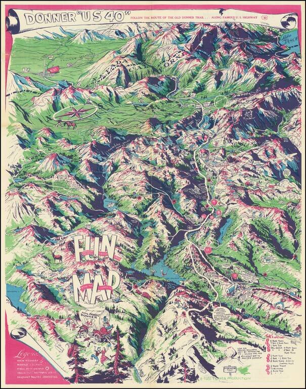
Humorous vintage pictorial map of U.S. Highway 40, the so-called Donner Trail Highway, through the Sierras near the California-Nevada border. The map is mostly focused on the Sierras west of the Nevada border, with Reno in the upper-left corner and...
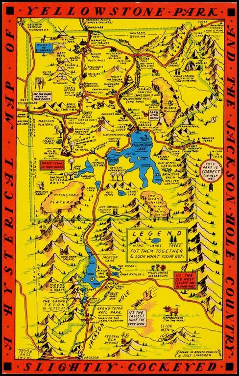
"Drawn in Broken English by Jolly Lindgren," this comic pictorial map is full of puns and comic vignettes related to Yellowstone and environs. The Lindgren brothers issued a number of other silly whimsical maps of national parks and other parts of the...
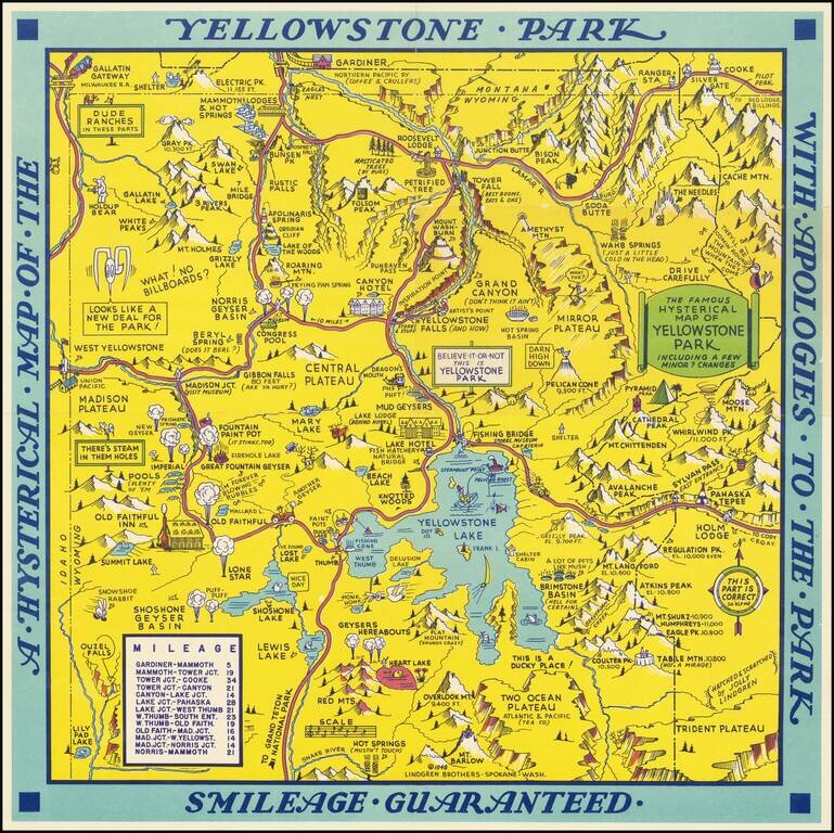
Scarce 1948 edition of the Jolly Lindgren map of Yellowstone, "Hatched & Scratched by Jolly Lindgren." This edition adds the table of miles at bottom left, among other changes, including the addition of Pilot Peak at the top right corner. This...
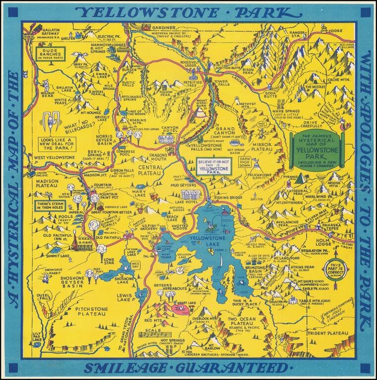
"Hatched & Scratched by Jolly Lindgren," this comic pictorial map is full of puns and comic vignettes related to Yellowstone and environs. The Lindgren Brothers issued a number of other silly whimsical maps of national parks and other parts of the...
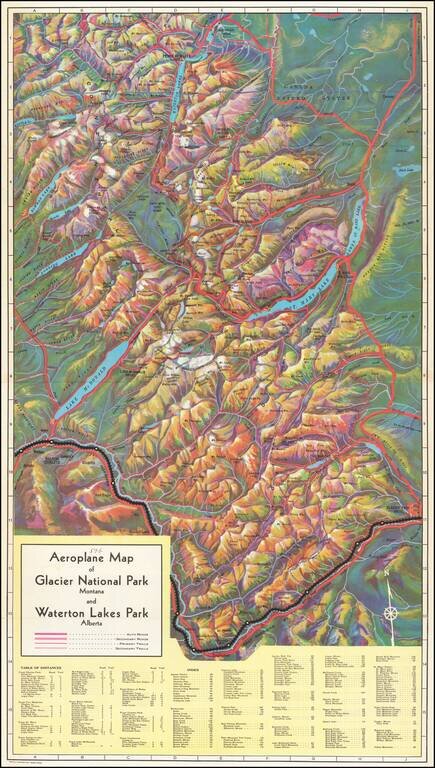
Rare birdseye view illustrating Glacier Park and environs, intended to promote the Great Northern Railway. Provides a fantastic topographical illustration of the area between Flathead River and the Glacier Park Hotel, with towns, mountains, roads,...
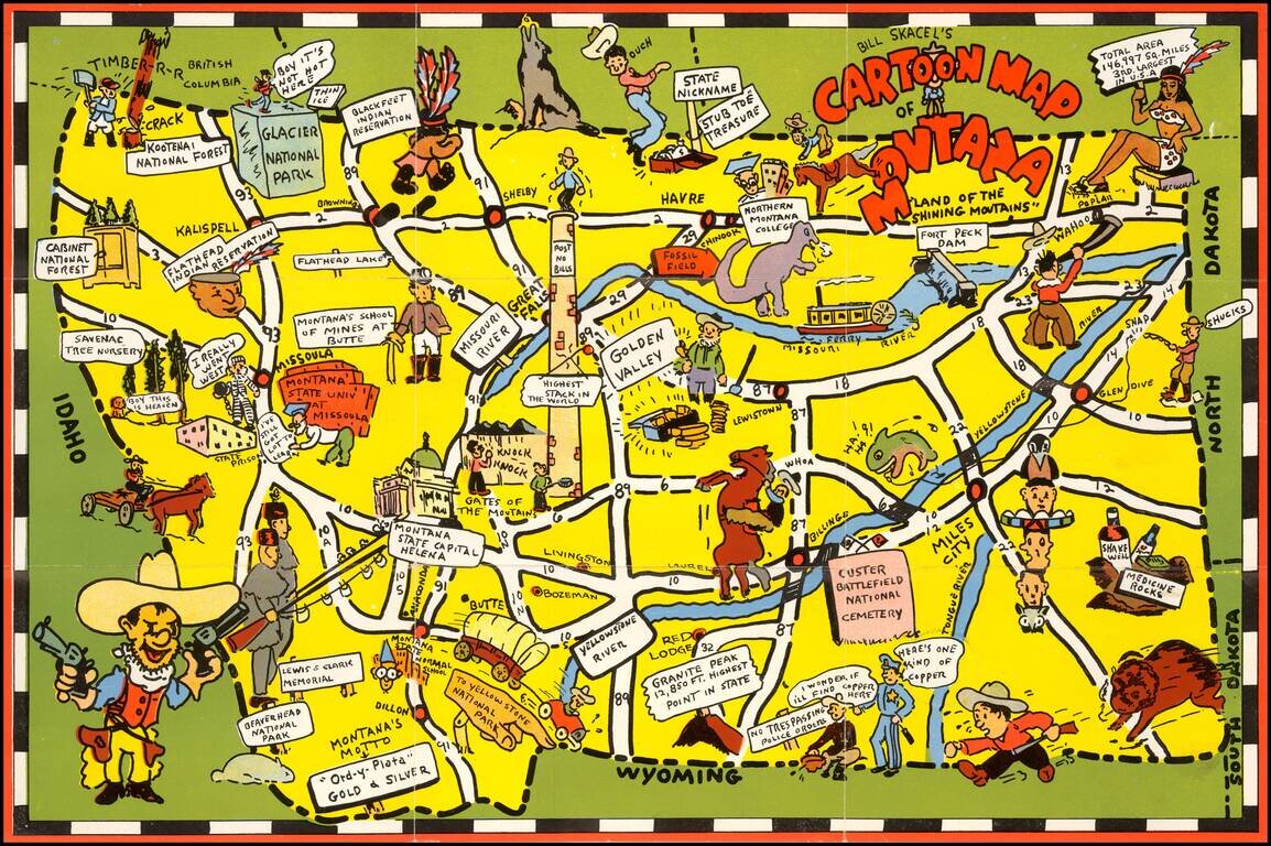
Scarce pictoiral map of Montana, which is printed to become a self mailing letter. The map provides a whimsical image of Montana's iconic national parks, national forest, Indian reservations, roads, trails, waterways, and recreational activities. On...
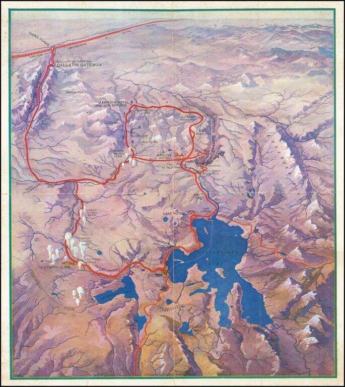
Attractive vintage pictorial bird's-eye view map of the Yellowstone National Park, produced by the Poole Brothers firm for the Chicago Milwaukee and St. Paul Railway in 1927. The map shows all of Lake Yellowstone and the surrounding region, with...
![Wm. T. Coleman & Co.'s Map of the State of California [and] Wm. T Coleman& Co's. Skeleton Map of Columbia River Canneries, Showing Their Location.](/map/small/69974.jpg)
Exceptional Chromolithographic Promotional Maps Rare promotional maps of California the Columbia River Basin one verso, promoting the shipping business of pioneer California Businessman William Tell Coleman. The California map locates several...
![[California in Miniature] Bird's-Eye View Map Showing Its Prominent Topographical Features, Location of Principal Cities, Towns and Points of Note, Also Lines of the Southern Pacific Company. 1898.](/map/small/63460.jpg)
A Synopsis of Resorts and other attractions worth visiting . . . Interesting birdseye view map of California, published by the Southern Pacific Company. The map is oriented with East at the top, looking from the Pacific Ocean to the Sierra Nevada...
![[Pictorial Road Maps] Motoring to Yosemite and the Mariposa Big Trees](/map/small/70985.jpg)
Finely illustrated promotional booklet, consisting of 16 pages and 7 color maps, published by the Yosemite Park and Curry Co., Yosemite National Park, California, and printed by H. S. Crocker Co., San Francisco. While the maps and pamphlet are...
![[Berkeley] This Is The Map of Berkeley Town Its Streets Go Winding Up & Down An Oak-Covered Camputs It Wears For A Crown With People & Places of Renown](/map/small/69776.jpg)
Rare pictorial map of the area around the campus of the University of California, Berkeley, published in about 1928 by Thomas Brothers and drawn by Virginia Tooker. The map is centered on the Campanile, with California Memorial Stadium at the east,...
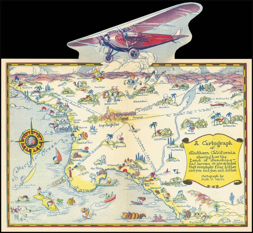
Rare pictographic map of Southern California with pop-up illustration of propeller plane. The map illustrates the routes of Western Air Express, with flights to Kansas City (12 hours), Tia Juana (1 hour), Catalina (30 minutes) and San Francisco (3...
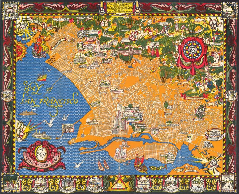
A Monumental Pictorial Map of Berkeley & The East Bay, With Original Decorative Folder Fabulous Art Deco style map by Michael Baltekal Goodman, notable for its brilliant color and striking design. The minimalist design of the street layout at...
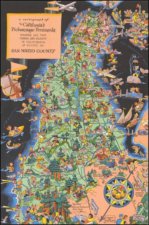
Marvelous whimsical map of San Mateo County by Ruth Taylor White one of the most famous pictograph artists of the period. Ruth Taylor White was among the most prolific makers of pictographic maps. Her whimsical style combines her artistic skills with...
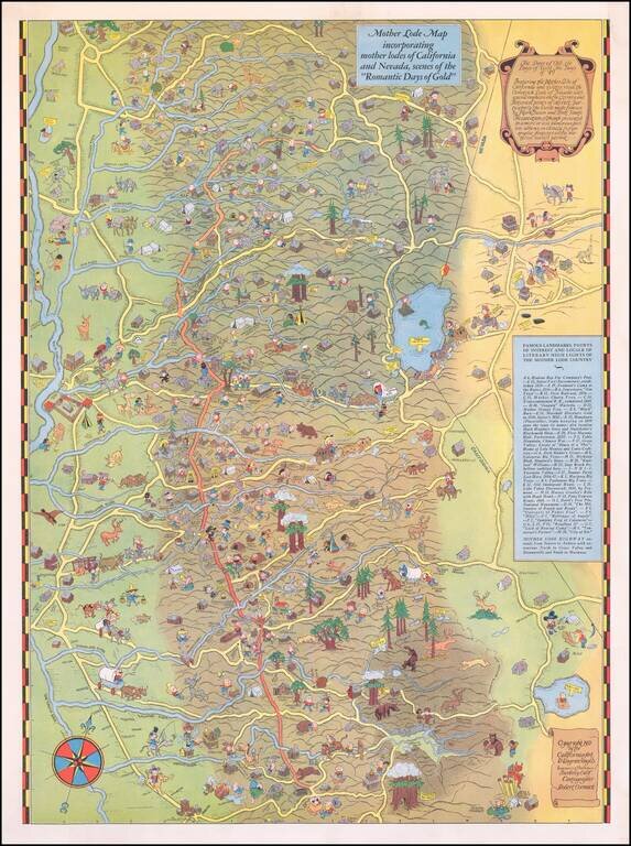
Scarce Pictorial Map of California's Gold Regions, including Lake Tahoe Area. The map extends from the Central Valley to the Comstock Lode, Nevada. A rare map -- the first example we have ever seen on the market.
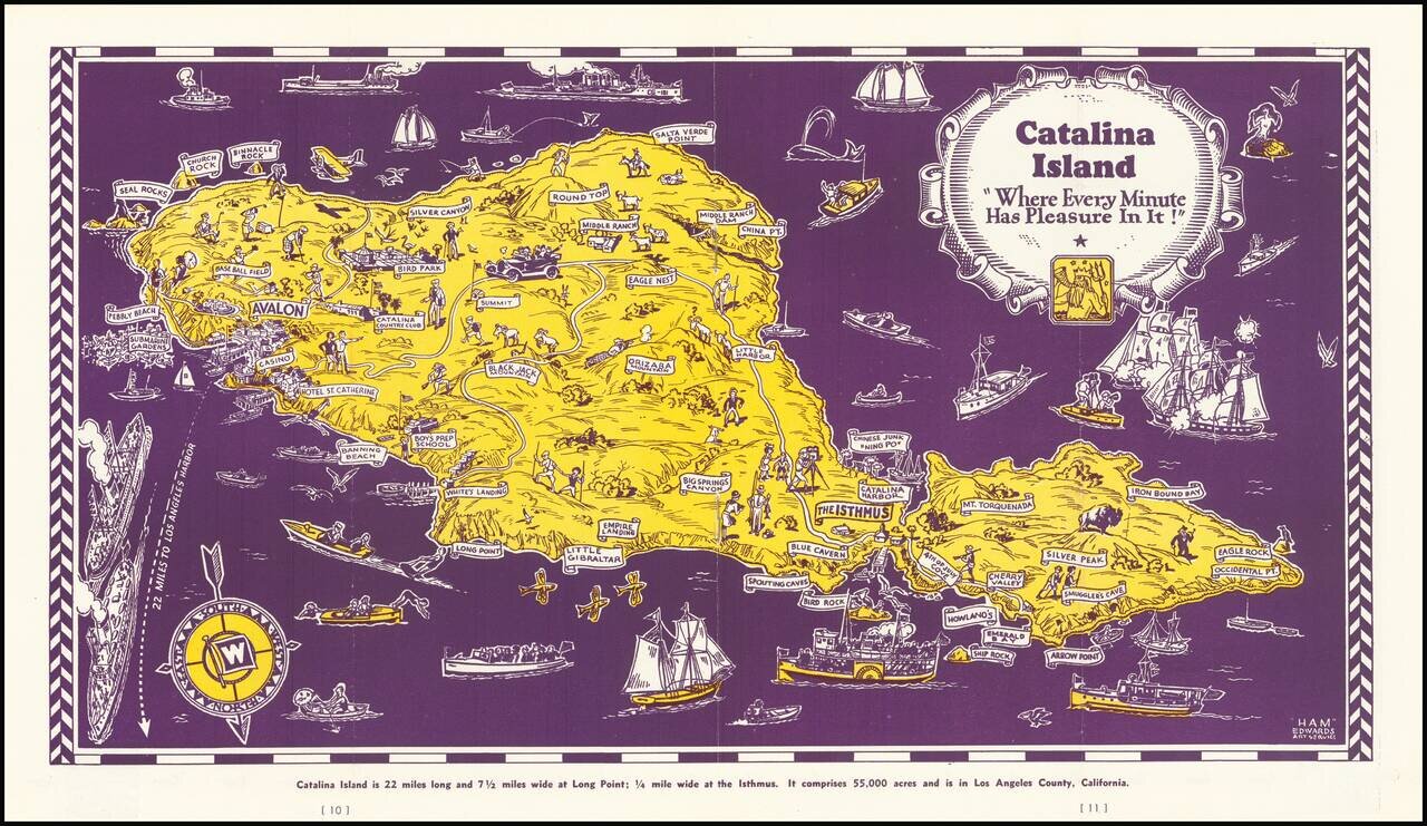
Decorative map of Catalina Island, appearing at the centerpiece of this interesting tourist brochure. The map is scarce. This is the first example we have offered for sale.