
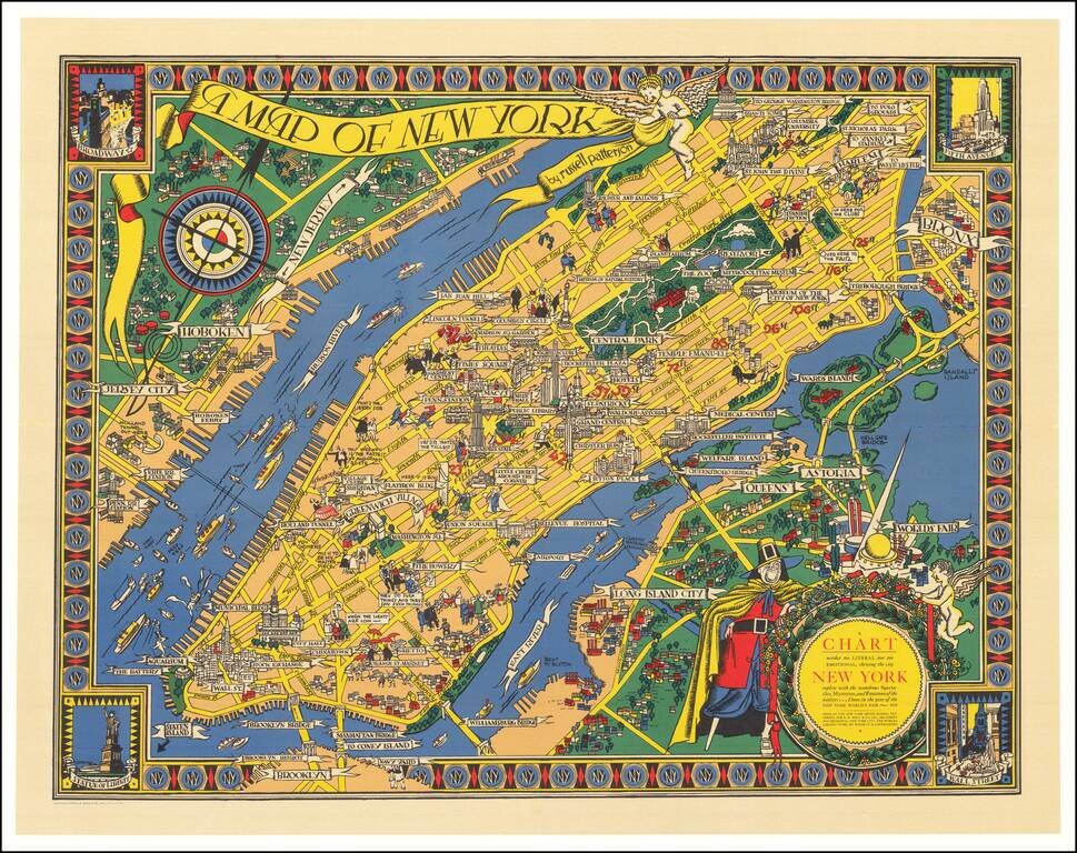
Fabulous Pictorial Map of Manhattan Published for the 1939 World's Fair. Fine vibrantly colored example of this scarce pictorial map of Manhattan published by Macy's department store (which is prominently featured on the map) and made by Russell...
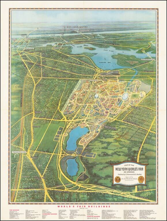
Dawn of a New Day -- New York City -- The Wonder City Rare pictorial view and map of the World's Fair and Rapid Transit map of New York, published by C.S. Hammond for the World's Fair. The World's Fair side of the map provides a marvelous futuristic...
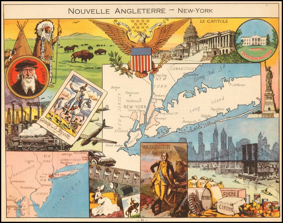
Decorative pictorial map of New England and New York, published by Children's book illustrator JP Pinchon. The map was used to educate primary school children in France in the first half of the 20th Century.
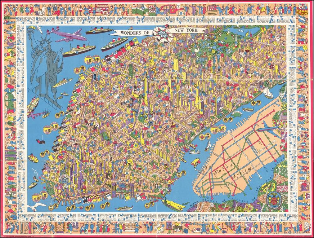
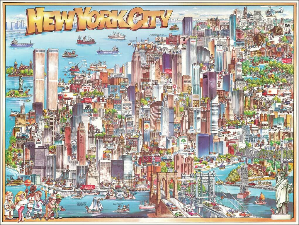
One of the Rarest and Most Sought After New York City Pictorial Maps Rare Large Pictorial Map of New York City, published by Nils Hansell and lithographed by Lutz & Sheinkman. Hansell's map is a whirlwind of whimsical imagery, focused on the...
Richly embellished advertising oriented pictorial map / birdseye view of Dallas, Texas, published by Archar Inc. of Canada. Packed with advertising for local businesses, the images shows buildings, tourism and other landmarks, recreational...
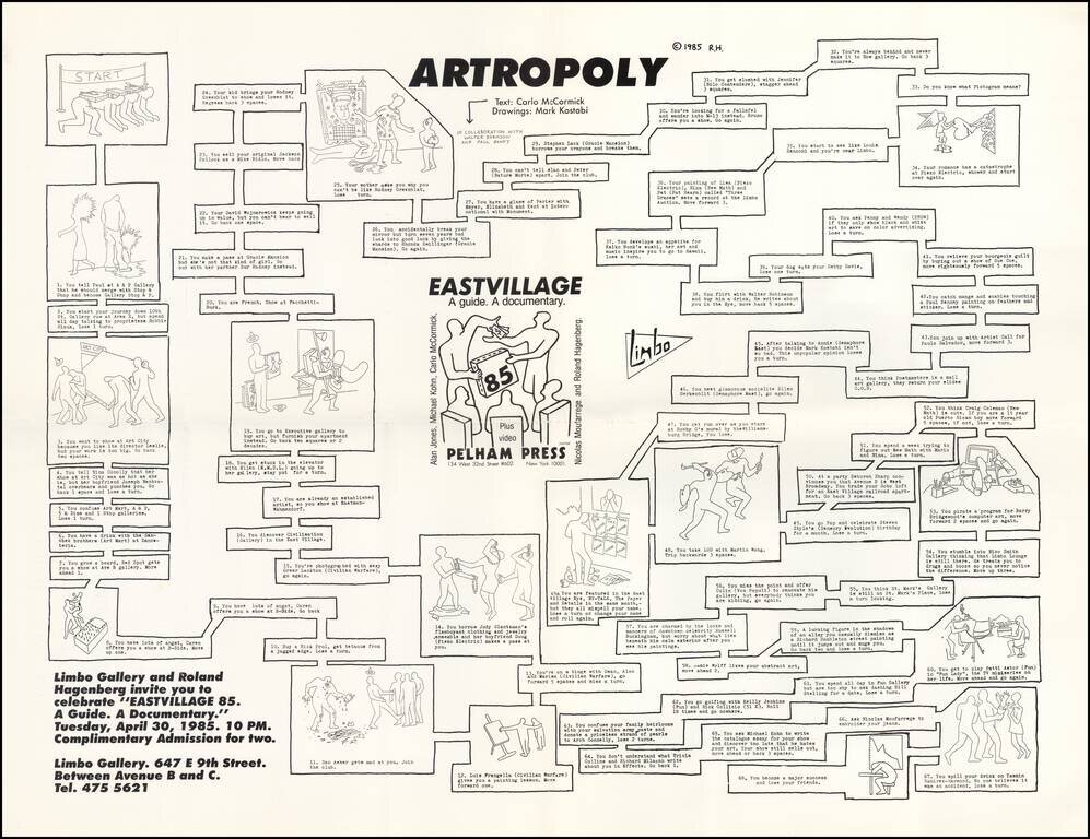
A Humorous Look At The East Village Art Scene, circa 1985. Promotional poster for Roland Hagenberg’s book East Village ’85. Text by Carlo McCormick, in collaboration with Walter Robinson and Paul Benney. Drawings by Mark Kostabi. The poster was...
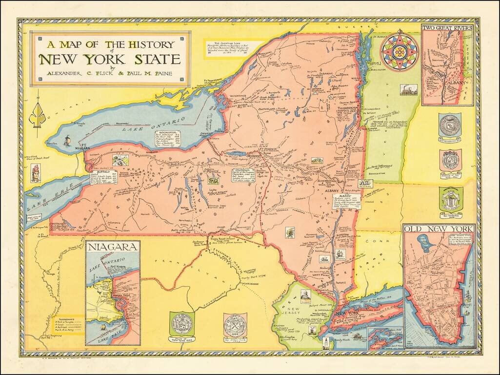
EArly pictorial map of New York State, published by R.R. Bowker in New York. The map provides a history of the state, covering a period of 400 years, including: Giovanni da Verrazzano's discovery of New York Bay in 1524 Dutch settlements of the...
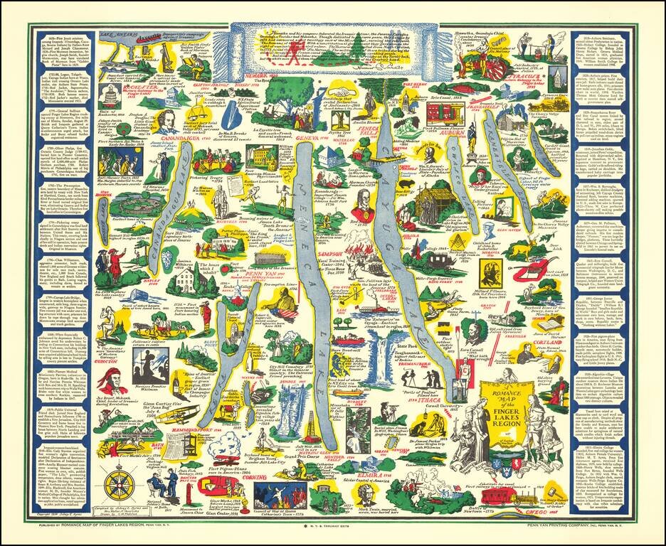
Decorative pictorial map of the Finger Lakes Region of New York. Provides numerous historical vignettes and facts about the region. Compiled by Sidney E. Ayres and Mrs. Walter A. Henricks.
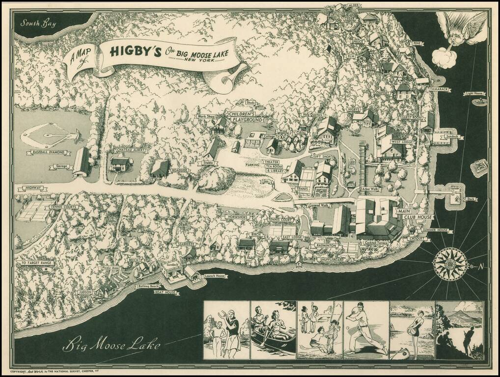
Scarce pictorial map of Big Moose Lake. As noted by Rumsey: Pictorial map of Higsby Campground on Big Moose Lake, New York. Shows roads, trails, beaches, buildings, Campgrounds, Sports and Recreation Facilities. Buildings are named. On bottom...
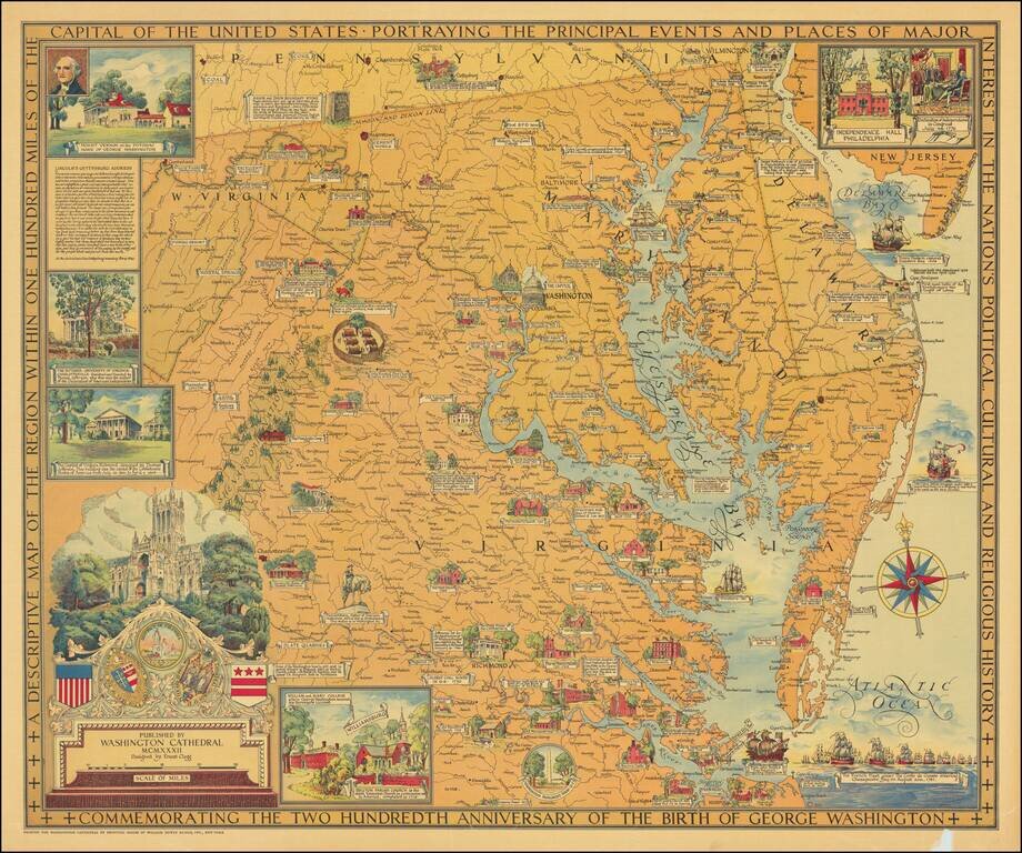
Beautiful color-printed vintage pictorial map of "the region within one hundred miles of the capital of the United States", showing Northern Virginia, Maryland, and Delaware. The title cartouche illustrates Washington Cathedral, the publisher of the...
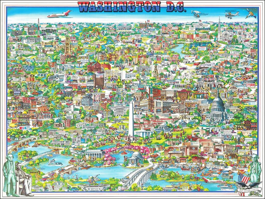
Richly embellished advertising oriented pictorial map / birdseye view of the Washington D.C., published by Archar Inc. of Canada. Packed with advertising for local businesses, the images shows buildings, tourism and other landmarks, recreational...
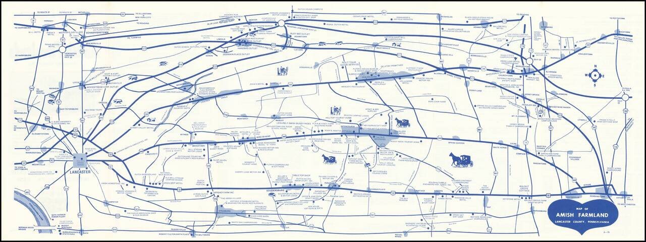
Early edition of this promotional map of the Amish Country. Interesting schematic style road map of the Amish Country, published to promote local businesses by the 340-23 Club. The verso notes that the Free Map of Amish Farmlands, Lancaster County,...
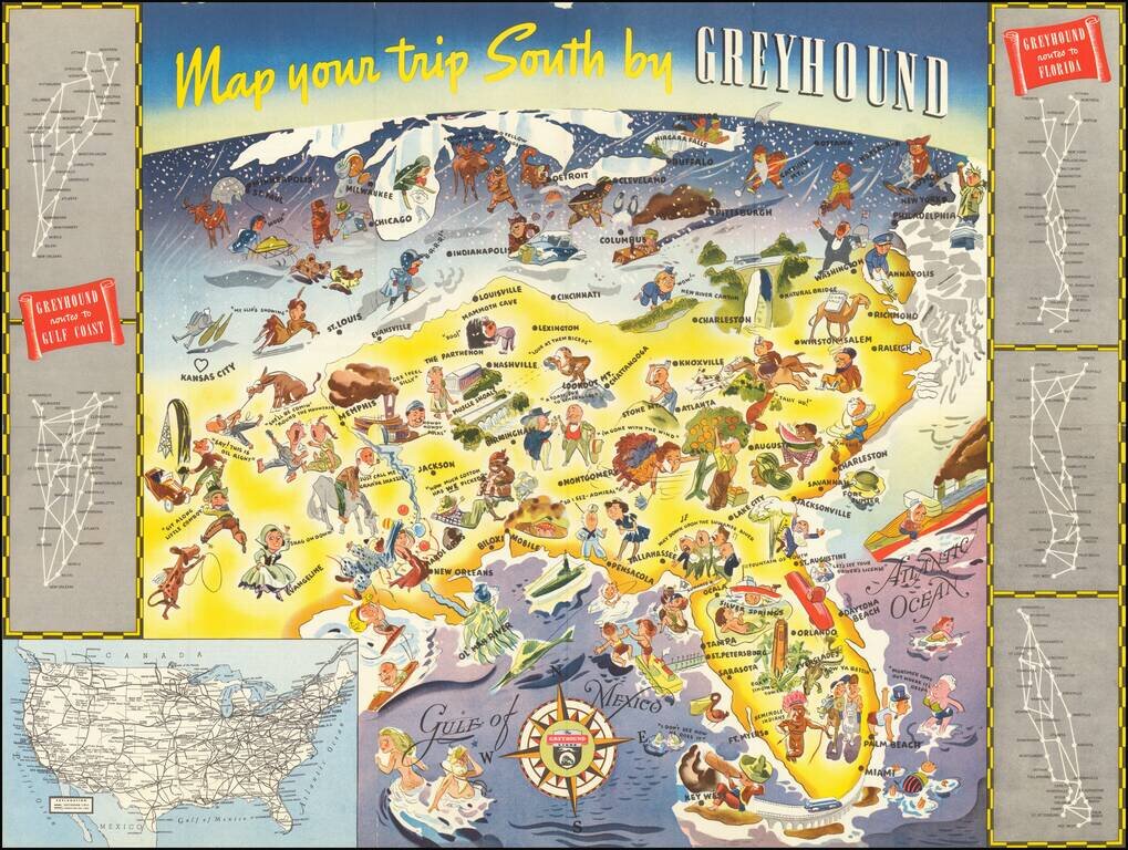
Whimsical map of the American South, promoting Greyhound's routes to Florida and the Gulf Coast in 1938. The image is dominated images of Florida tourist attractions, as well as other southern sites. Further north, the residents of the Midwest,...
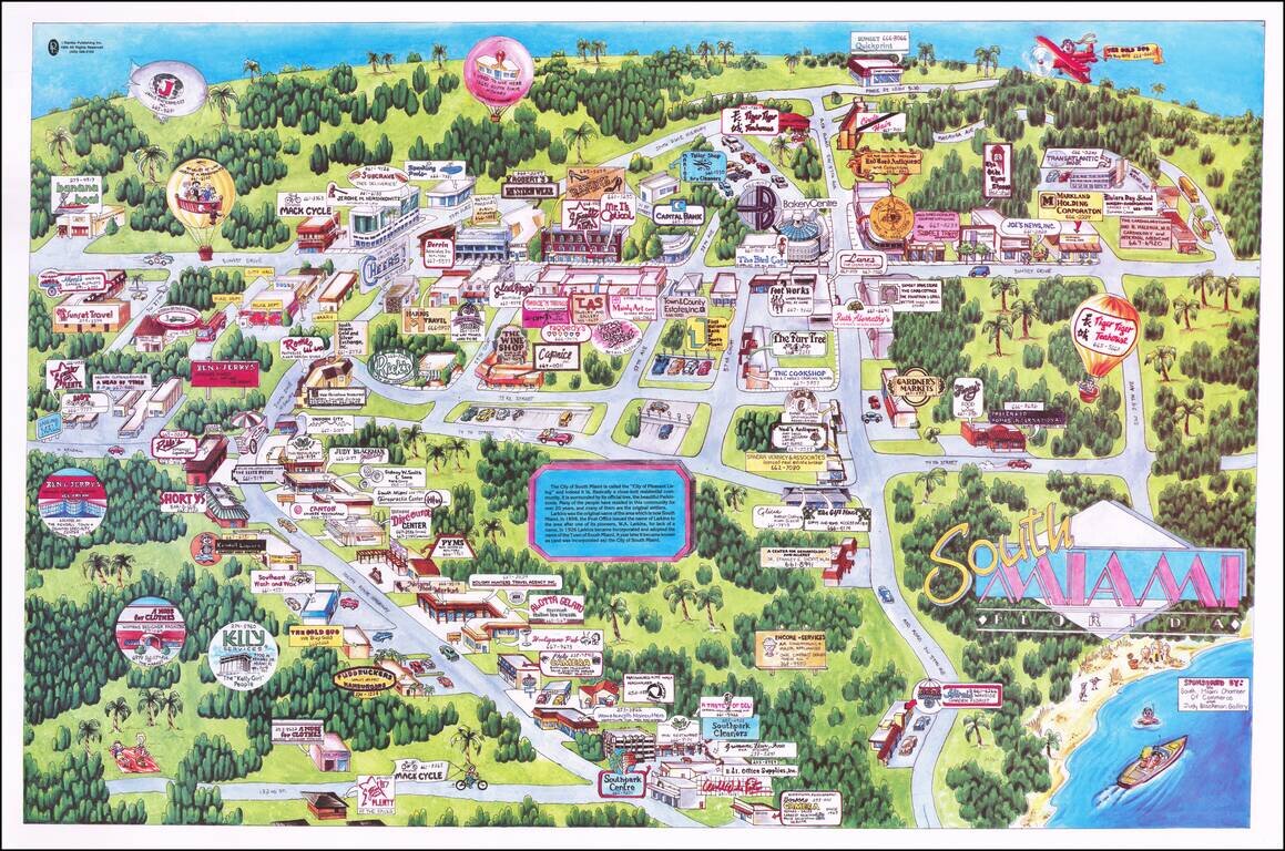
Fine pictorial map of South Miami, showing the neighborhood immediately south of the University of Miami. A fine whimsical mid-1980s image, filled with local advertising. The map shows what must have been one of the earliest Ben & Jerry's Ice...
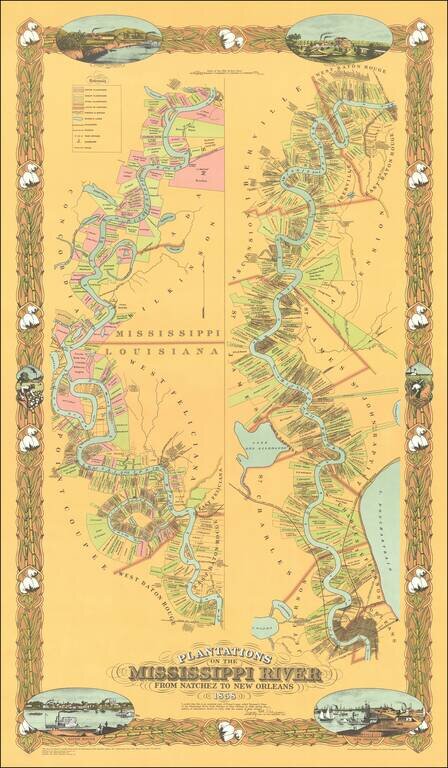
Fine limited edition copy of Norman's Chart of the Mississippi River from Natchez to New Orleans, also known as the Persac map. The map shows the divisions of land with owners’ names, vignettes of New Orleans, Baton Rouge and plantations, the...
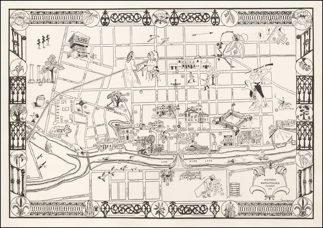
Decorative pictorial map of Natchitoches, Louisiana, by Thelma Z Kyser. Thelma Kyser was a life resident of Natchitoches, Louisiana, who seems to have been very active in Women's Physical Education and Health issues. We can find no information about...