Map size in jpg-format: 26.2882MiB
Click to open in high resolution (open in new tab).

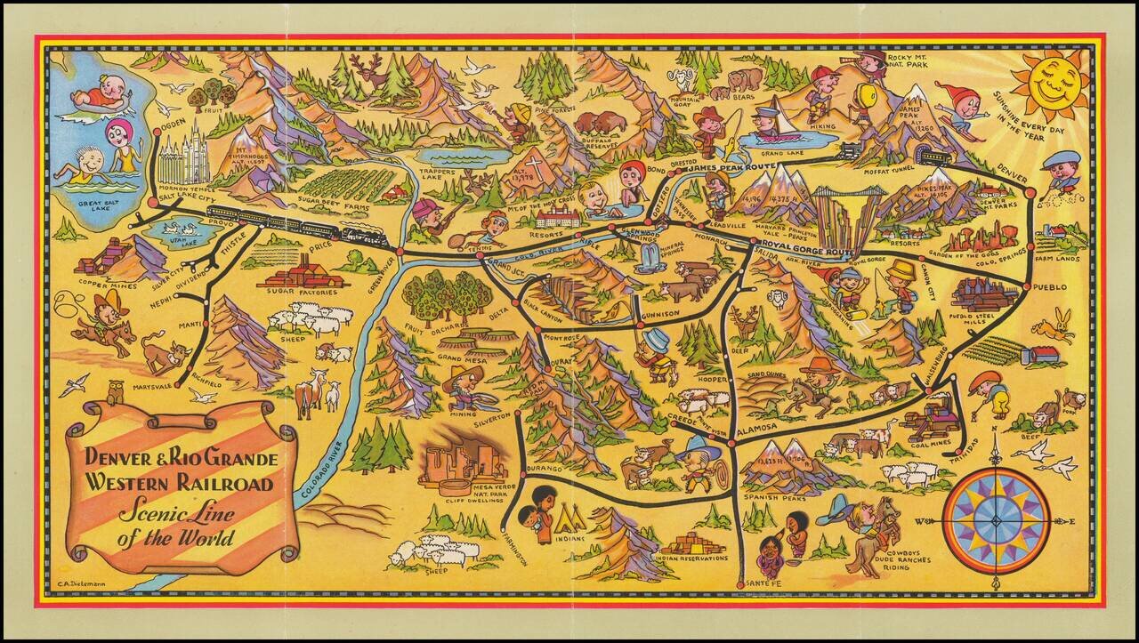
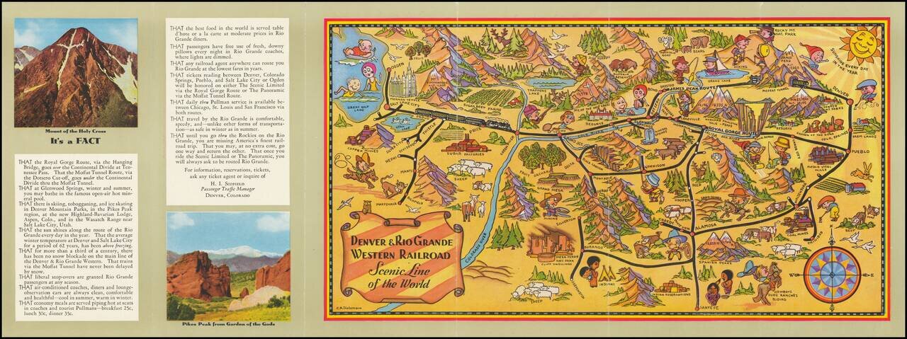
Scarce early Denver & Rio Grande Western Railroad promotional brochure, illustrated with a fine pictorial map of Colorado by Charles E. Dietemann (1902-1973).
Focused on the rail lines of the Denver & Rio Grande Western, the map provides whimsical imagery focused on recreational activities, agriculture, mining and the history of Colorado.
Born in Denver, Dietemann was noted for mountain landscapes and Indian portraits, and in later years he focused on abstract subjects. From 1934-35, he was vice-president of the Denver Artists Guild. Dietemann was a Professor of Art at the University of Illinois from 1937 to 1968.
As noted by John Gruber:
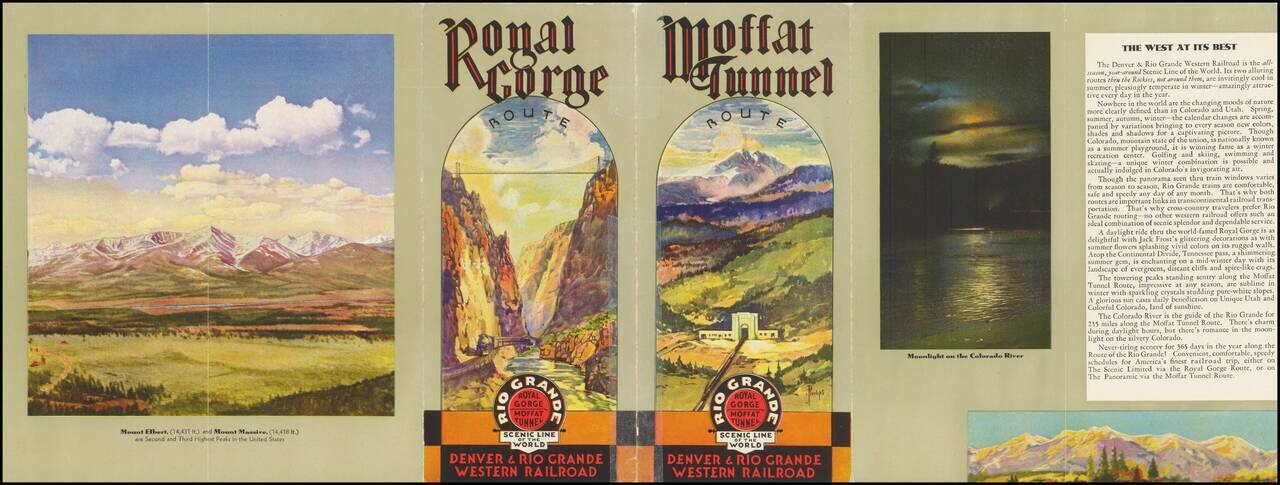
Sometime after 1934, the Denver & Rio Grande Western Railroad turned to advertising its "Scenic Line of the World" with three- and five-fold brochures illustrated with watercolors and crayon drawings by Frank L. Philips, a Denver commercial artist. Compared to Proehl's Chicago work, Philips' is modest, almost retro in appearance. The brochures emphasized the railroad's two spectacular engineering feats: the Moffat Tunnel west of Denver, and the twisting route along the Royal Gorge in Colorado - both places where autos could not go. (A scary suspension bridge spans the gorge; the train travels along the Arkansas River.)
The five-fold brochure has a cartoon-like map, typical of 1930's design, that depicts numerous attractions. It was the creation of Charles A. Dietemann, a commercial artist in Denver. His work has Disney-like traits and suggests that a good time will be had by all. . . .
If you are a student, write to us in telegram: @antiquemaps and indicate what material you need and for what work you need a map in high detail. We are ready to provide material on special terms. For students only!
![Mexique par Th. Duvotenay…1843 [Republic of Texas]](/map/small/67925.jpg)
