
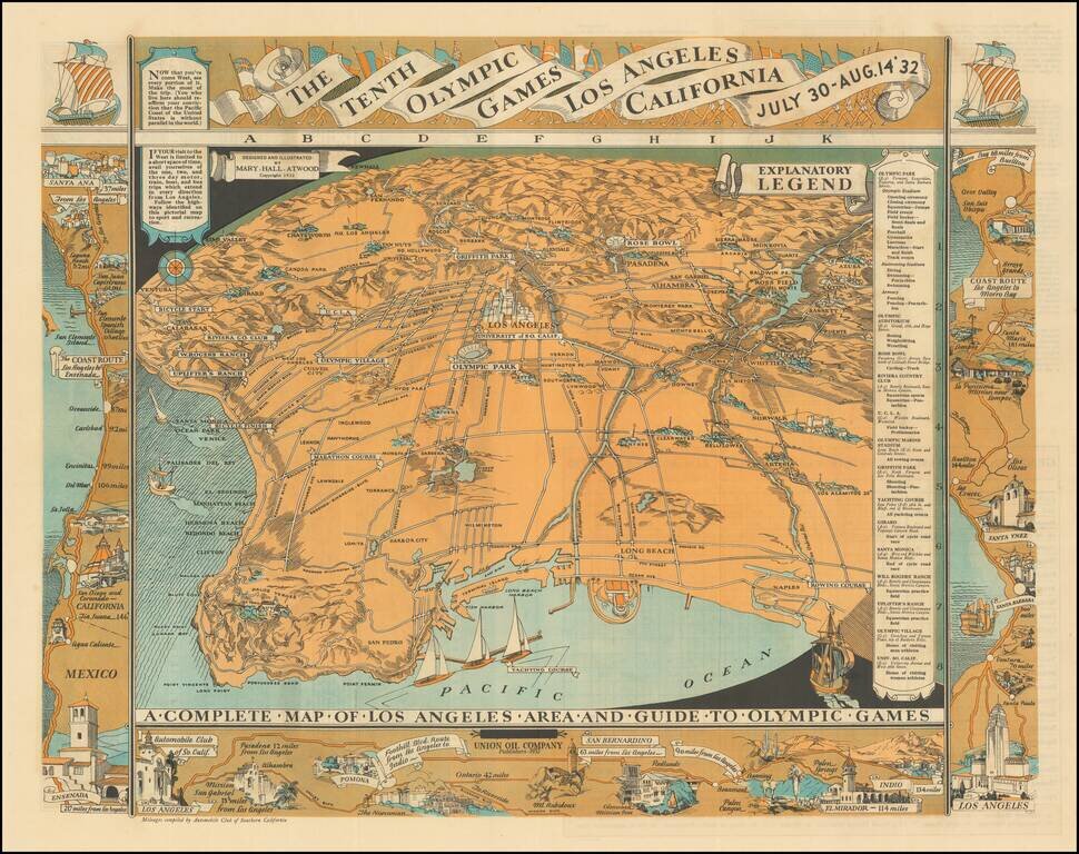
Highly detailed pictographic map, depicting Los Angeles, with a number of maps around the outer portion of the map illustrating various coastal and inland routes. The verso of the map extends from Riviera Country Club and USC and the Coliseum to City...
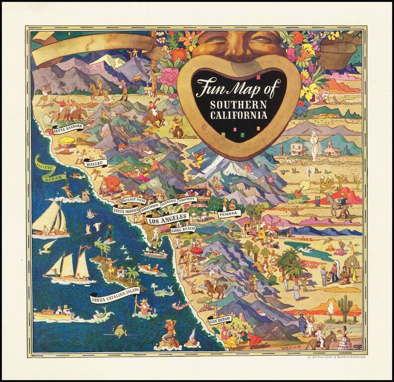
Striking pictorial advertising map, drawn by Raymond Winters in 1935. The map was originally published for the All-Year Club of Southern California and was issued both as a separate map and an advertising insert. Raymond Winters was a noted Western...
![[Imperial Valley]](/map/small/69292.jpg)
America's Winter Garden Fine promotional map and pamphlet, promoting the benefits of the Imperial Valley as an agricultural opportunity for farmers. The map provides a fine pictorial overview of Imperial County, with pictorial vignettes highlighting...
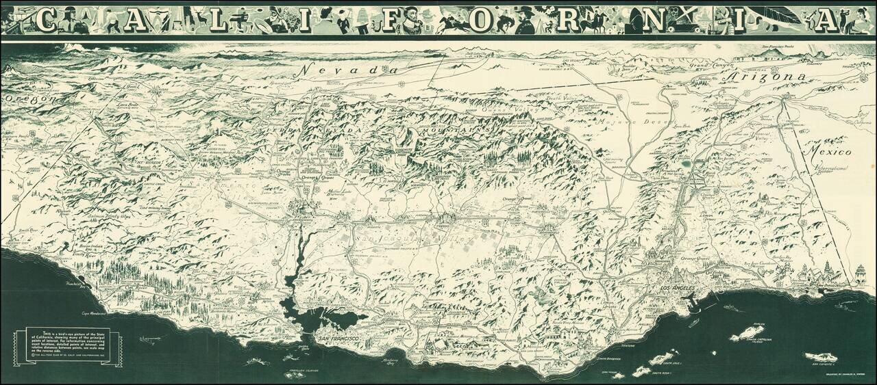
"While attractions for tourists are unlimited in California, it is necessary to advise persons seeking employment not to come here at this time. When opportunity arises California will gladly make it known." A striking Depression Era birds-eye view...
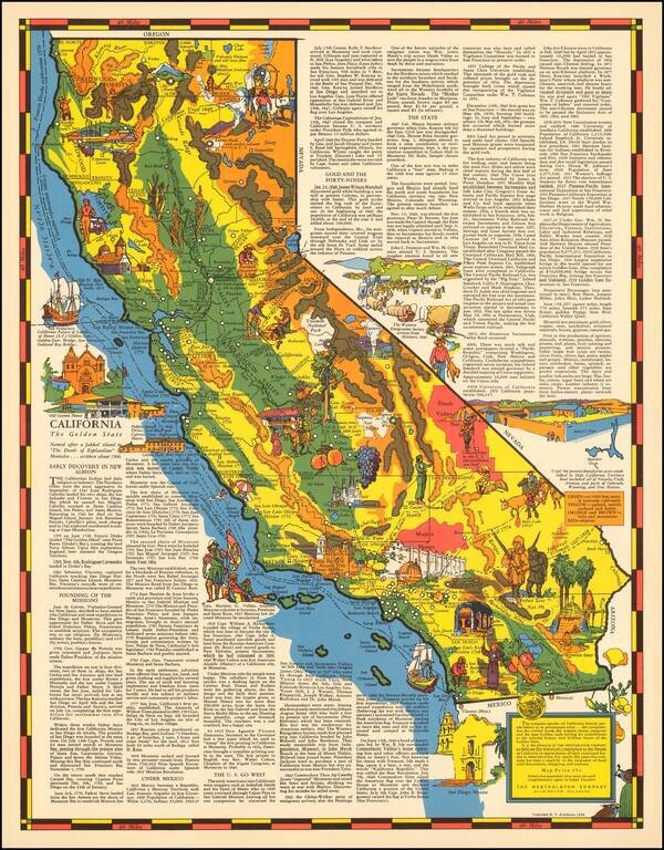
Rare pictorial map of California by R.T. Aitchison, published by the The Mentholatum Company. The map includes decorative vignettes illustrating California and a detailed text history of the state. R.T. Aitchison was a Wichita, Kansas illustrator....
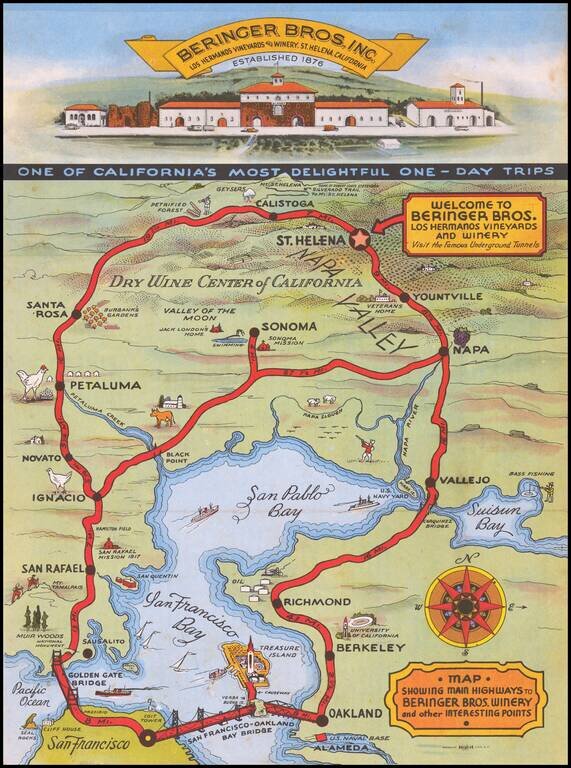
Striking map of the route from San Francisco to the Beringer Winery, with a decorative vignette of the front of the Winery.
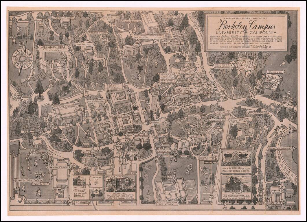
Showing The Berkeley Radiation Laboratory in 1939 Rare pictorial map of the Berkeley campus, by Artist Milt Schenkovsky (UC Berkeley class of 1937). The map provides a detailed treatment of Berkeley and the University of California Campus in the...

An attractive tourist map of Sacramento produced for the city's 1939 centennial. The recto is centered on a map of Sacramento itself and the immediate vicinity, while the verso shows a map of the greater "Golden Empire" area from Mt. Shasta to Tuolumne...
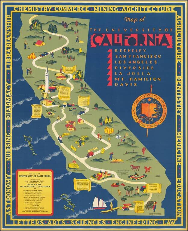
Rare map of California, published by the California Club. The map identifies the existing University of California Campuses and labels a number of regional places where off campus educational and research programs were being conducted. Berkeley...
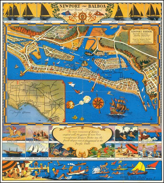
An early pictorial map of Newport Beach. Decorative promotional map of Newport Harbor and Newport Beach, California, issued by the Newport Harbor Chamber of Commerce. Includes a number of lively vignettes.

"The Palm of God's Hand" (Harold Bell Wright) Rare tourist promotional map, focused on tourism in the Imperial Valley. Centered on Brawley, California, the map includes vignettes highlighting tourist attractions, including the Salton Sea, Painted...
![[California] Panorama of Progress -- California State Fair America's Largest Ten Day State Fair](/map/small/69899.jpg)
Fascinating pictorial map of California, prepared for the 87th Annual California State Fair, held between August 29, 1941 to September 7, 1941. The map presents a fascinating image of California, partitioned in 58 "color-laden" counties, each looking...
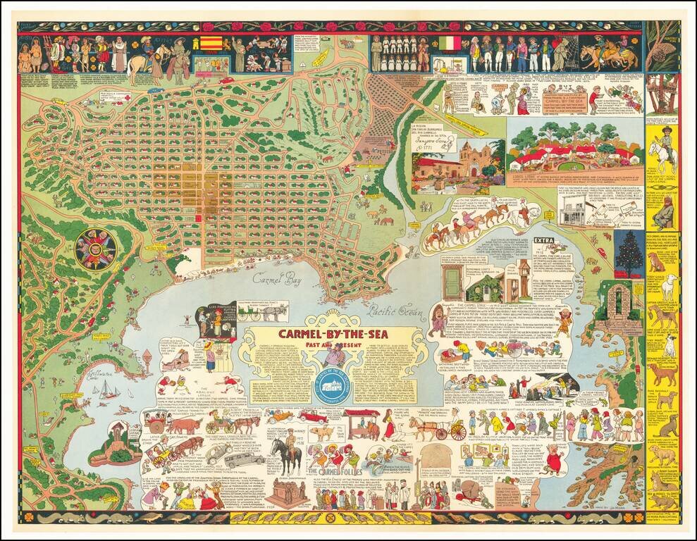
Fine example of Jo Mora's marvelous map of Carmel and the location of Mora's art studio. The map includes a detailed and whimsical look at the area around Carmel, with marvelous vignettes of the major landmarks, past and present, a town plan and a...
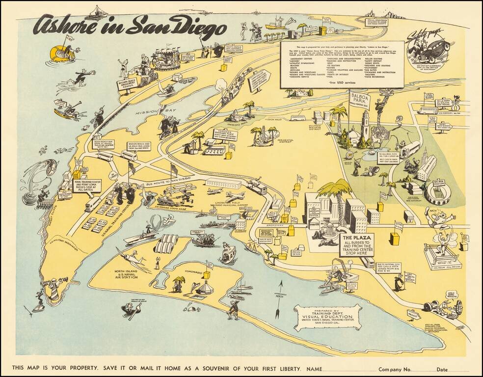
Lively pictorial map of San Diego, prepared for soldiers on leave from the Naval Training Center during WWII. The map extends north to La Jolla, showing the USO facility at 7776 Eads Avenue, and East Balboa Park. The map is centered on Lindbergh...
![[WWII War Bonds] As Bond Away Finishes Its Tour](/map/small/63461.jpg)
Fourth Air Force Aviation Engineers Camouflage Bond Show -- Northern California 1944 Rare promotional pamphlet and map, supporting the sale of bonds to support the war effort. Issued in the winter of 1944, the map illustrates the different places...
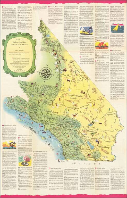
Rare Sightseeing Map of Southern California. The map combines pictorial vignettes with a tourist road map of the region, with text describing tourist opportunities in each of Southern California's counties. On the verso, a sightseeing map of Los...