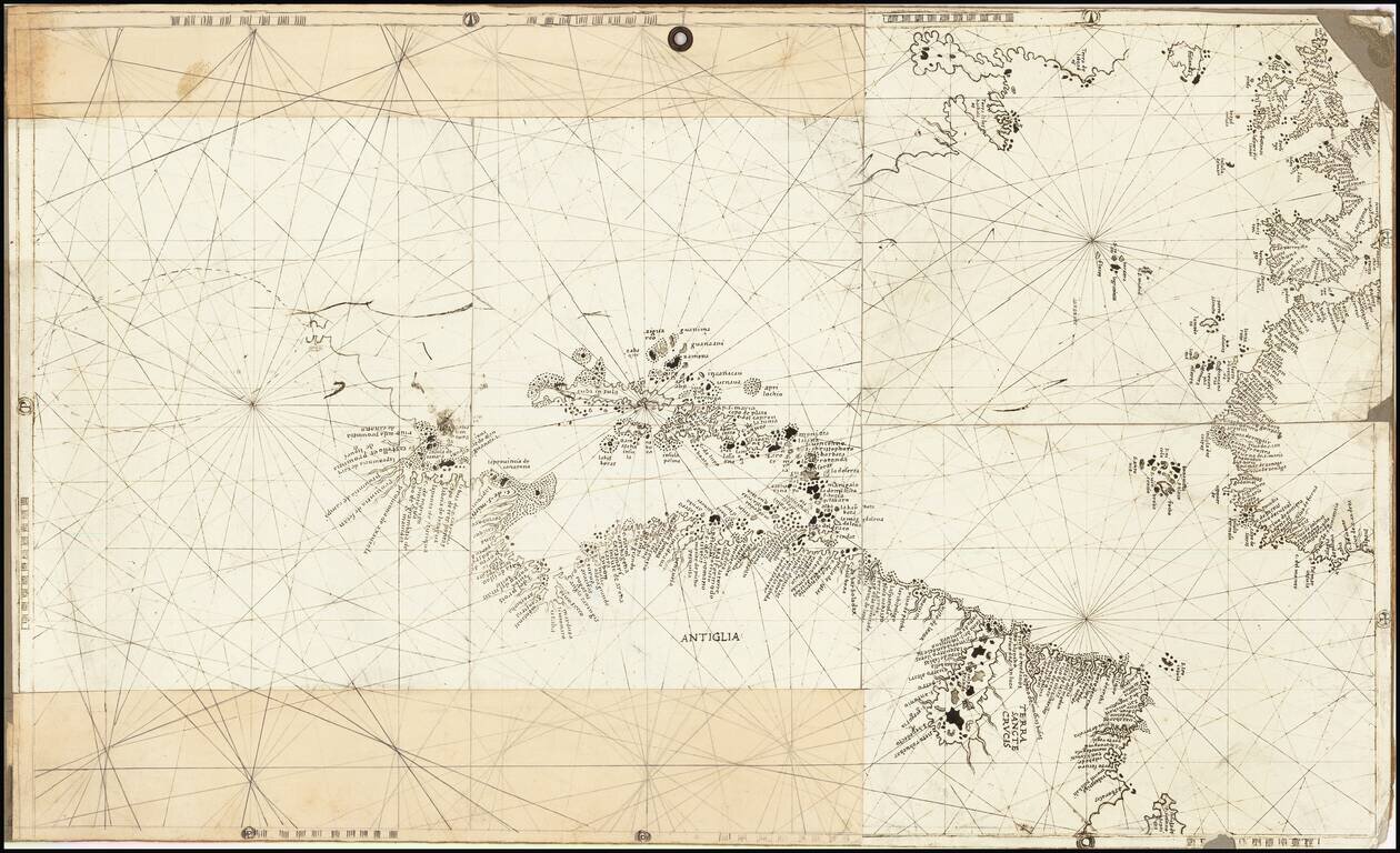
Rare and antique old maps of the Caribbean & Central_America
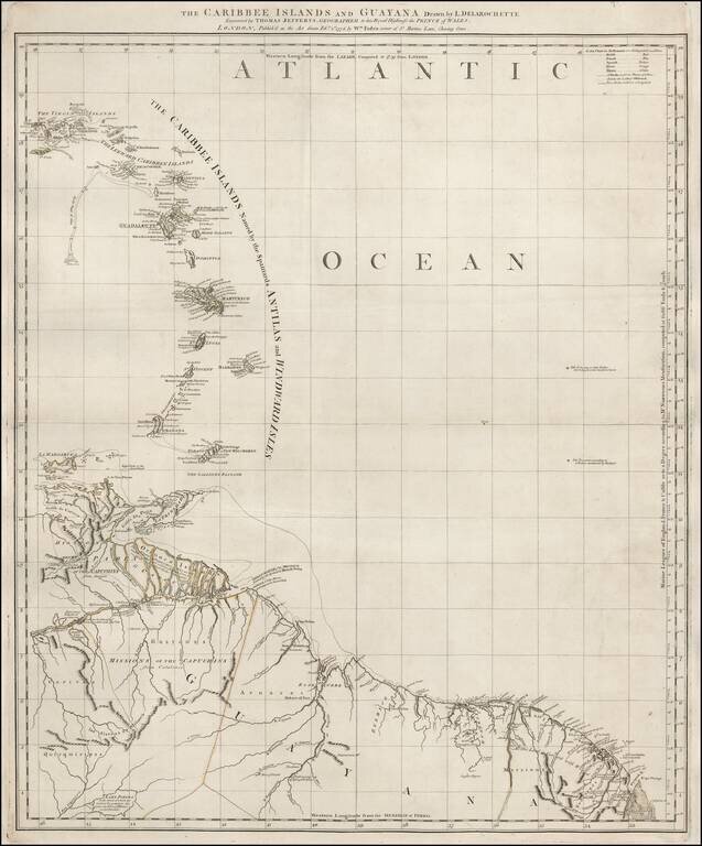
Scarce map of the Eastern Caribbean and Northeastern Coast of South America, published by Thomas Jefferys. The map extending from the Virgin Islands to Margarita and Trinidad Islands to Cayenne and Lake Parima, including a nice treatment of the...
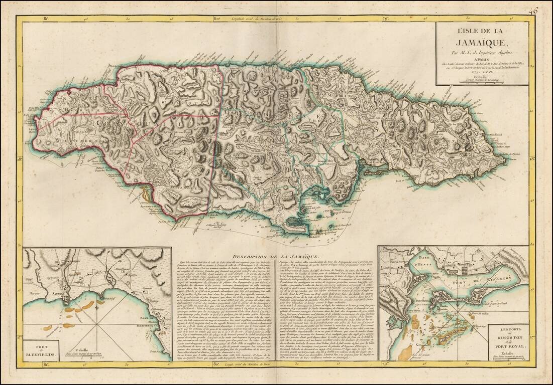
Rare French Map of Jamaica, published by Jean Lattre in Paris. The map provides remarkable topographical details, including mountains, rivers, islands, and other coastal features. Towns, Roads, Plantations, Churches and other features are also shown....
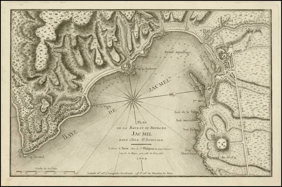
Fine example of this scarce chart of the bay and town of Jacmel, on the south coast of Haiti's southwestern peninsula, with multiple depth soundings and the topography of the surrounding countryside rendered in great detail. The map appeared in the...
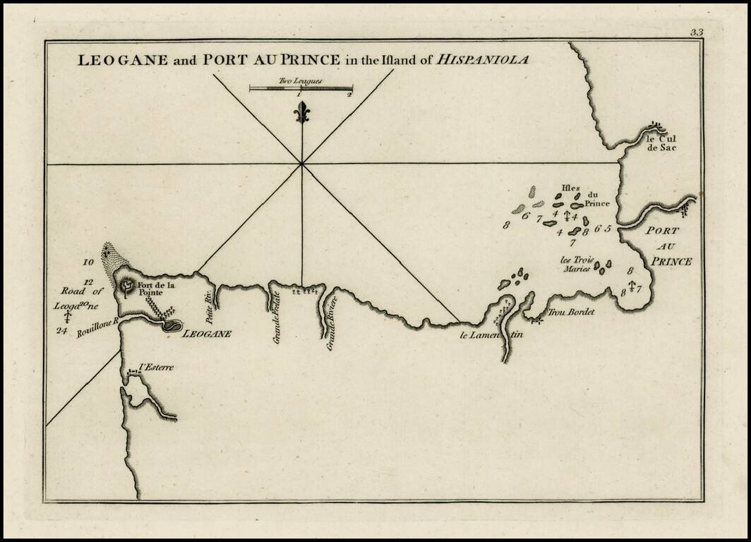
Rare plan of the coast of Haiti, from Port Au Prince to Leogane first published by Sayer & Bennett. Includes a detailed charting of the harbor, with soundings and anchorages, forts, islands and other details. One of the earliest obtainable...
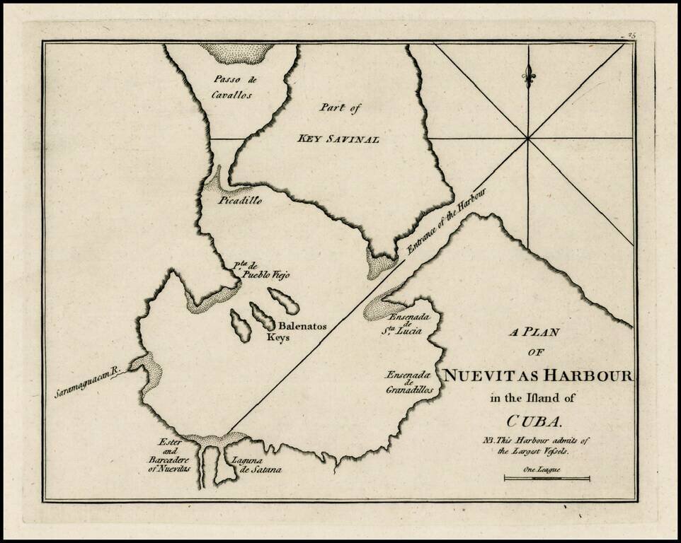
Rare early plan of the harbor at Nuevitas, Cuba, published by Sayer & Bennett, one of the earliest obtainable English Plans of the harbor. Includes a detailed charting of the harbor, with soundings and anchorages, and place names. A note indicates...
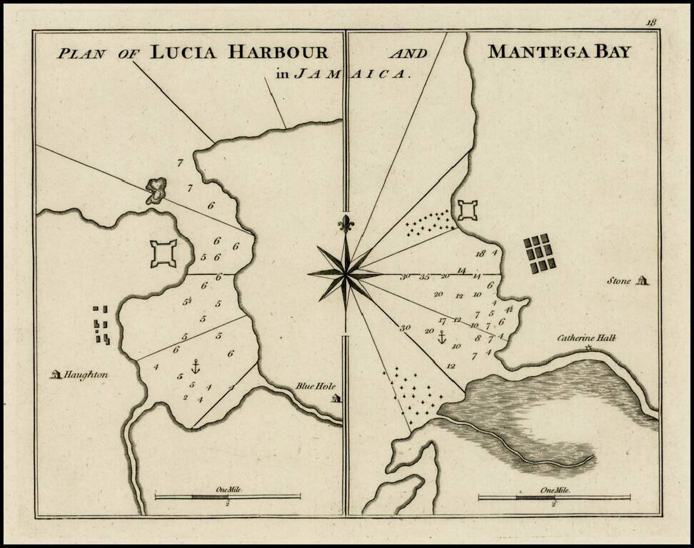
Rare early plan of Lucia Harbor and Mantega, published by Sayer & Bennett, one of the earliest obtainable English Plans of the harbor. Includes a detailed charting of the harbor and Bay, with soundings and anchorages, and place names.
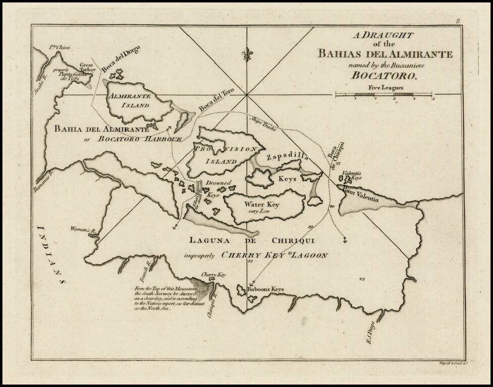
Rare early plan of the region around Bahia Del Almirante or Bocatoro Harbor, published by Sayer & Bennett, one of the earliest obtainable English Plans of the harbor. Includes a detailed charting of the bay, with soundings and anchorages, and...
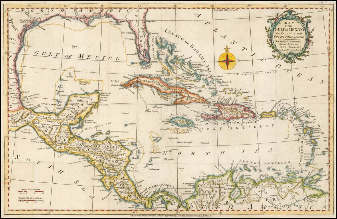
Striking map of the West Indies, Gulf Coast, Florida, etc. Florida shown as an archipelago. Includes a compass rose and decorative cartouche.
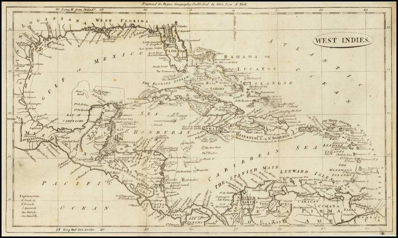
Highly detailed map of the Gulf Coast and the Caribbean, published in 1799 in Payne's Geography. Includes an interesting treatment of Florida and detail among the islands, and locating well over 100 place names. Shows East and West Florida, the...
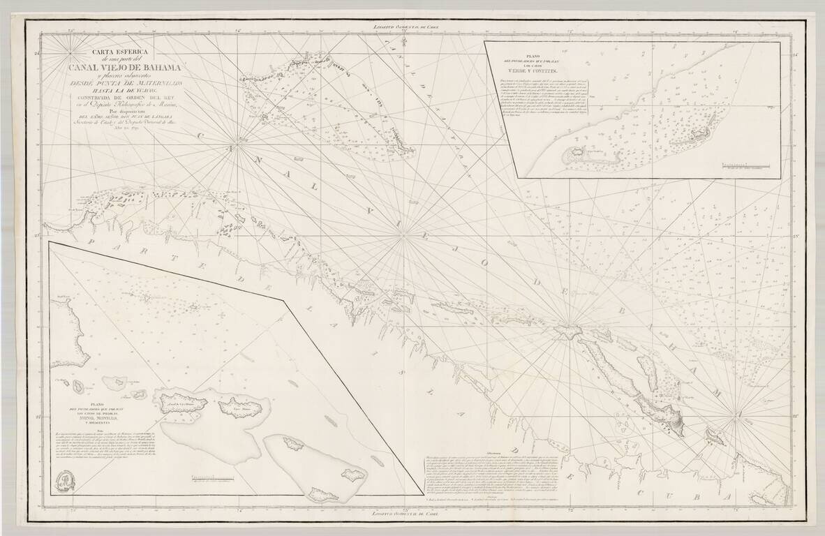
Early edition of this important Spanish chart of part of the Bahama Channel and the northern coastline of Cuba, published by the Spanish Admiralty. First issued in 1799, this example adds rhumb lines not on the earlier state of the chart. This is the...
![[Bahamas, Cuba, Santa Domingo] Carta Esferica que comprende los desemboques Al Norte De La Isla de S.to Domingo y La Parte Orientale Del Canal Viejo De Bahama. Construida de oreden superior en la Direccion Hidographical y publicado en Madrid ano 1802](/map/small/48809.jpg)
A Working Spanish Sea Chart Centered on the Turks & Caicos Islands and the Southern Bahamas Scarce Spanish Sea Chart of the southern part of the Bahamas, eastern Cuba, most of Jamaica, western Haiti and neighboring islands. The map extends from...
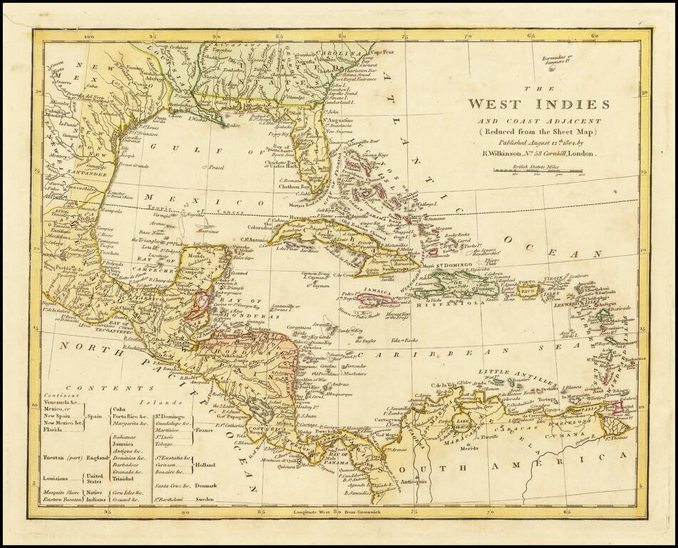
Marvelous map of the West Indies, Florida, the Gulf Coast, Texas and Central America, published by Wilkinson. Includes a key showing the various colonial possessions of Spain, England, the United States, France, Holland, Denmark and Sweden, along with...
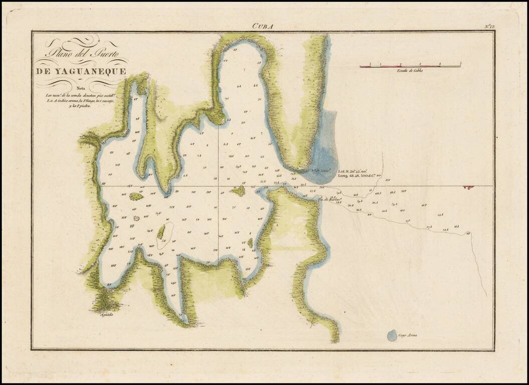
Highly detailed and accurate engraved map of the bay on the north side of Cuba. The map shows soundings in the bay, elevation is rendered pictorially. The map is based on the surveying work of Joaquin Francisco Fidalgo (1758-1820). He was a teacher...
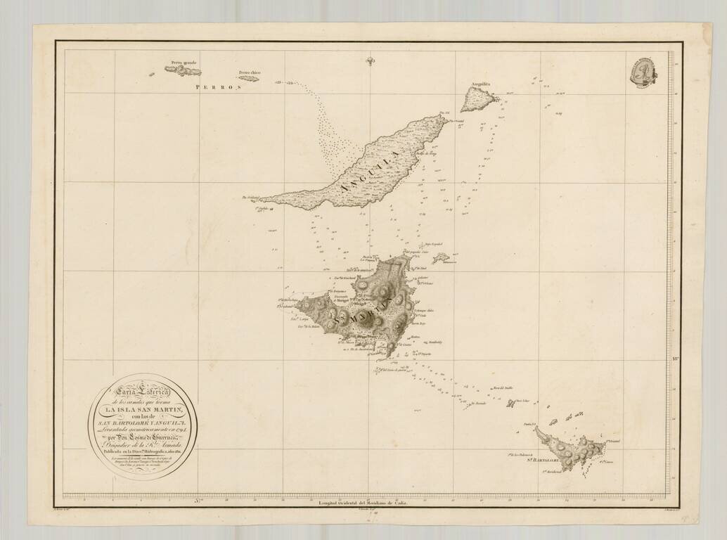
Rare separately issued chart of St. Barts, Anguila and St. Martin, published by the Direcion Hidrografica in Madrid. The chart is one of the few charts or maps to focus on these islands and the only Spanish chart published in the 18th Century to treat...
Interesting general map of the Caribbean, published by Matthew Carey in his General Atlas.
![St. Vincent [and] Barbadoes](/map/small/47045.jpg)
Detailed maps of the islands of Jamaica and St. Vincent, published by John Thomson in Edinburg. The map includes topographical details, parishes, towns, rivers, bays, points, etc. Among the best obtainable large format maps of the two islands during...