Map size in jpg-format: 10.3814MiB
Click to open in high resolution (open in new tab).
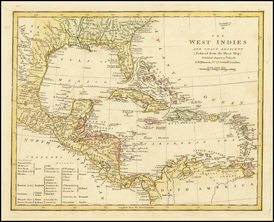
Marvelous map of the West Indies, Florida, the Gulf Coast, Texas and Central America, published by Wilkinson.
Includes a key showing the various colonial possessions of Spain, England, the United States, France, Holland, Denmark and Sweden, along with native Indian regions.
Perhaps most interesting is the location of "British Yucatan" which would later be renamed British Honduras. The Treaty of Versailles (1783), between Britain and Spain, gave the British rights to cut logwood between the Hondo and Belize rivers. The Convention of London (1786), expanded this concession to include the area between the Belize and Sibun rivers. In 1862, the Settlement of Belize in the Bay of Honduras was declared a British colony called British Honduras, and the crown's representative was elevated to a lieutenant governor, subordinate to the governor of Jamaica. In 1981, the region would gain full independence and be renamed Belize.
Louisiana is now appearing as part of the US, indicating that the map was issued shortly after the Louisiana Purchase. Excellent early detail in Texas.
Robert Wilkinson was active in London as a cartographic publisher from 1785 to 1825. He produced a number of nice works, including a General Atlas and a re-issuance of Bowen & Kitchen's English Atlas, along with excellent large format separate maps.
If you are a student, write to us in telegram: @antiquemaps and indicate what material you need and for what work you need a map in high detail. We are ready to provide material on special terms. For students only!


![[Wall Map] West-Indische Paskaert waer in de graden der breedde over weder zyden vande middelyn wassende so vergrooten dat die geproportioneert syn tegen hunne nevenstaende graden de lengde.](/map/small/60169.jpg)