Map size in jpg-format: 2.02629MiB
Click to open in high resolution (open in new tab).
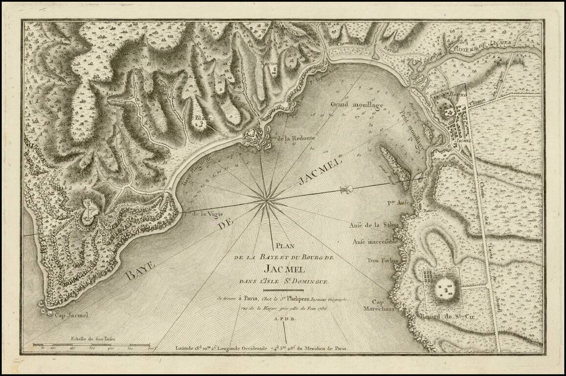
Fine example of this scarce chart of the bay and town of Jacmel, on the south coast of Haiti's southwestern peninsula, with multiple depth soundings and the topography of the surrounding countryside rendered in great detail.
The map appeared in the rare first edition of Recueil de vues des lieux principaux de la colonie francaise de Saint-Domingue, the atlas published as a companion to the six-volume Loix et constitutions des colonies françoises de l'Amérique sous le Vent by Moreau de Saint-Méry, a key chronicler of life on the French colony of Saint Domingue, today's Haiti, on the eve of the Haitian Revolution.
If you are a student, write to us in telegram: @antiquemaps and indicate what material you need and for what work you need a map in high detail. We are ready to provide material on special terms. For students only!


![[Wall Map] West-Indische Paskaert waer in de graden der breedde over weder zyden vande middelyn wassende so vergrooten dat die geproportioneert syn tegen hunne nevenstaende graden de lengde.](/map/small/60169.jpg)