Map size in jpg-format: 414089B
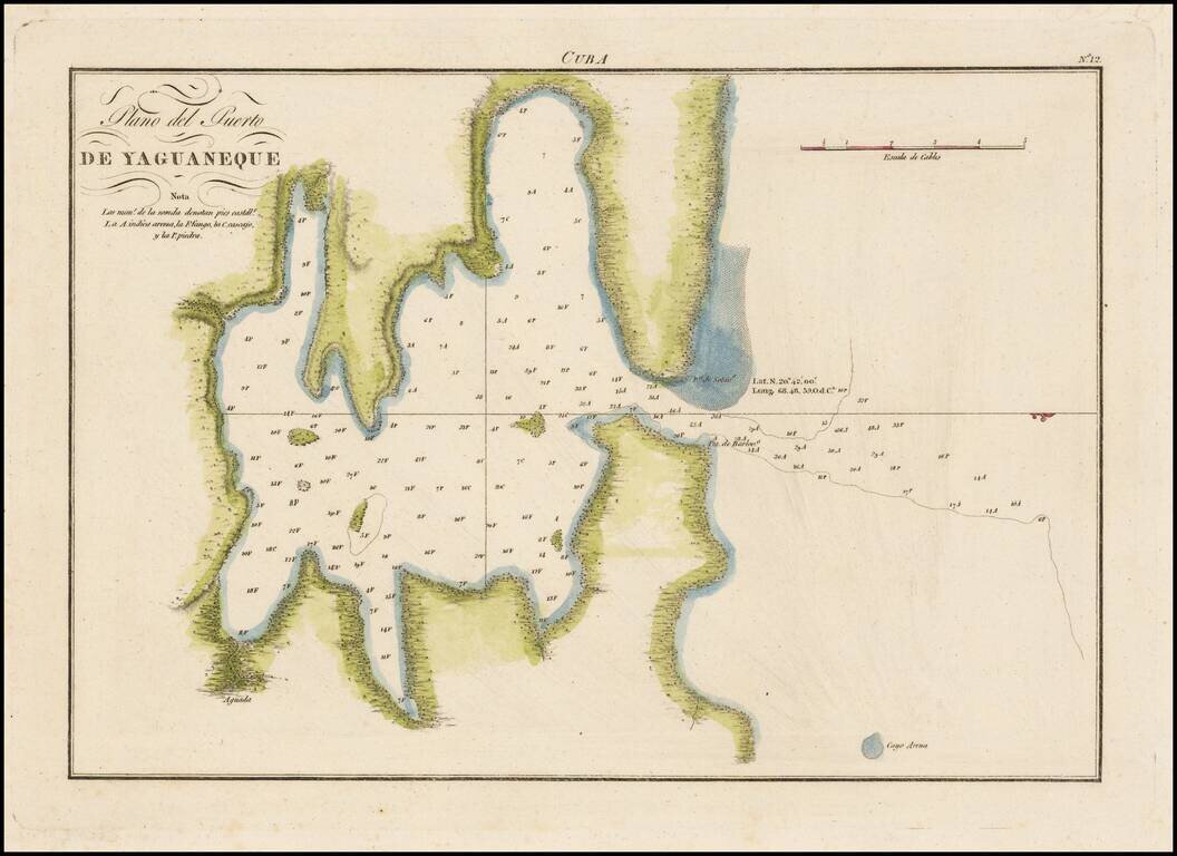
Highly detailed and accurate engraved map of the bay on the north side of Cuba.
The map shows soundings in the bay, elevation is rendered pictorially.
The map is based on the surveying work of Joaquin Francisco Fidalgo (1758-1820). He was a teacher at the Academy midshipmen of Cadiz. He was promoted to commander in 1791, and from 1792 he captained one of the two divisions of brigs, the other was led by Cosme Damian Churruca, working on charts and sailing directions between the Gulf of Mexico, Florida, Terra Firma and around the West Indies. In 1794 Fidalgo led the geographic exploration from Guajira to Panama.
Fidalgo also collaborated in the founding of a sailing school in Cartagena de Indias. Fidalgo concluded his work in 1810 and returned to Spain, where he headed the Direccion Hidrografica de Madrid.
The Dirección de Hidrografía, or the Directorate of Hydrographic Works, was established in 1797. Its roots were in the Casa de Contratación, founded in 1503 in Sevilla, which housed all the charts of the Spanish Empire and oversaw the creation and maintenance of the padrón real, the official master chart. The Casa, now in Cadiz, was shuttered in 1790, but Spain still needed a hydrographic body. In response, the Dirección was created in 1797. One of its first projects was the publication of charts from the Malaspina Expedition (1789-1794). The Dirección oversaw not only publication, but also surveying. The Dirección was abolished in the early twentieth century, when their work was distributed to other organizations.
If you are a student, write to us in telegram: @antiquemaps and indicate what material you need and for what work you need a map in high detail. We are ready to provide material on special terms. For students only!


![[Wall Map] West-Indische Paskaert waer in de graden der breedde over weder zyden vande middelyn wassende so vergrooten dat die geproportioneert syn tegen hunne nevenstaende graden de lengde.](/map/small/60169.jpg)