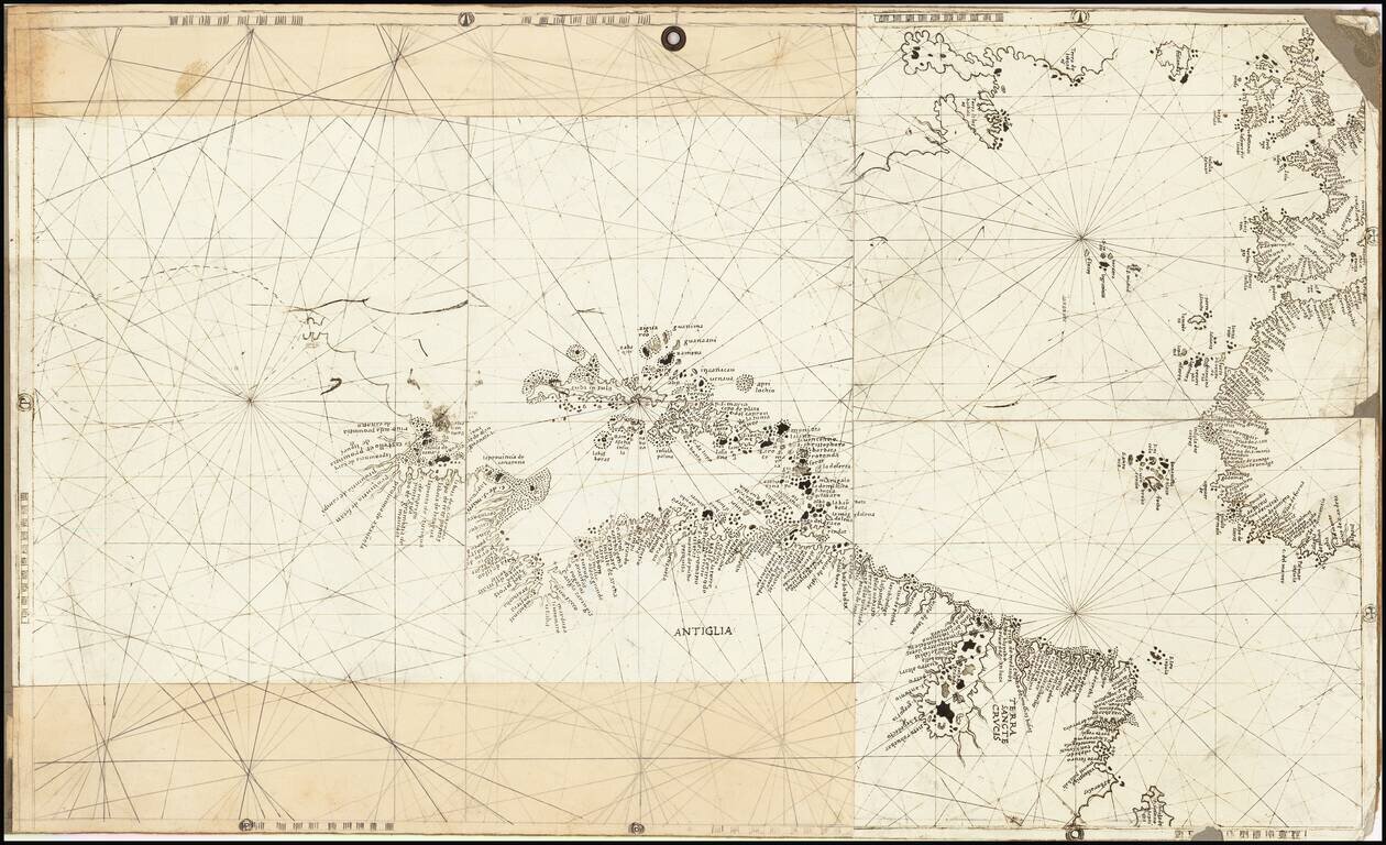
Rare and antique old maps of the Caribbean & Central_America
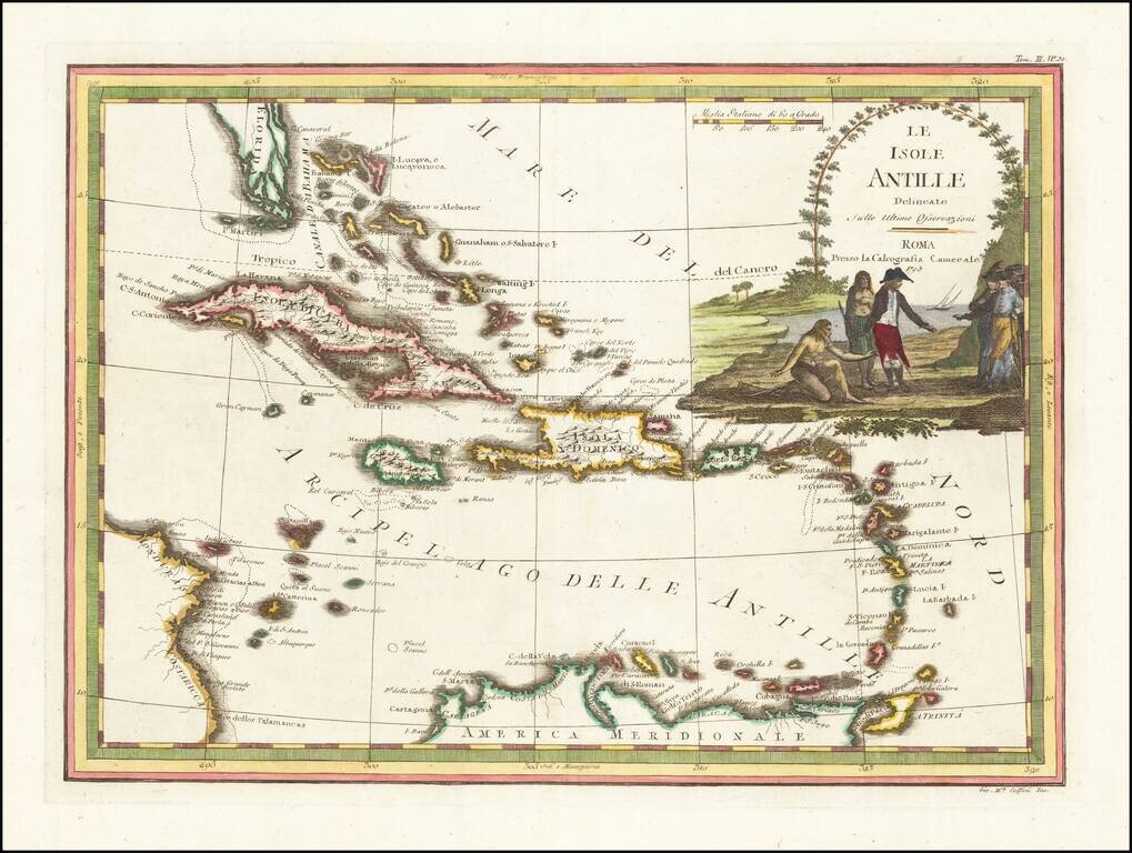
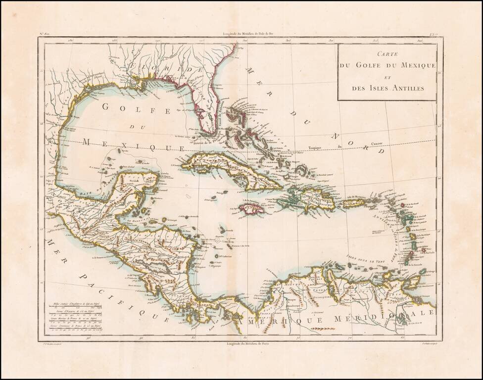
Antique Map of the Caribbean and South Florida A striking color example of Cassini's scarce map of the Caribbean and south tip of Florida. The map is outlined in attractive reds, greens and yellows, while the cartouche is fully colored and appears to...
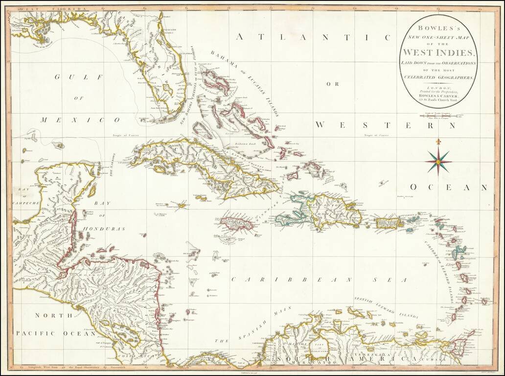
Large detailed map of Florida and the Caribbean, published by Bowles & Carver. The map extends from Florida, the Yucatan and Central America to the Windward and Leeward Islands. Centered on Cuba and the Bahamas. The map references the "Supposed...
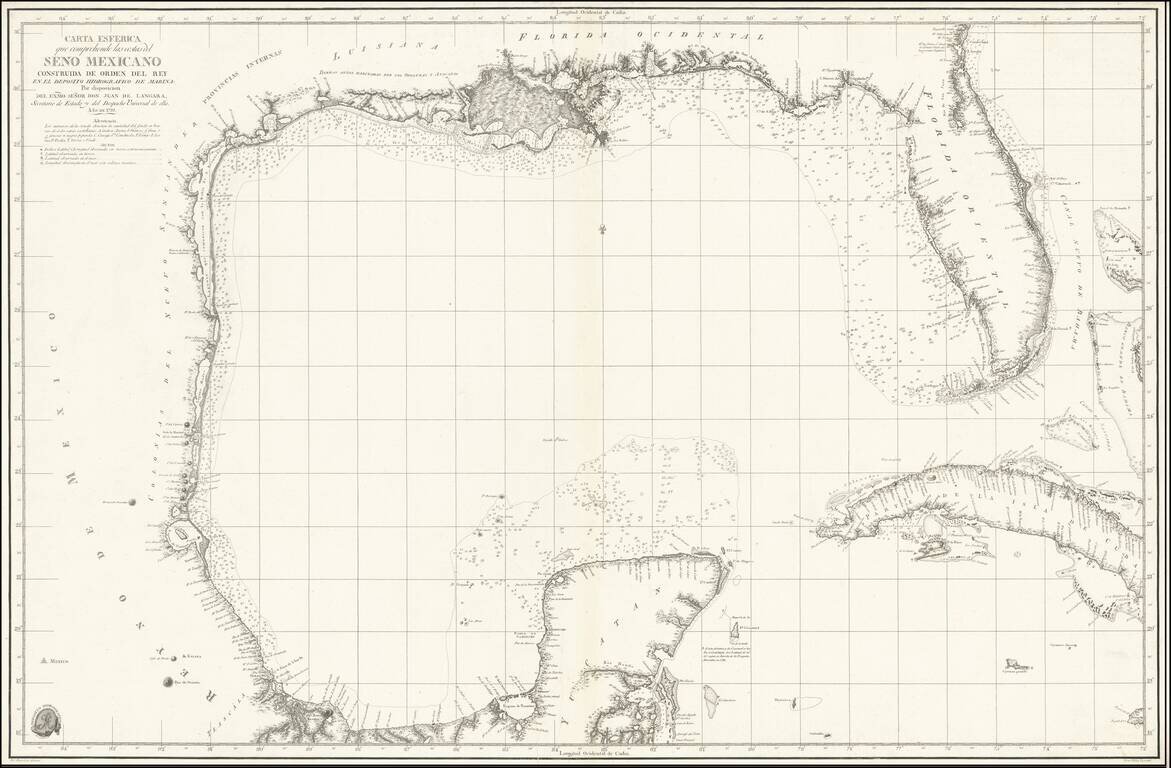
The foundational Spanish sea chart of the Gulf Coast, Florida, Texas, etc. -- One of the six most important maps of Texas (Streeter). This is the first large-scale printed chart of the Texas coast based upon actual soundings and explorations. The map...
Scarce antique map of Florida, the Gulf Coast, and the Caribbean from Mentelle & Chanlaire's Atlas Universel…, engraved by Tardieu and drawn by Valet. Includes nice detail throughout the map.
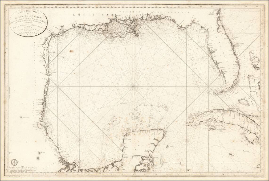
The First Modern French Sea Chart of the Gulf of Mexico Important early chart of the Gulf Coast and Florida, issued in the 9th Year of the French Revolution (An. IX.) The map was issued one year after the Spanish Carta Esferica and draws extensively...
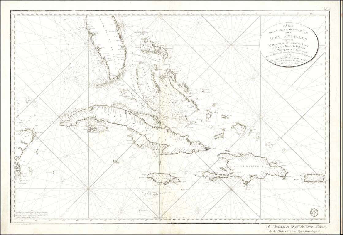
Detailed sea chart of South Florida, the Bahamas, Cuba, Jamaica, Cayman Islands, Puerto Rico, Santa Domingo and the part of the Yucatan Peninsula, published by the Depot De La Marine 1801. The chart is one of the most detailed maps of the region and...
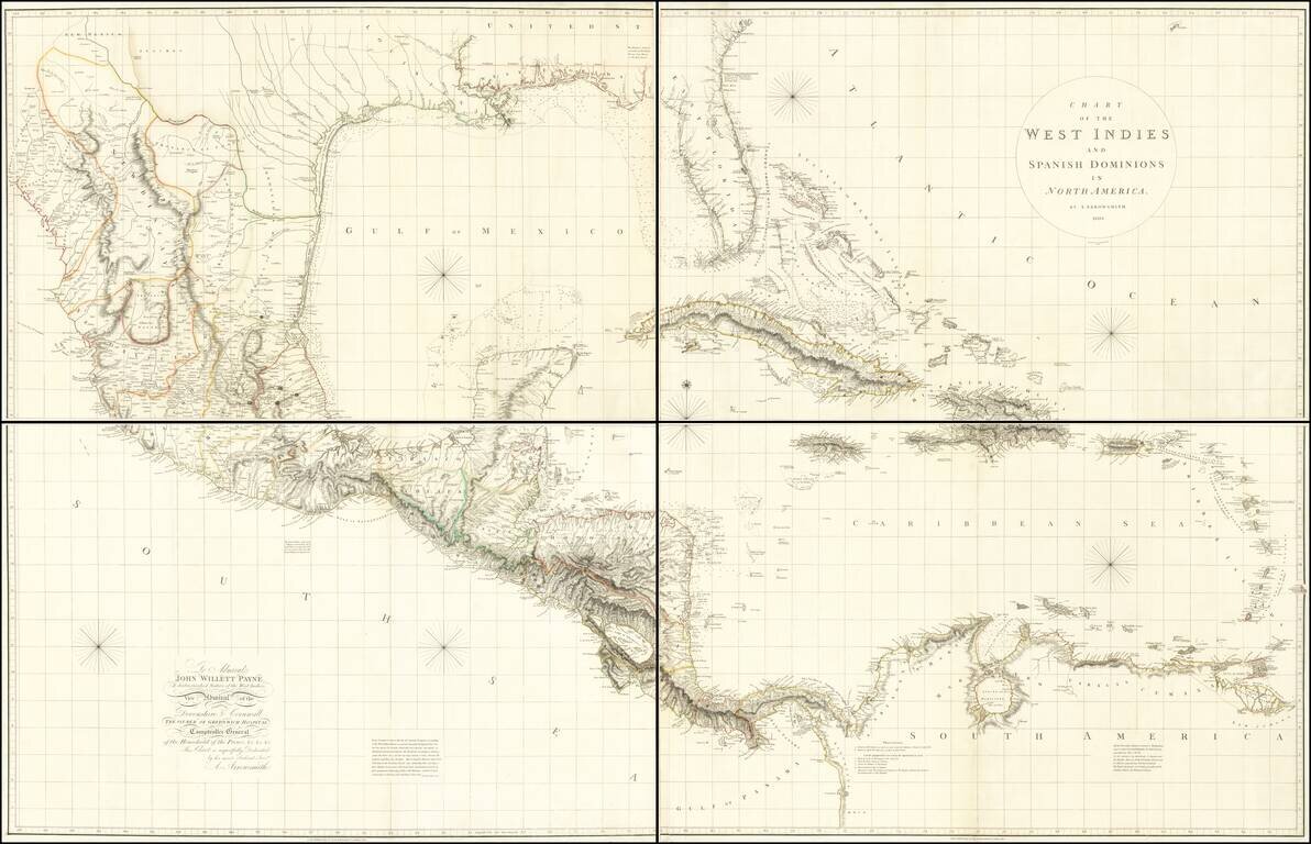
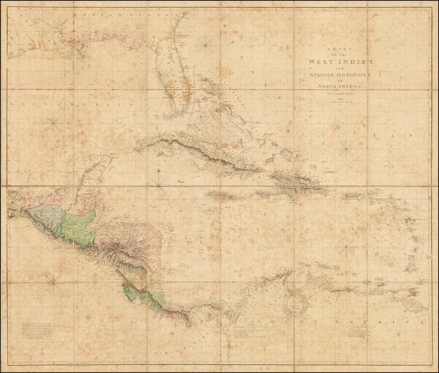
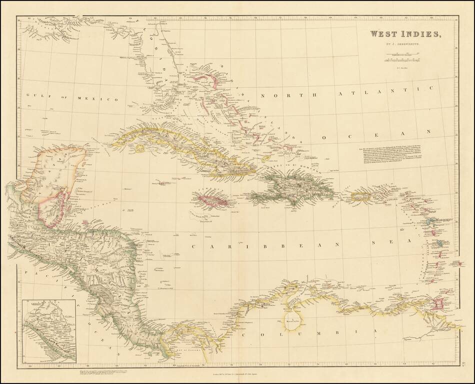
A Seminal Map of Florida, The Caribbean and Texas! First edition of Arrowsmith's map of Mexico & the West Indies, and the only edition to extend to the Pacific, thereby showing modern Texas and parts of New Mexico and Arizona. The map is...
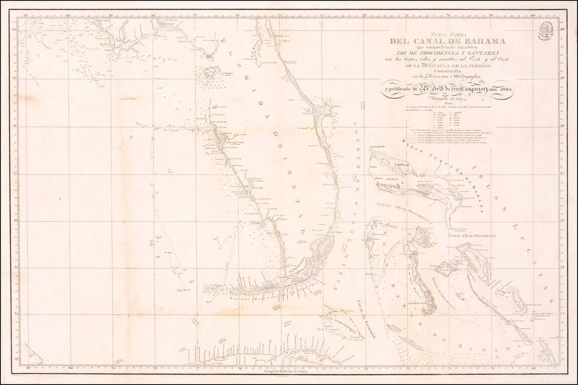
A Landmark Spanish Chart of Florida and the Bahamas Important early 19th Century Sea chart of Florida and the Bahamas, one of the earliest Spanish Sea Charts to focus on the coast of Florida and the Bahamas. The map offered here is identified as...
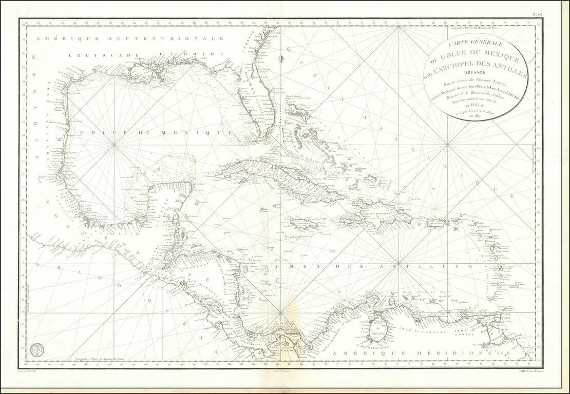
Detailed French Sea Chart of the Caribbean Fine and intricately-drawn French sea chart of the Spanish Main and the Caribbean, published in Paris in 1807. Drawn for the benefit of French vessels, as the cartouche in the upper right explains, the chart...
The Best Early 19th-Century Map of Central America and the Caribbean. Large hand-colored engraved antique map of Florida, the Gulf Coast, West Indies, and Central America, published by Aaron Arrowsmith in London in 1810. The map contains a detailed...
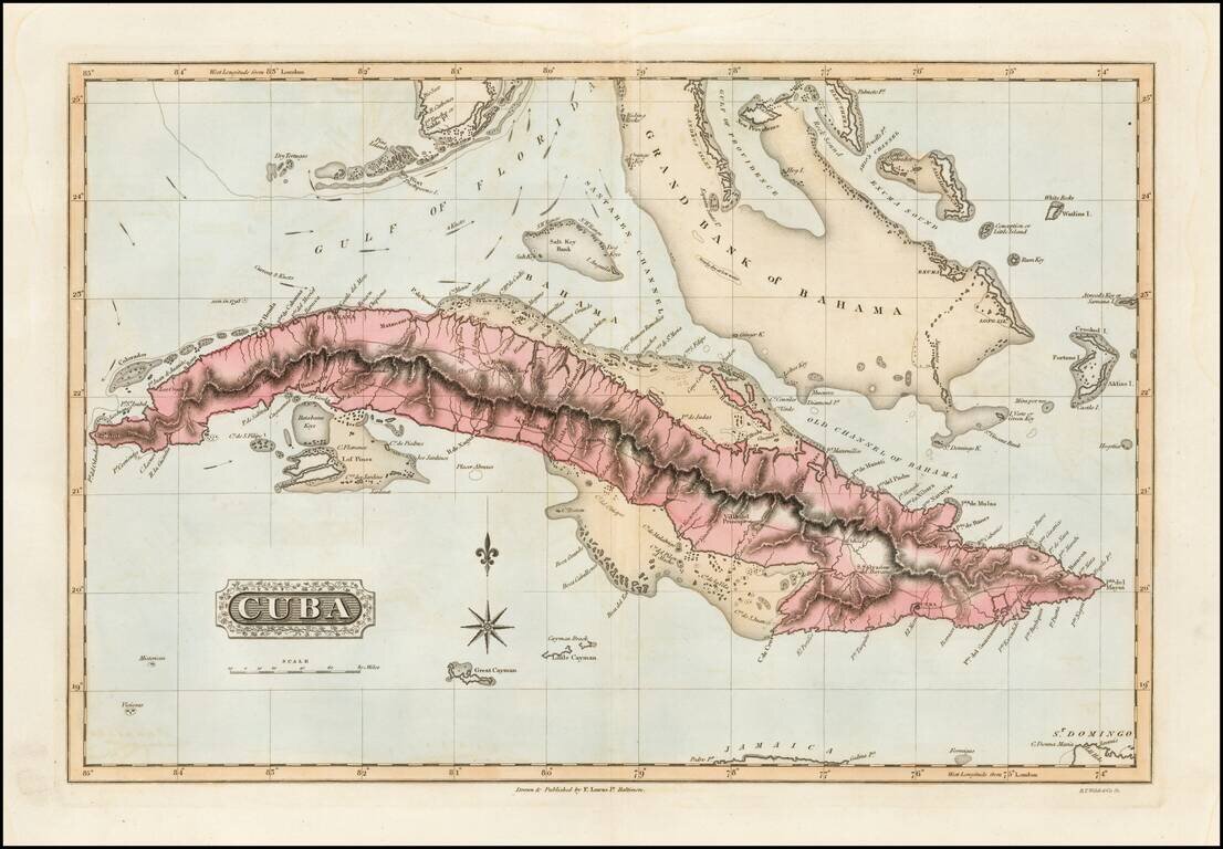
Detailed early American map of Cuba, the Bahamas and Florida Keys, published in Baltimore by Fielding Lucas Jr. The map includes topographical details, roads, and a host of other details. Fielding Lucas's New & Elegant General Atlas included a...
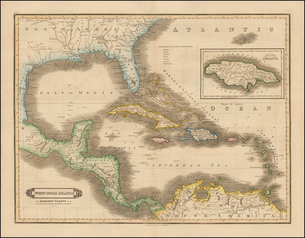
Scarce early edition of Lizars map of the Caribbean and contiguous coasts of Florida, the Gulf Coast, Central and South America, with a large inset of Jamaica. East and West Florida still appear, but both Missisippi and Alabama Territories are...
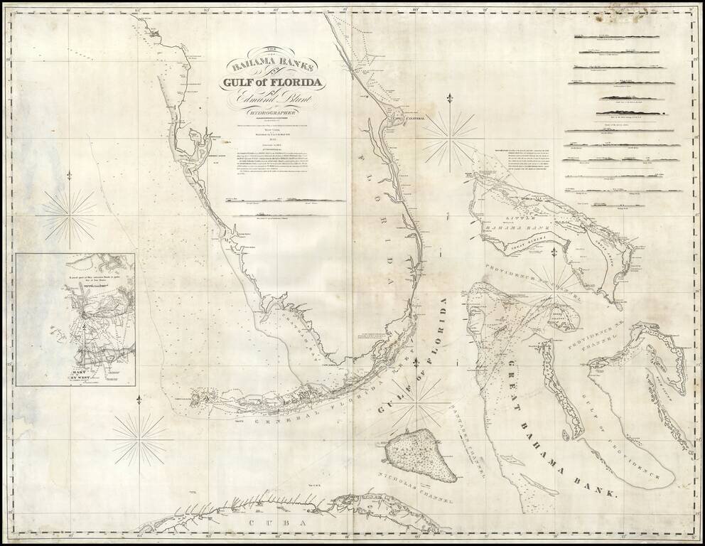
Rare early state of Blunt's sea chart of Florida and the Bahamas, first published in 1833. Nice coverage of the Bahama Islands. Has a small inset chart of Key West and twelve small recognition views of coastal approaches. The Coastline of Florida is...
Arrowsmith's London Atlas Map of the Florida, the West Indies & Central America Nice example of this fine map of Florida, the Caribbean and Central America, published in Arrowsmith's London Atlas. In Florida, the map notes the "Cape Florida...
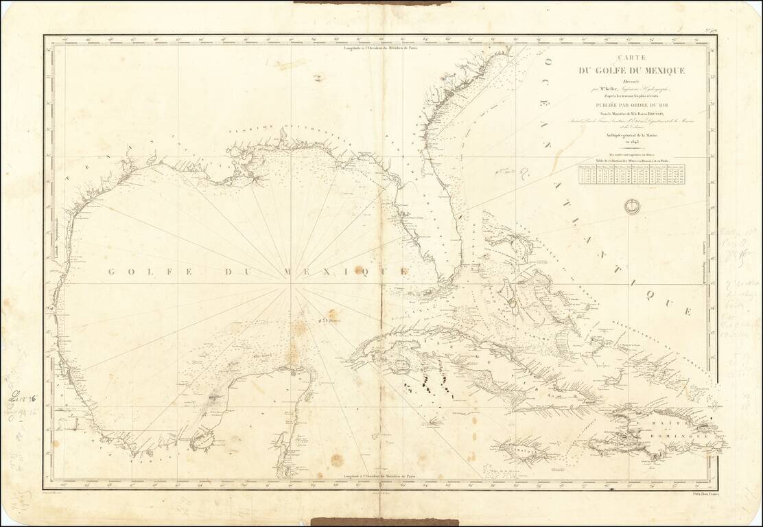
A Well Used Sea Chart of Florida, Gulf Coast and the Caribbean French Sea Chart of Florida, the Gulf Coast, Mexico, Yucatan, the Bahamas, Cuba and the western Caribbean, published in Paris in 1843. The chart was used as sea, with what appears to be a...
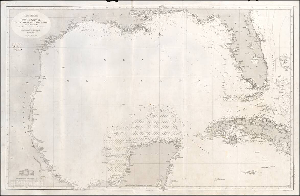
Scarce Spanish Sea Chart of the Gulf of Mexico, from Texas and the Yucatan to Florida and Cuba. Includes notes on the direction of the currents. A note opposite the Florida keys states that "Within these limit the current is directed strongly over...