Rare and antique old maps of the Caribbean & Central_America
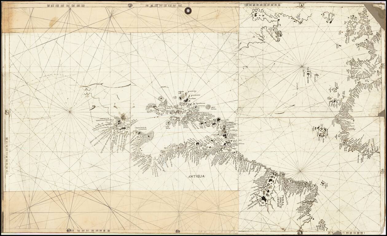
Finely colored example of Jansson's edition of Hessel Gerritsz' rare chart of 1631. The area covered is exactly the same as the original Gerritsz map, except for the addition of the west coat of Central America. The nomenclature in North America is...
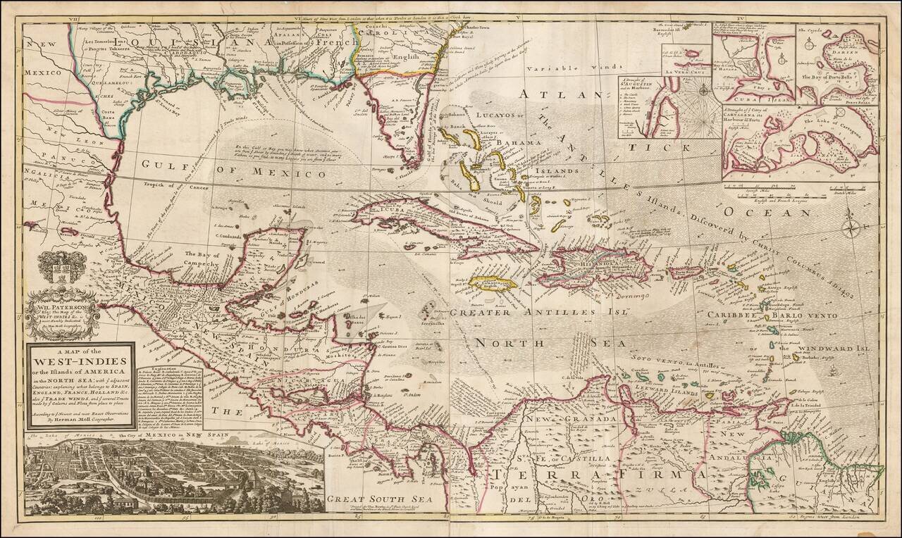
Highly detailed and decorative large format engraved map of the Caribbean by Herman Moll. Moll's map was the most popular large English map of the Caribbean, Florida, the Gulf Coast, Texas, and Central America in its day. It was a central image in the...
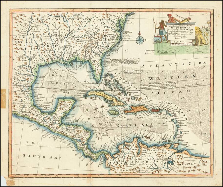
Decorative example of Bowen's map of the Southeastern United States, Florida, Gulf Coast, Texas, Caribbean and Central America. The map is embellished by an elaborate native American scene, along with a depiction of a lion and other indigenous...
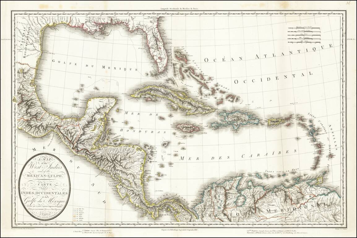
This is a rare separately issued map of the Gulf Coast and the Caribbean by Tardieu. The map was issued shortly after the Louisiana Purchase (1803) and the creation of the Mississippi Territory (1804). The map demonstrates the remarkably fine engraving...
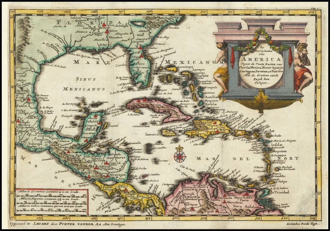
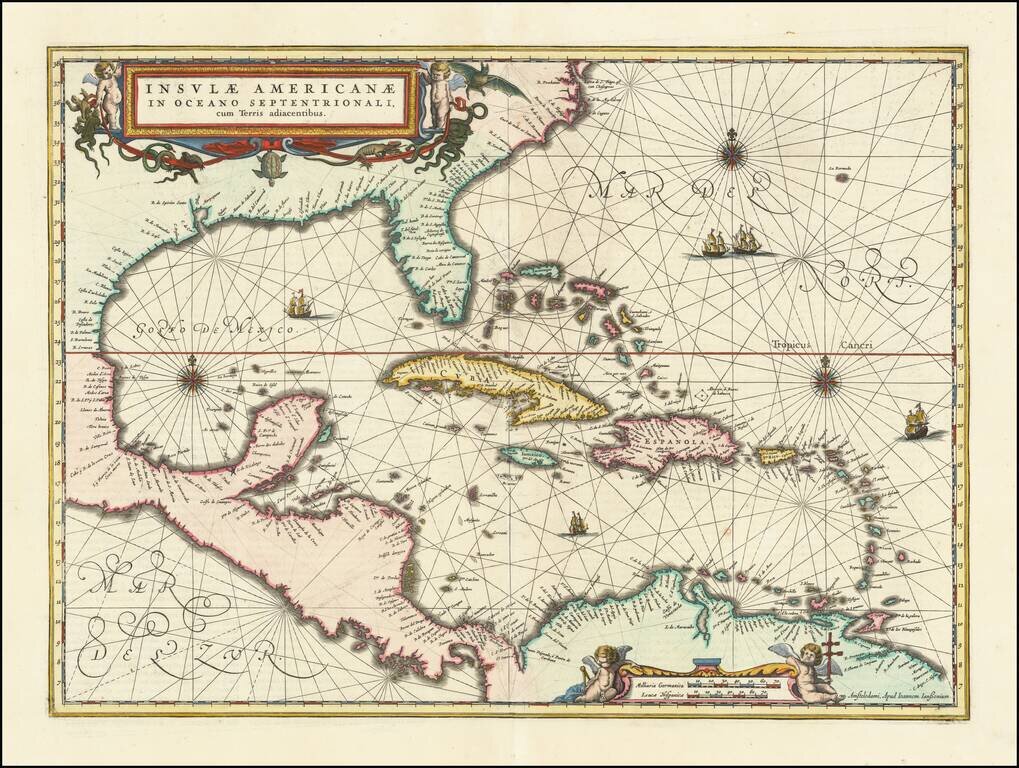
Detailed regional map of Florida and the Caribbean, used by Vander Aa to illustrate a Dutch translation of the narrative of one of Columbus' Voyages to the New World. Shows Central America and the Caribbean in full, with small parts of South America...
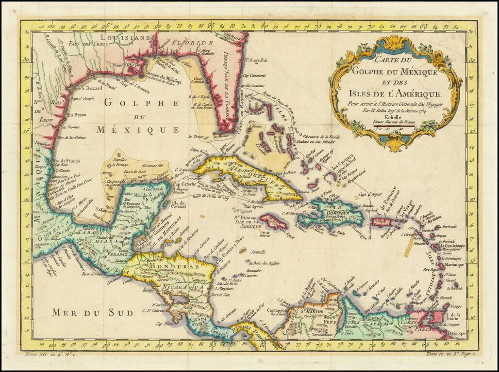
Interesting and detailed map of Florida, the Gulf Coast, Central America, and the Caribbean. The map shows the route of Ponce de Leon when he discovered Florida, Cortez's route in 1519, and that of De Cordova in 1517. The map features a decorative...
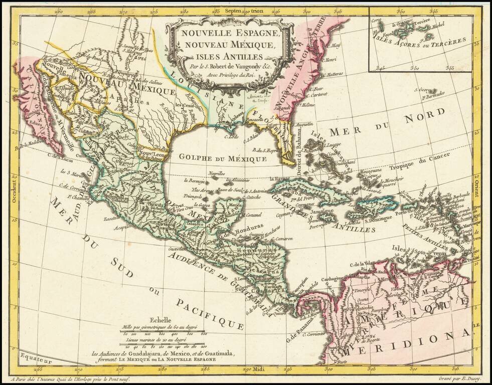
Antique Map of Texas, Mexico and the American Southwest, Florida and the Caribbean Scarce map of the Southwest, Caribbean and Gulf Coast, from De Vaugondy's Nouvel Atlas Portatif. Includes a marvelous contemporary cartographic representation of the...
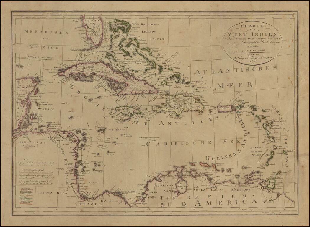
Rare edition of Gussefeld's map of South Florida, the Caribbean and coastlines of Central America. The map would be updated and re-issued for at least the next 20 years, with corrections. A comparison of this edition to the 1816 edition which we...
![Amer. Sep. No. 57(bis) Partie De Etats Unis [North Carolina & Bermuda]](/map/small/21805.jpg)
Scarce map of a part of North Carolina, showing Albermarle Sound, Pamlico Sound, Tyrrel County, Hyde County, Martin Coutny, Caretare County and areas just to the West, including towns such as Columbia, Tarborao, Greenville, Newberne, Washington,...
![Map of Mexico, Central America, and the West Indies [Insets of Bermuda, Cuba, Jamaica and Panama Railroad]](/map/small/51948.jpg)
Attractive map of Mexico, the Caribbean and the Gulf Coast, published by SA Mitchell Jr. Includes large insets of Cuba, Bermuda, Jamaica, and the Isthmus of Panama and a small inset of Jamaica. Shows shipping routes from New Orleans to points...
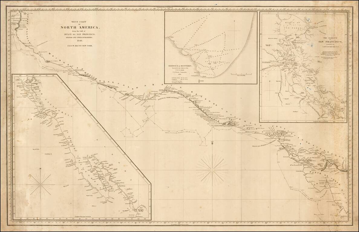
Rare sea chart of California, Mexico and Central American coastline, showing the southern sea route to San Francisco printed on the eve of the California Gold Rush. This fine chart depicts the length of the Pacific Coast of North and Central America,...
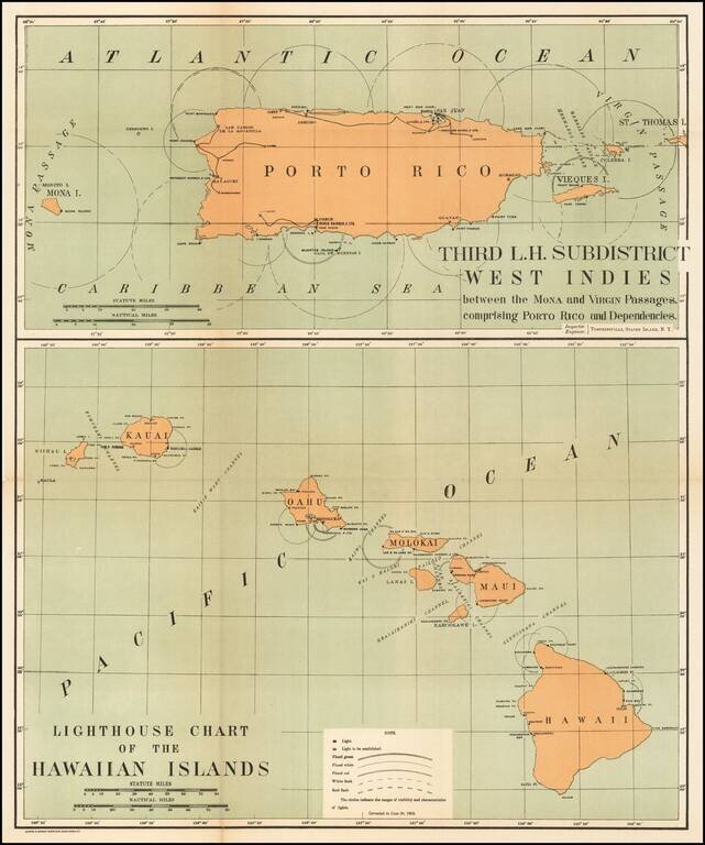
Rare pair of maps showing the lighthouses in Hawaii and the Puerto Rico areas, including proposed light houses, fog lights, light vessels, lighted buoys and a host of other navigational details within the state. This is the first time we have ever...
![[Fruit Crate Label Advertising Map] Panama Brand (North America & Panama Canal)](/map/small/48860.jpg)
Decorative Fruit Crate Label, showing various routes through the Panama Canal, published for the Johnson Fruit Company of Santa Barbara, California.
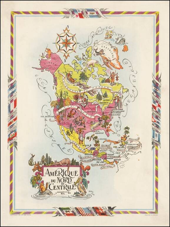
Decorative map of North and Central America, published by Jacques Lizou. Lizou published a number of maps in this style in 1951, including maps of the French provinces, etc. The map was also used in a Pan American Airways menu in the 1960s.
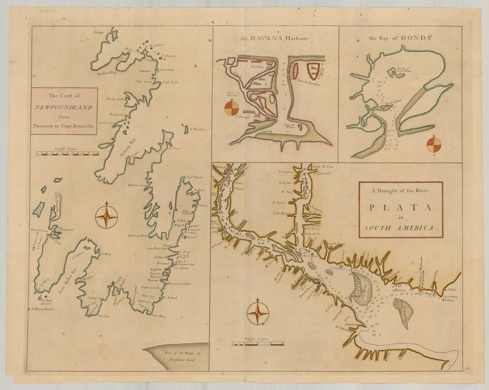
![The Coast of Newfoundland From Plancentia to Cape Bonavista [and] A Draught of the River Plata in South America [and] Havana, Harbour [and] the Bay of Honda](/map/small/38599.jpg)
Rare Sea Charts of North and South American Ports from an Influential Atlas This composite sea chart shows Newfoundland, Havana Harbor and the Bay of Honda, both in Cuba, and the River Plata in South America. The chart shows the coastlines and...
Rare Sea Charts of North and South American Ports from an Influential Atlas This composite sea chart shows Newfoundland, Havana Harbor and the Bay of Honda, both in Cuba, and the River Plata in South America. The chart shows the coastlines and...