Map size in jpg-format: 28.8586MiB
Click to open in high resolution (open in new tab).
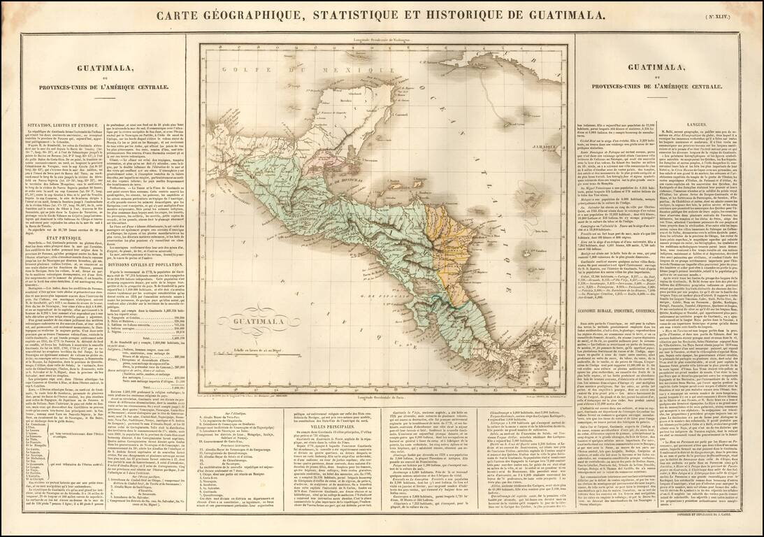
Nice example of the Buchon's map of Guatemala, pubilshed in Paris in 1825.
The map also shows Honduras, Belize, Nicaragua and Costa Rica, with Belize called Colonie Anglre de Balize.
At the time of the map, these countries were part of the United Provinces of Central America (also called the Federal Republic of Central America). Independence would not come for each until:
Overall plate size is 24 x 17 inches, surrounded by text describing the state, its population, governors, religion, education, commerce, climate topography and other details.
Jean Alexandre Buchon (1791-1849) was a French scholar and historian. Born as the French Revolution raged, Buchon was dedicated to recovering France’s history in order to help the country heal and grow. He gathered French stories and published them as part of Collection des chroniques nationales franciases ecrites en langue vulgaire, du XIe au XVIe siècle (4 vols, 1824-1829). He also compiled and published an exploration collection and several histories, particularly about medieval France.
For geography, his most important contribution was publication of the French edition of Carey & Lea’s American Atlas in 1825. Each page of the atlas includes highly detailed text about the state or territory depicted, as well as a map of the area. The French edition is generally considered in high regard as compared to other editions, as it has quality paper and superior engraving.
If you are a student, write to us in telegram: @antiquemaps and indicate what material you need and for what work you need a map in high detail. We are ready to provide material on special terms. For students only!

![[Blaeu Atlas of America] America, Quae Est Geographiae Blavianae Pars Quinta Liber Unus Volumen Undecimum](/map/small/66852.jpg)
