Map size in jpg-format: 1.25407MiB
Click to open in high resolution (open in new tab).
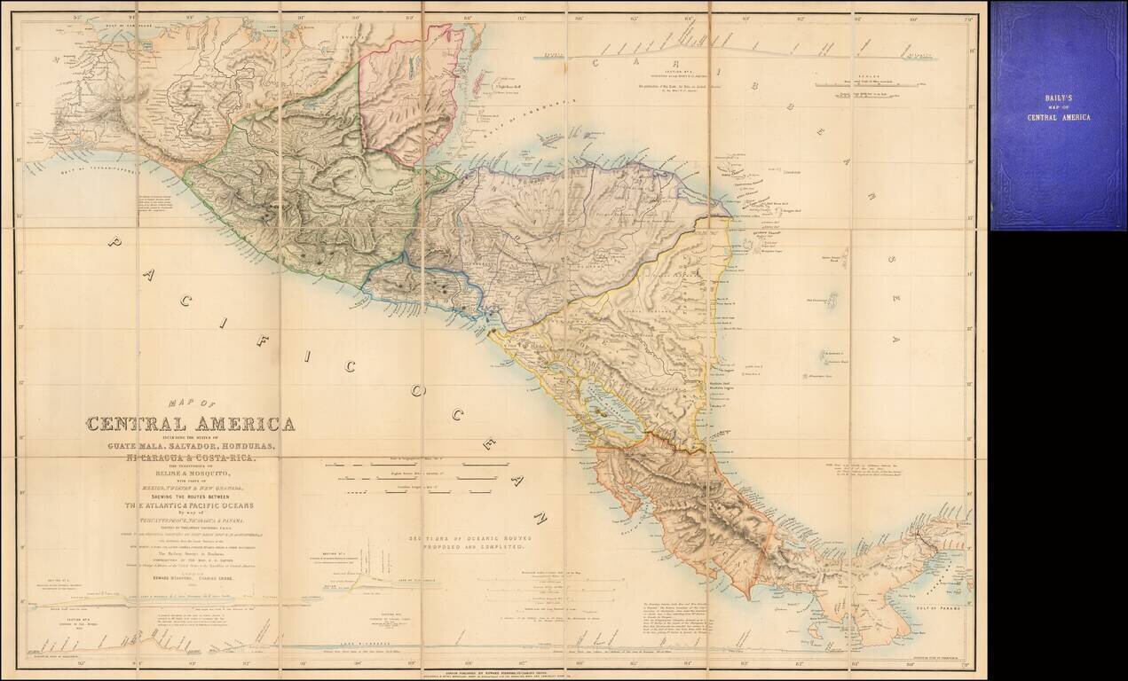
Fine example of the second edition of this finely detailed map of Central America, prepared by John Baily, who served as a surveyor of Nicaragua and was an early proponent of a canal across Central America, published in London by Trelawney Saunders.
First issued in 1850, the map indicates that it has been revised to include surveys by:
John Baily was an Englishman who lived for many years in Central America. He was employed in 1837-38 by the government of Nicaragua to survey a potential canal route from the Caribbean Sea to the Pacific Ocean. In 1850, Baily published this book and a separate map of Central America (the present map), which showed four proposed routes for a canal between the Atlantic and Pacific Oceans. Baily was convinced of the "remarkable capacity for colonization" of the Central American countries. Baily compared agricultural conditions in Central America to those in southern Texas and argued that European farmers who settled in the region and worked hard would prosper and "prepare a handsome inheritance for their posterity."
If you are a student, write to us in telegram: @antiquemaps and indicate what material you need and for what work you need a map in high detail. We are ready to provide material on special terms. For students only!

![[Blaeu Atlas of America] America, Quae Est Geographiae Blavianae Pars Quinta Liber Unus Volumen Undecimum](/map/small/66852.jpg)
