Map size in jpg-format: 16.5977MiB
Click to open in high resolution (open in new tab).
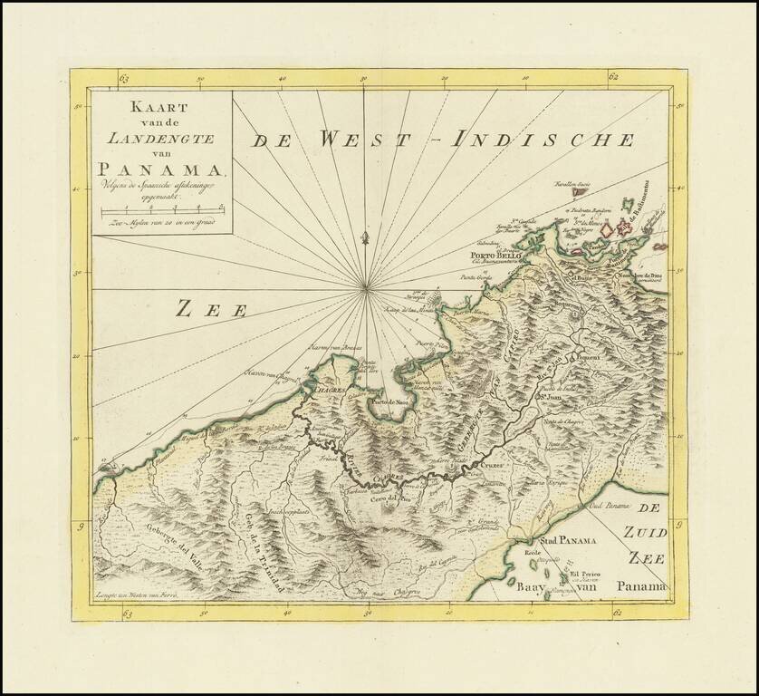
Detailed map of Panama, published in Amsterdam by Isaak Tirion.
Extends from Panama City at the southeast, Chagres at the northwest and Porto-Bello at the northeast. Several missions are also located. Roads and the Chagres River connect them all.
Isaak Tirion was a prominent Dutch publisher based in Amsterdam in the eighteenth century. He is best known for historical works that included prints showing scenes from around the world. He also produced maps, such as those in the Nieuwe Hand-Atlas of 1744.
If you are a student, write to us in telegram: @antiquemaps and indicate what material you need and for what work you need a map in high detail. We are ready to provide material on special terms. For students only!

![[Blaeu Atlas of America] America, Quae Est Geographiae Blavianae Pars Quinta Liber Unus Volumen Undecimum](/map/small/66852.jpg)
