Map size in jpg-format: 7.27538MiB
Click to open in high resolution (open in new tab).

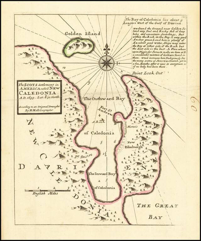
Interesting map depicting the site of the short-lived Scottish colony of New Edinburgh.
In 1698, William Paterson, Scottish Governor and founder of the Bank of England, proposed a plan to create a colony in modern day Panama. The Company of Scotland was formed as a means of exploiting the economic benefits of the colony. Funds were raised and in November 1698, and three ships with 1,200 colonists arrived at Darien and started construction of the colony.
The region was re-named New Caledonia. William Hacke, an English Thames School chartmaker, produced several promotional manuscript maps of the colony, several copies which survive today. Herman Moll in turn engraved and printed an edition of the map, which is copied here in a reduced format..
Unfortunately, disease and attacks from Spanish galleons doomed the colony to failure, and within 9 months the remaining colonists returned home. Intended to boost Scotland's failing economy, the colonial fiasco bankrupted the country and Scotland, to sign the Act of Union in 1707, creating the United Kingdom.
If you are a student, write to us in telegram: @antiquemaps and indicate what material you need and for what work you need a map in high detail. We are ready to provide material on special terms. For students only!

![[Blaeu Atlas of America] America, Quae Est Geographiae Blavianae Pars Quinta Liber Unus Volumen Undecimum](/map/small/66852.jpg)
