Map size in jpg-format: 3.48533MiB
Click to open in high resolution (open in new tab).
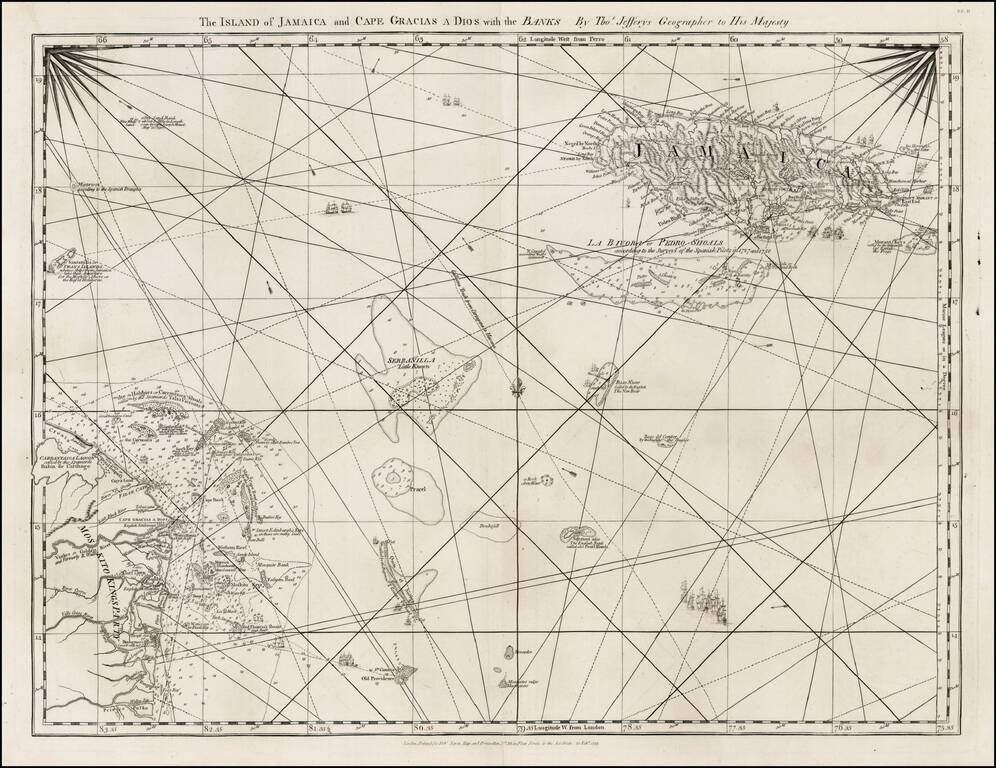
Detailed map of the Island of Jamaica and the Mosquito Coast, with the islands and shoals between, from Jefferys West India Atlas.
If you are a student, write to us in telegram: @antiquemaps and indicate what material you need and for what work you need a map in high detail. We are ready to provide material on special terms. For students only!
![[British Colonies in North America] Carte Qui Contient Une Description Des Iles & Terres Que Les Anglois . . .[Chesapeake, Carolinas, New England, Bermuda, Gulf Coast, Jamaica, Barbadoes & Canada]](/map/small/46200.jpg)
![Cuba Insula [with] Hispaniola Insula [with] Insula Jamaica [with] Ins. S. Ioannis [with] I.S. Margareta Cum Confiniis](/map/small/70194.jpg)