
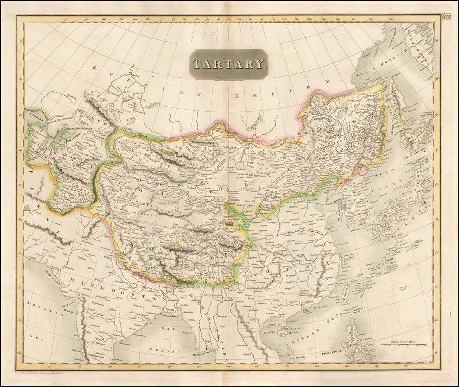
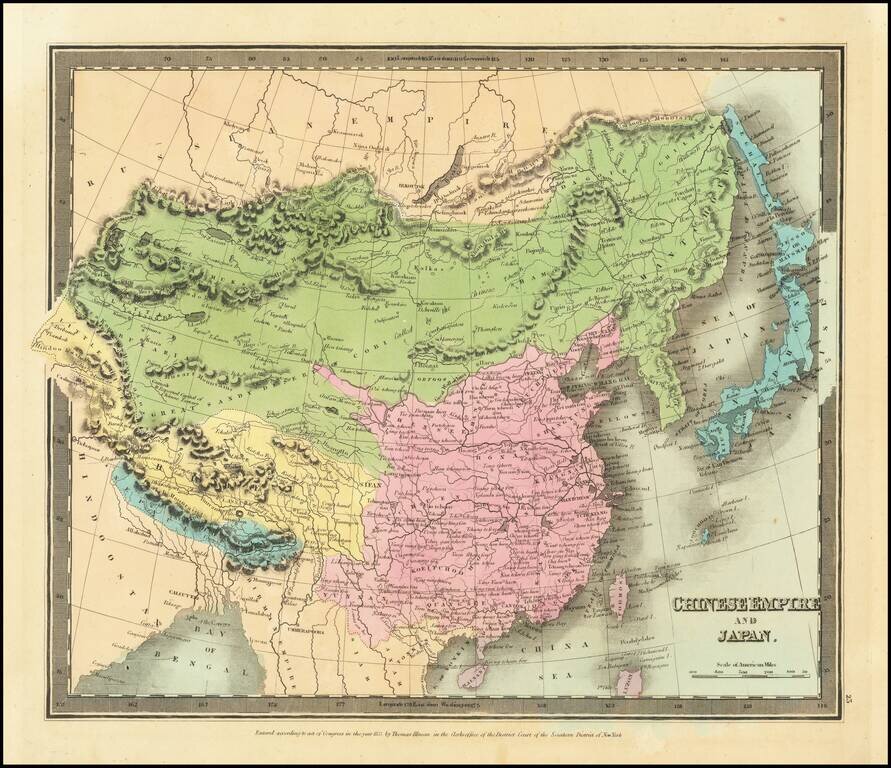
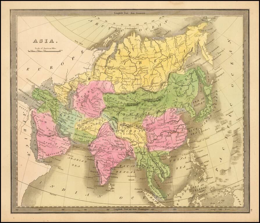
Detailed large format map of Tartary, extending from China, Japan and the Northeastern Russian Regions of Asia to Hindoostan and Beloochistan. One of the most detailed and interesting large format maps of the early 19th Century. A fine example with...
![[China - Jesuit Embassy] Map of that part of China through which the embassy passed on its Route from Pekin to Canton . . . (and) Map of the Route of the Embassy on the Yang-Tse-Kiang](/map/small/61438.jpg)
Scarce pair of maps illustrating the travels of the British Embassy to China, let by Lord Amherst, in 1816 and 1817. The maps are likely from Narrative of a journey in the interior of China : and of a voyage to and from that country, in the years 1816...
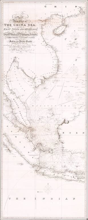
Antique Sea Chart of East Asia Fine early sea chart of Eastern Asia, centered on Malaysia and Singapore. One of three stand-alone images comprising the massive chart of Southeast Asia by Norie. This is the central sheet, with the engraved title and...
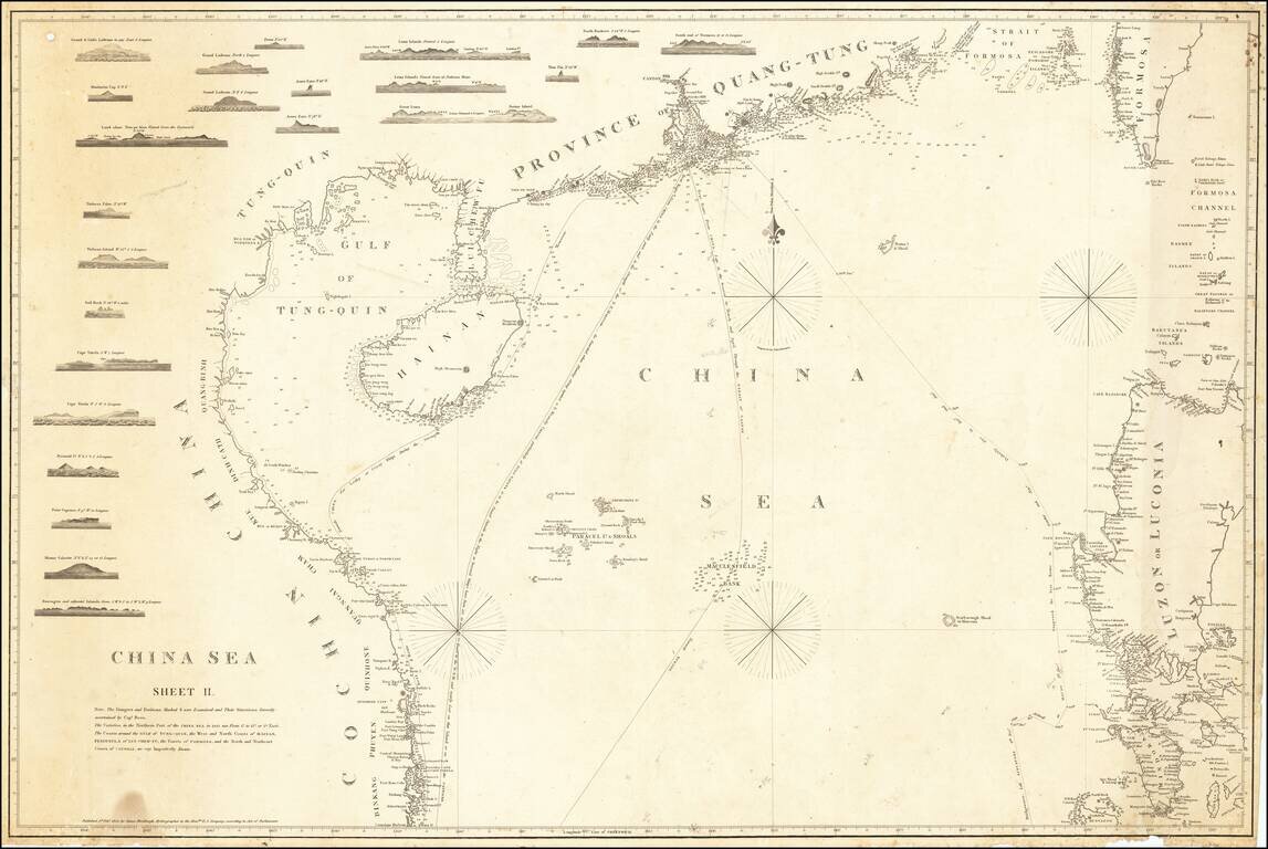
First State of Horsburgh's Second and Substantially Improved Chart of the Coast of China, Philippines and Cochinchina etc. Finely executed general chart of the South China Sea from Na Trang to Tonkin, Taiwan and Mindoro, with a number of approach...
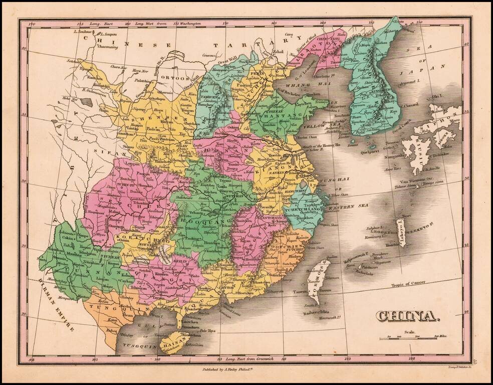
First edition of Finley's map of China (including Formosa) and Corea, colored by provinces, from his New General Atlas.
![[Hong Kong / Macao / Canton] Asie No. 98. Partie de La Chine](/map/small/64115.jpg)
Detailed map of the Province of Canton and Hainan Island, published in Brussels. The map includes nice detail at the mouth of the Pearl River, with Lantao, Macao and Canton named.

An Important Early Sea Chart of the Area around Hong Kong and the Pearl River Delta Updated To Incorporate Placenames in Chinese Rare separately published chart of the areas between Canton (Guangzhou), Hong Kong to the islands around Hong Kong, with a...
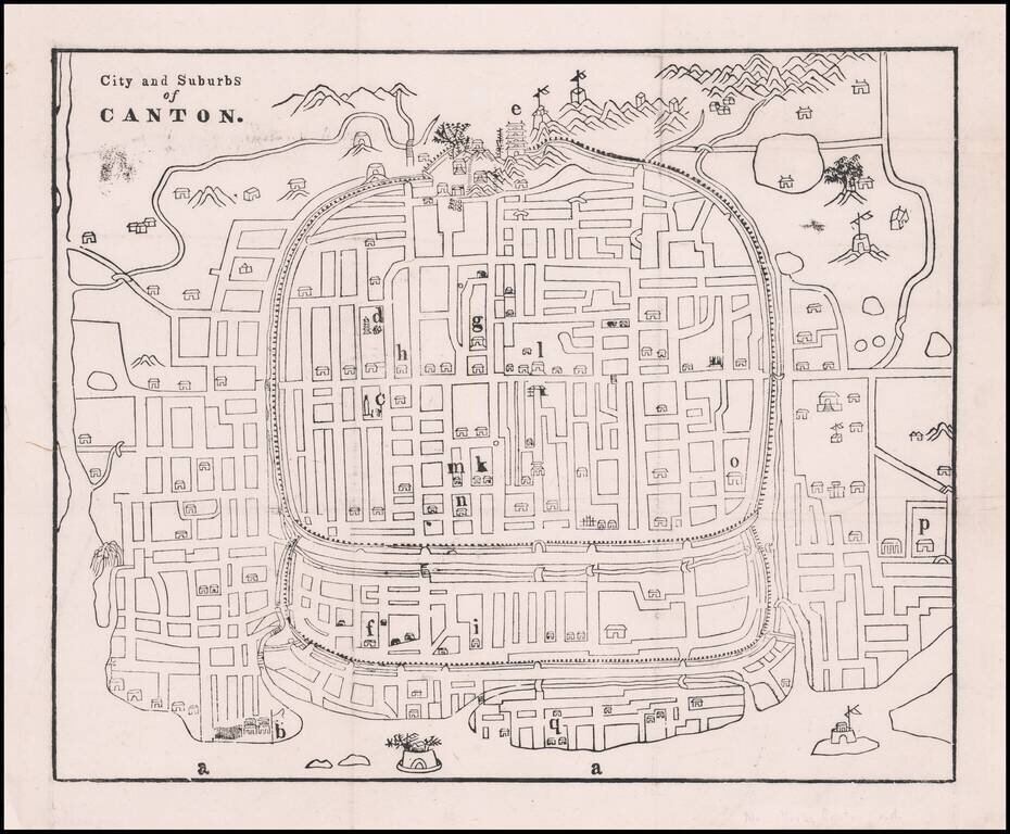
Early Missionary Map of Canton (Guangzhou), Published in Canton in the First Major Journal of Sinology Fine woodblock map of Canton showing the city’s street plan, waterways, and important buildings and sites. The plan was based on a Chinese map and...
Striking full hand-color example of Burr's map of China, which first appeared in David Burr's Universal Atlas, in 1836. Burr's Atlas was perhaps the most elegant American commercially published atlas of its time, utilizing wonderful wash colors and...
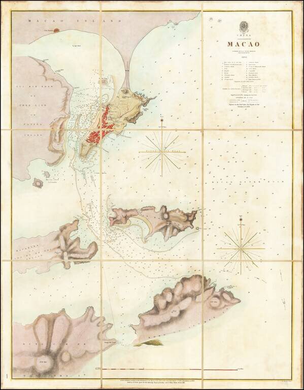
A Surreptitious Survey of Macau By A Famed British Officer Rare separately published sea chart of Macau, published by the British Admiralty, based upon the work of Peter Heywood, of Mutiny on the Bounty fame. The chart shows the town of Macau,...
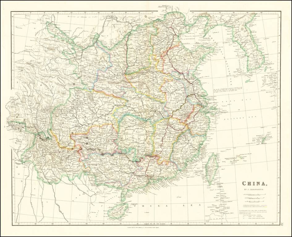
With Lord Macartney's Route and Lord Amherst's Route Illustrated Striking example of Arrowsmith's map of China and Korea. The map names Hong-Kong I. & Victoria City. The map appeared in Arrowsmith's London Atlas, one of the most popular English...
Striking full color example of Greenleaf's map of China, which first appeared in David Burr's Universal Atlas, in 1836. Burr's Atlas was perhaps the most elegant American commercially published atlas of its time, utilizing wonderful wash colors and...
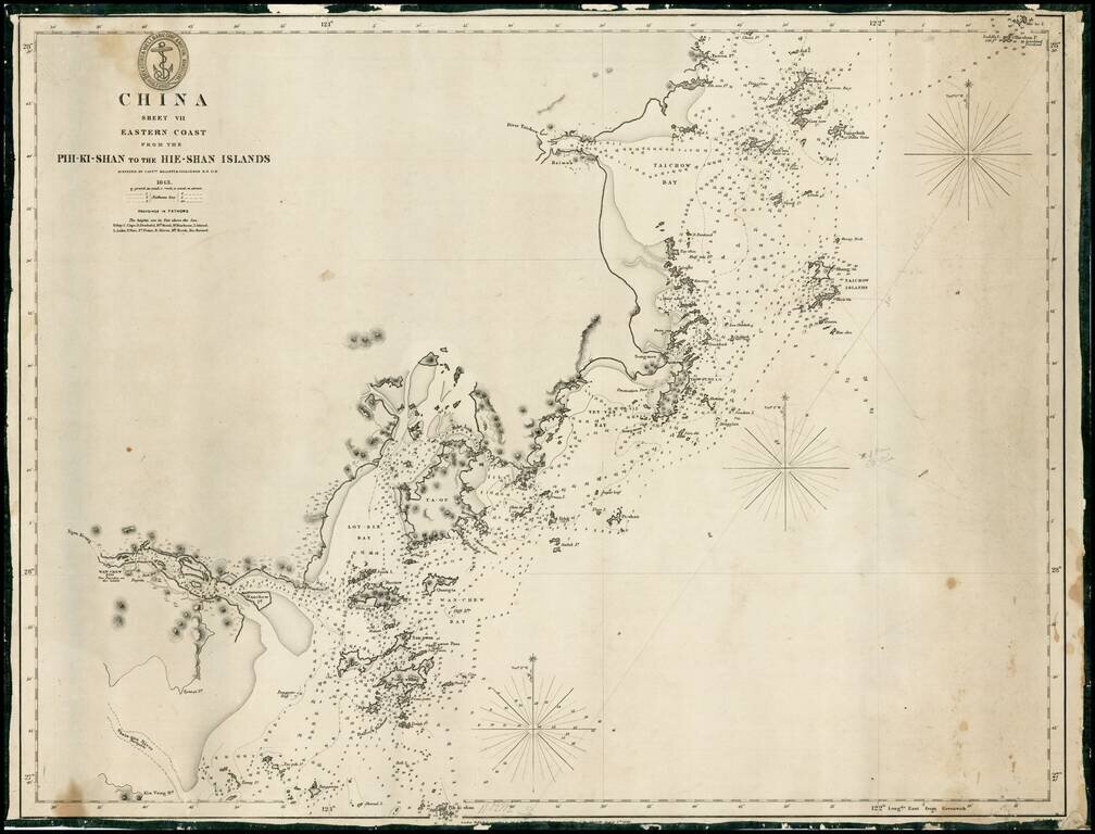
Rare early sea chart of the coast of China, from Taizhou to Wenzhou. Detailed chart, with extensive soundings and other sailing information. Includes pencil notes showing contemporary charting.
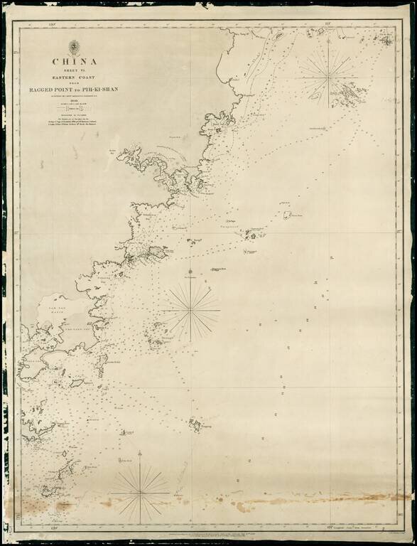
Rare early sea chart of China, showing the coast from Pingyang to Huangqiwan. Detailed chart, with extensive soundings and other sailing information. Includes pencil notes showing contemporary charting.
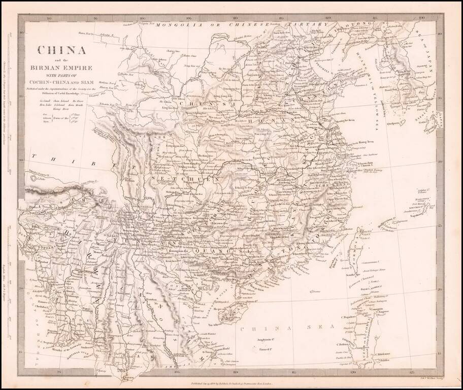
Detailed map of China, Formosa (Taiwan), Korea and the northern part of Southeast Asia. The Society for the Diffusion of Useful Information (SDUK) was created to provide the British public with reasonably priced printed information. The 2 volume atlas...