Map size in jpg-format: 2.46129MiB
Click to open in high resolution (open in new tab).
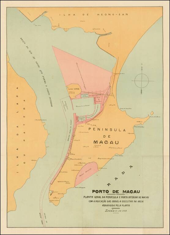
Rare and decorative large plan of the Peninsula of Macau, showing the beginnings of the significant man-made changes to the Portuguese colony.
This artistically virtuous map employs attractive pastel colors and a transitional Art Nouveau-Art Deco font to depict the Macau peninsula just before a series of massive land reclamation projects radically increased the size of the colony. When Macau was founded by the Portuguese in 1557, it was an island with a land area of only 1.1 square miles. Modest early landfill projects linked the island to the mainland and created more flat land for development. However, for the longest time the outline of the peninsula largely remained the same. The Portuguese added the islands of Taipa and Coloane to the colony in 1851 and 1864, respectively (located to the south, off of the map).
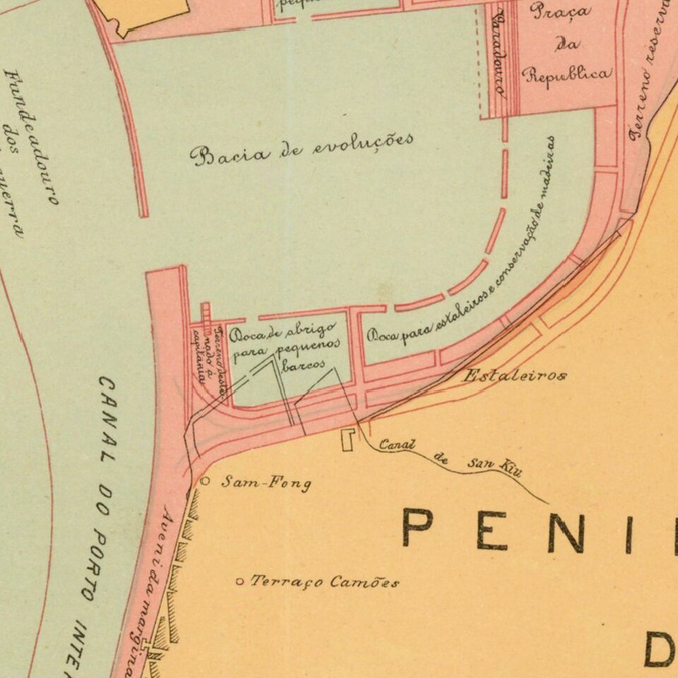
The present map, which was issued around 1920, depicts the peninsula in its contemporary form (in beige), along with the proposed land reclamation projects (in pink) to the north around Ilha Verde and along the harbor bordering the Rio de Oeste, as well as on the eastern shore at the Praia Grande. These projects were eventually fulfilled, however, it was the project to create the quayside bordered by today's Avenida de Amizade that was the first project to be commenced, and which was finished by 1927.
Land reclamation projects on both the Macau peninsula and Taipa and Coloana continued for the rest of the century, and were dramatically accelerated from the 1970s onwards. For instance, in 1972, the area of the colony had grown to 5.8 square miles, and by 2010 had reached 8.2 square miles.
The map is therefore a rare and highly attractive final view of 'Old Macau' before its geography was revolutionized to accommodate dramatic growth.
If you are a student, write to us in telegram: @antiquemaps and indicate what material you need and for what work you need a map in high detail. We are ready to provide material on special terms. For students only!
![[Martin Behaim Globe / Book] Pars Globi terrestris Ao. 1492 a Martino Behaim Equite Lusitano Norimbergae confecti Delineavit Christoph. Theoph de Murr 1778 (bound with:) Diplomatische Geschichte des Portugesischen berühmten Ritters Martin Behaims](/map/small/68828.jpg)
![Il Disegno Della Terza Parte Dell' Asia [Gastaldi's Wall Map of SE Asia with extra panels!]](/map/small/30554hbp.jpg)
![Chinae, olim Sinarum regionis nova descriptio. auctore Ludouico Georgio. [English Edition!]](/map/small/71123.jpg)