
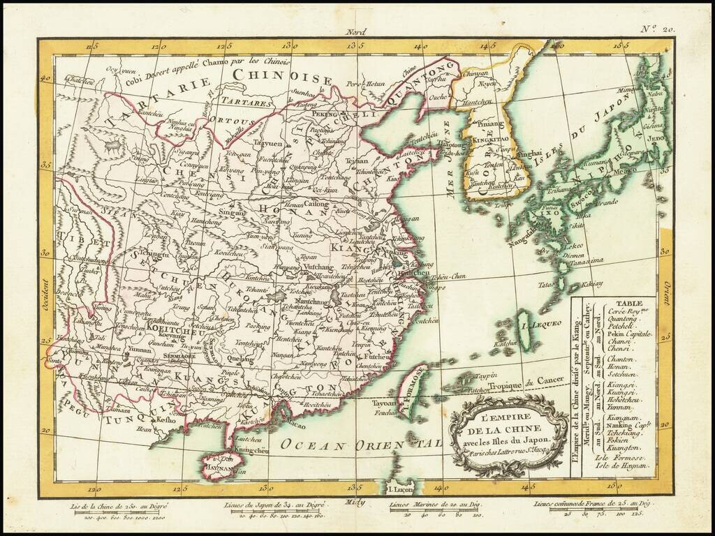
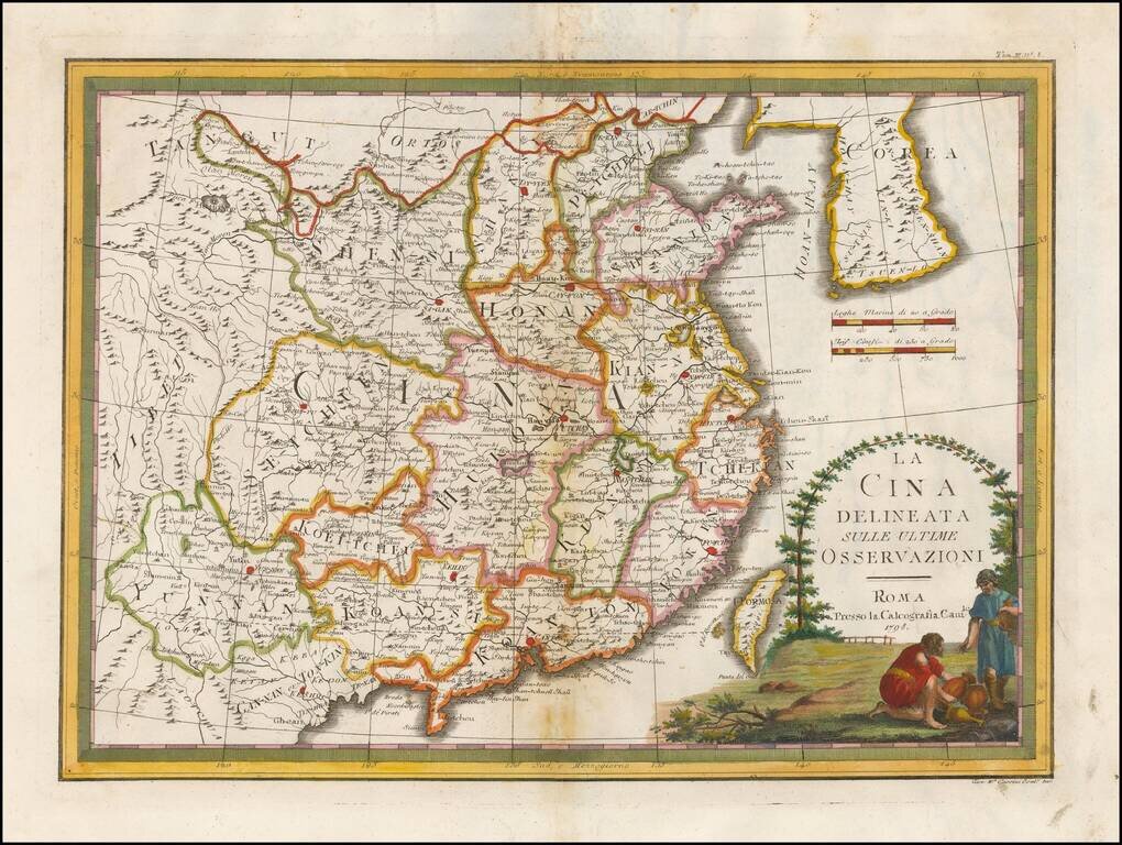
Detailed map of China, Korea and the Islands of Japan, showing the Provinces, towns, mountains, rivers, lakes, islands, published in Paris by Jean Lattre. The map is drawn from D'Anville's atlas of China, the first modern atlas of China and a work...
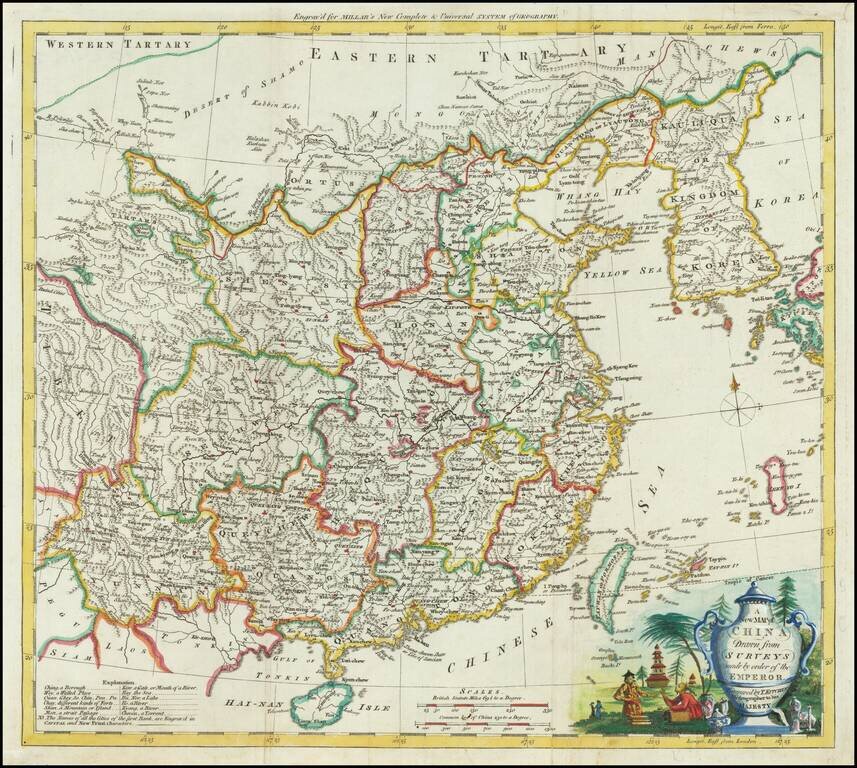
Attractive engraved map of China, produced by Thomas Kitchin for George Henry Millar's New Complete & Universal System of Geography. The map was published in London circa 1782. The cartouche is particularly attractive on this map, featuring a...
![La Tartaria Chinese . . . 1784 [show Corea]](/map/small/44378.jpg)
Decorative map, showing the region from Korea and Tartary to Northern China. Corea is spelled with a "C." Decorative cartouche. The map was issued in Zatta's Atlante Novissimo, a monumental 4 volume work and one of the last great decorative atlases.
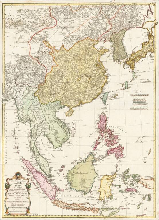
Detailed map of East Asia, extending from China and Korea to Java, published in Vienna in 1786. The map is centered on the Philippine Islands and provides a nice detailed overview of the region.
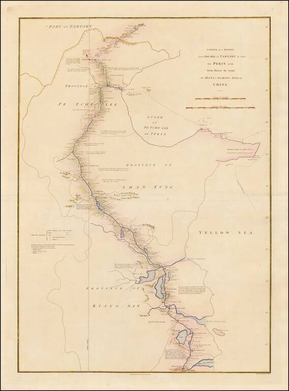
Detailed map showing the route taken from Zhe-Hol in Tartary to Beijing and then on to Hang-Tchoo Foo, from Staunton's An Authentic Account of an Embassy from the King of Great Britain to the Emperor of China. The map details George Macartney's...
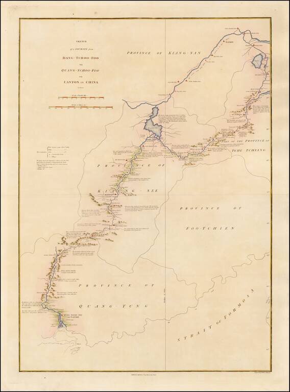
Detailed map showing the route taken from Hang-Tchoo Foo to Quang-Tchoo-Foo (Canton), from Staunton's An Authentic Account of an Embassy from the King of Great Britain to the Emperor of China. The map details Geroge Macartney's Embassy to China, the...
Detailed chart of the coast of China from Staunton's An Authentic Account of an Embassy from the King of Great Britain to the Emperor of China, showing the tracks of the vessels carrying the Earl of Macartney's Embassy along the coast of China with a...
Nice example of Giovanni Maria Cassini's decorative map of China and Korea. The map includes a fine decorative vignette, being one of the last great decorative maps of the region.
![Kарта пути или дороги по которой Посольство Английское пролзжая изъ ганж-тшoo-фоо въ канж-тшoo-фоо. [Russian Map Depicting a Journey Through China to Canton.]](/map/small/47671.jpg)
Rare Russian Imprint Depicting Canton and Macao. Detailed map showing the second part of the route across China taken by the George Macartney mission after meeting the Emperor of China. This map represents the overland journey from Hang-Tchoo-Foo to...
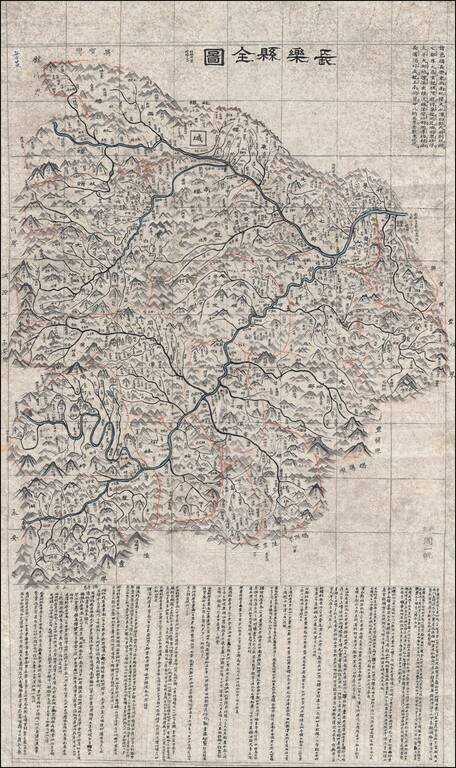
Hand Drawn Map of the Wuhua County in the Guangdong Province Finely executed late Qing Dynasty Chinese manuscript map of Wuhua County, northeast of Hong Kong in eastern Guangdong Province, China. The map, which uses the Qing name of the region,...
![[Greek Map of Philippines, Southeast Asia, China, etc.] Πίναξ γεώγραφικος της Ασιας (Pinax geographikos tis Asias)](/map/small/61785.jpg)
The present map is one sheet of a 4 sheet Greek language map of Asia, published in Vienna by Anthimos Gazi in 1802. The map is one of at least 4 maps created by Gazis in Vienna, as part of an effort to educate the Greek populous. Other maps include 4...
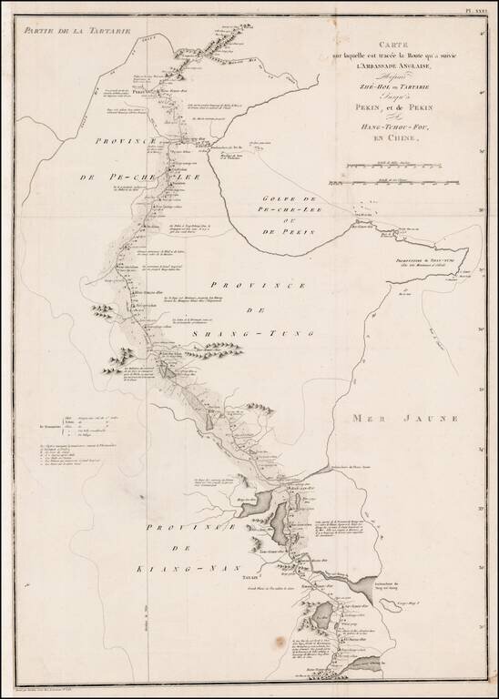
Detailed map of the Macartney's Route across China during his Embassy of 1792-1794. The Macartney Embassy, also called the Macartney Mission, was a British embassy to China in 1793. The Mission ran from 1792-94 . It is named for the first envoy of...
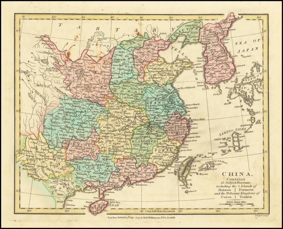
Interesting map of China, extending from Corea and the Sea of Japan and Tartary in the North, to Teypin Is. Belonging to I. Ekeyo, Formosa, Hainan, Tonkin and Yunnan Province. Hong Kong not yet named. Shows provinces, cities, towns, rivers,...
Detailed map of China, Korea and Japan, showing provinces, towns, rivers ports, islands, etc. Includes Formosa and Hainan Islands. Decorative vignette.
![[Macao] Видъ Города Макао съ морской стороны | Ansicht Der Stadt Macao in China](/map/small/70739.jpg)
Magnificent View of Macao From the Original Russian Edition of Krusenstern's Important Atlas Fine example of this skillfully-engraved view of Macao, based upon drawings taken by Wilhelm Gottlieb Tilesius in 1805-6, which appeared in the atlas to...
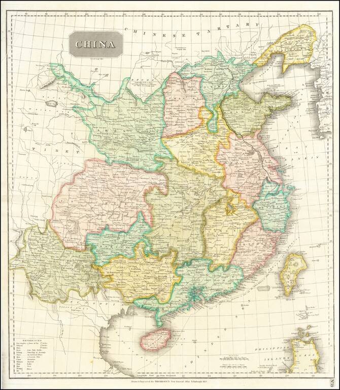
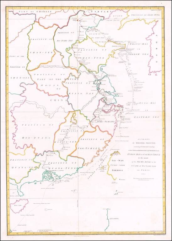
Striking large format map of China, colored by provinces. Shows towns, rivers, roads, the Grand Canal, islands, mountains, etc. The Tract of the Hindoostan & Lion with the British Embassy to China is shown.