Map size in jpg-format: 87.815MiB
Click to open in high resolution (open in new tab).
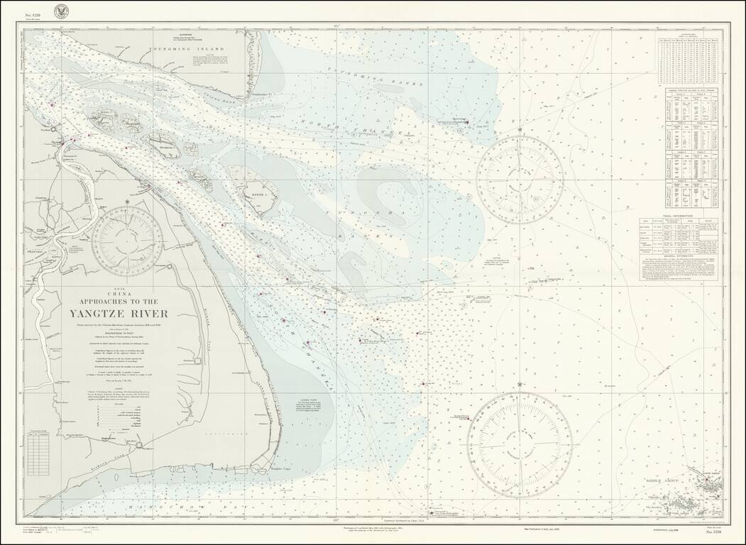
World War II-era hydrographical chart of the entrance to the Yangtze River and the Shanghai Region.
Shanghai is shown at the left of the map, with details such as the railroads and their stations, the International Settlements, and local hamlets and creeks all labeled.
Interestingly, Shanghai was under Japanese occupation in 1944, when this map was made, and it would remain so until the end of the war in 1945.
If you are a student, write to us in telegram: @antiquemaps and indicate what material you need and for what work you need a map in high detail. We are ready to provide material on special terms. For students only!
![[Martin Behaim Globe / Book] Pars Globi terrestris Ao. 1492 a Martino Behaim Equite Lusitano Norimbergae confecti Delineavit Christoph. Theoph de Murr 1778 (bound with:) Diplomatische Geschichte des Portugesischen berühmten Ritters Martin Behaims](/map/small/68828.jpg)
![Il Disegno Della Terza Parte Dell' Asia [Gastaldi's Wall Map of SE Asia with extra panels!]](/map/small/30554hbp.jpg)
![Chinae, olim Sinarum regionis nova descriptio. auctore Ludouico Georgio. [English Edition!]](/map/small/71123.jpg)