
![[Shanghai, Hangzhou, Ningbo, Suzhou] Carte du Tche-kiang dressee ar les Missionaires sous la direction de Mgr Guierry de la Congregation de St. Lazare Vicaire Apostque du Tach-Kiang](/map/small/64426.jpg)
Rare Missionary map of China, showing the region from Shanghai in the north to Ningde. The map illustrates the province of Tche-kiang. As noted by the text which accompanied the map, it was drawn up by the missionaries working in province, under the...
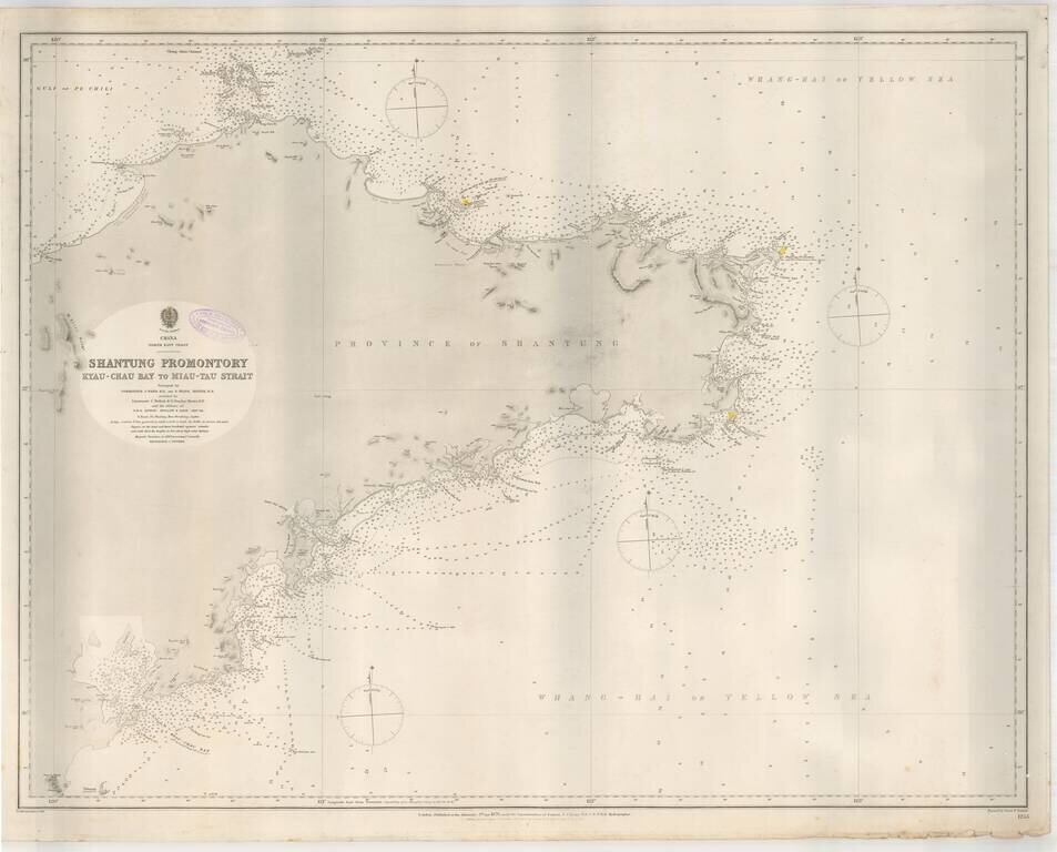
Highly detailed sea chart of the Shantung (Shandong) Province, published by the British Admiralty. The chart provides a highly detailed treatment of the region, from Kyau-Chau Bay (Jiaozhuo Bay) and the Qingdao area to Miaodoa Strait in the North and...
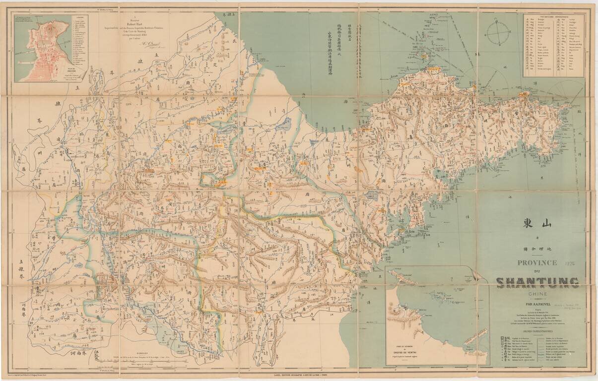
Detailed map of the Shandong Province, printed in Chinese and French. The map shows rivers and mountains and natural resources, and includes a Geographical Vocabulary table at the top left, showing Chinese symbols and translations and a table at the...
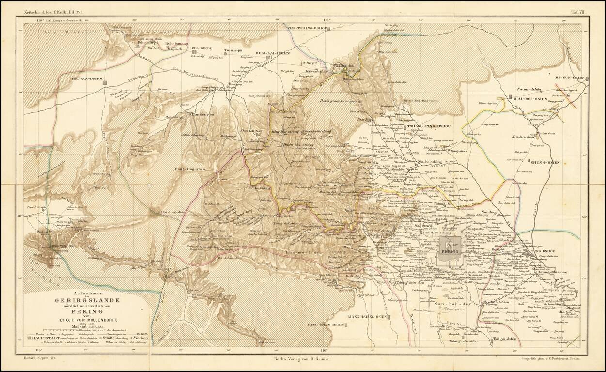
Fine map illustrating the area north and west of Beijing, as explored by Dr. O.F. von Mollendorff. Paul Georg von Mollendorff Paul Georg von Möllendorff (1847 – 1901) was a German linguist and diplomat. Möllendorff is mostly known for his service...
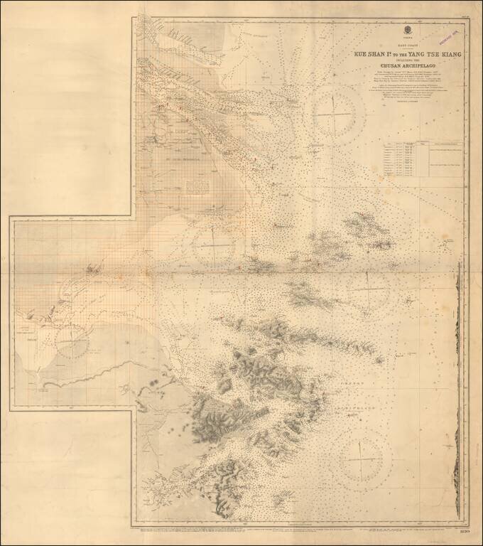
Redlined For Contemporary Use Detailed sea chart of the mouth of the Yangtze River in the north to the Zhousan Island, published by the British Admiralty. The chart includes thousands of soundings, islands, sailing directions and lighthouses,...
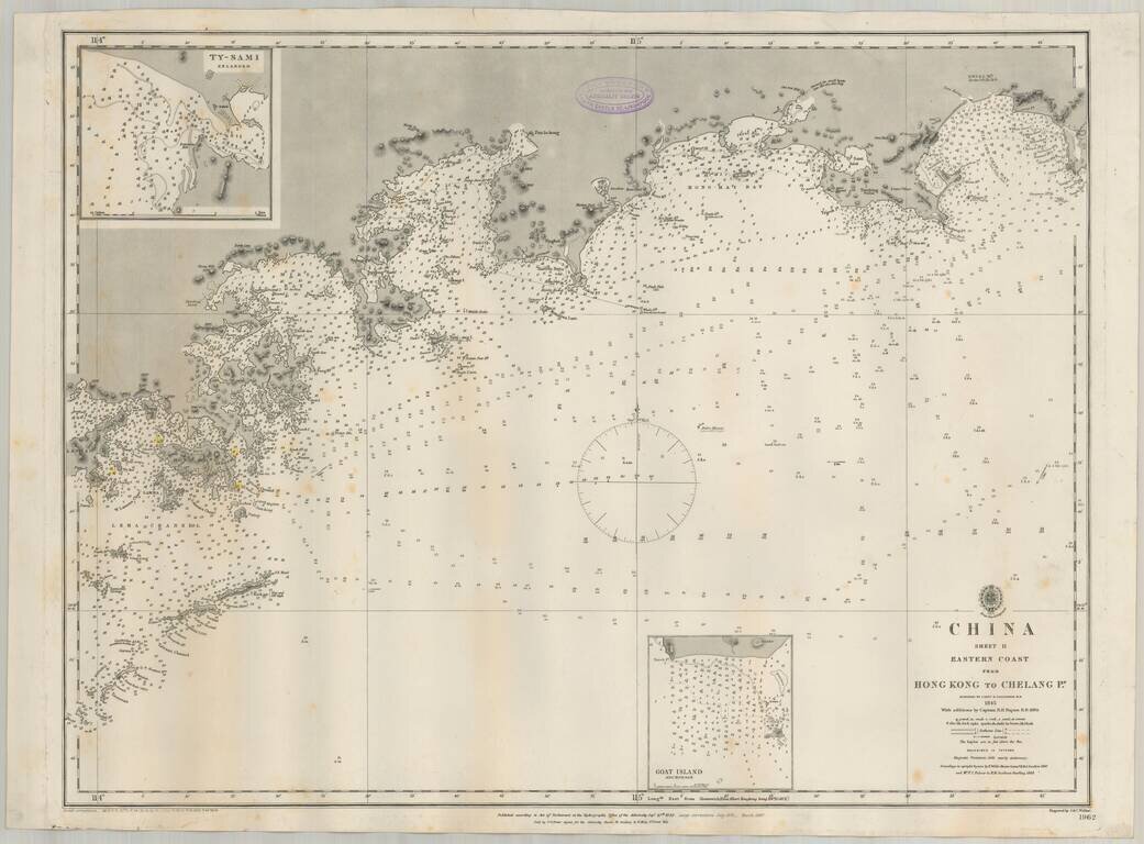
Detailed British Admiralty sea chart of China, extending from Hong Kong and the Lena Islands in the south to Hie Che Chin Bay in the north. Victoria is named on Hong Kong. The map includes extensive soundings and other sailing information. Includes...
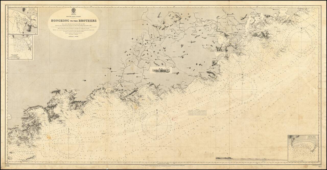
19th Century British Navigational Chart Scarce early sea chart of the coast of China, from Hong Kong and Lantao to Nan'ao Island and Dongshan. Engraved chart, including tidal information, compass roses, soundings, seabed notations, currents,...
![[China] 古今地舆全圖 / Full Modern and Ancient Map](/map/small/62437kb.jpg)
A Rare and Important Discovery -- The First Map of China Published For Commercial Use and Sale Mingjie Liu's (刘明杰) (1857 - 1911) important 1892 (Guangxu 18) Qing Era xylographic (woodcut) map of China is the earliest known example of what is...
![支那全圖 Shina zenzu [Comprehensive Map of China]](/map/small/65521.jpg)
Rare Imperial Japanese Army Map of China Finely executed large map of China and Korea published in Tokyo just before the outbreak of the Sino-Japanese War. The map was issued by the Imperial Japanese Army General Staff Office (Sanbō-honbu). The map...
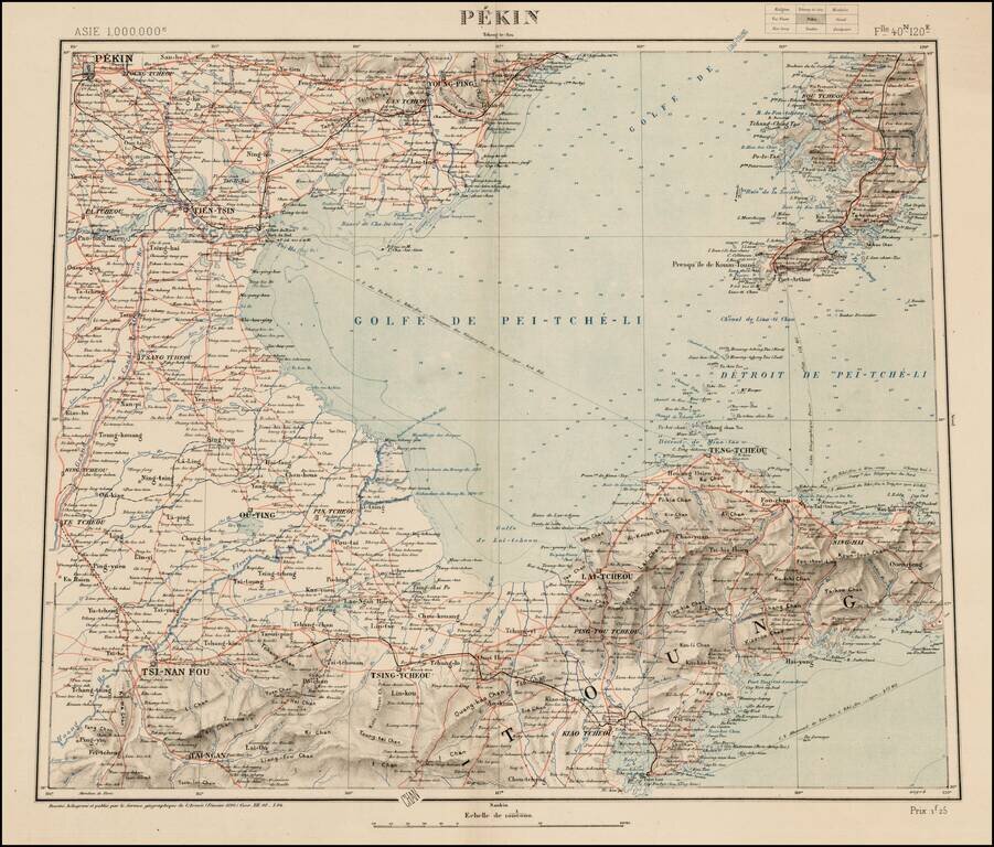
Rare map of the area near Bejing, from a 9 sheet map published by Dessine, for the Geographical Service of the French Army (Service Geographique de l'Armee). The map is discussed at length in the journal of the Eighth Annual Geographical Conference,...
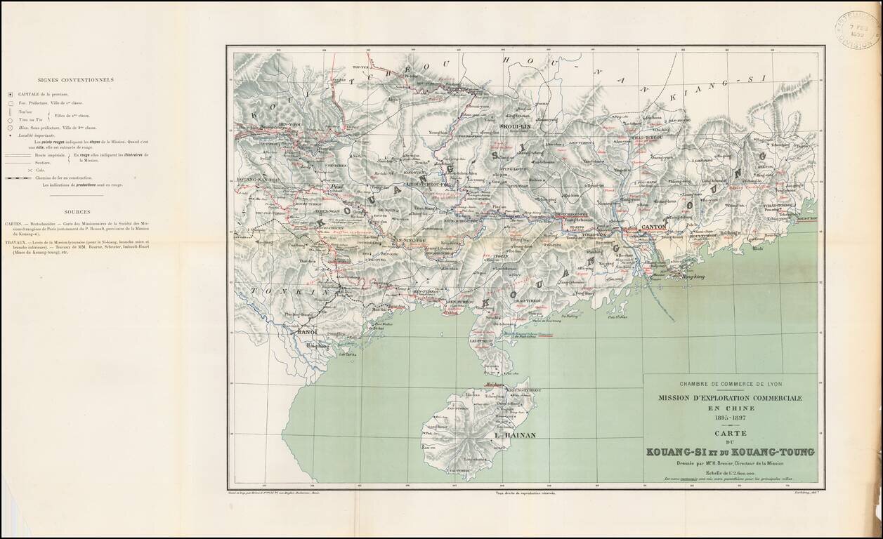
Rare regional map of eastern China, published by the Lyon (France) Chamber of Commerce in connection with its attempts to expand trade with China. The map is one of at least 3 maps in a set prepared by Erhard Freres in Paris, published in conjunction...
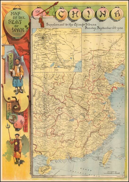
Rare separately published map of the Theater of War in China, published by the Chicago Tribune. The image includes Chinese figures in border to left, and an inset map of Peking region to the Gulf of Pechili, and political map of eastern China. The...
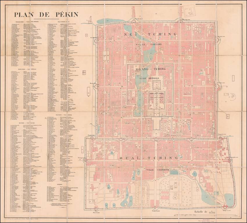
Large French Map of Beijing, Sold by A French Bookseller in Beijing. Lithographed folding map of Beijing published by the French Service Geographique de l'Armee at the beginning of the 20th century. The map includes a massive key with 384 points of...
![[Rare Set of Boxer Rebellion Maps] Boxer-Aufstand in China. Karte der weiteren Umgebungen von Peking und Tientsin von F. von Richthofen . . . [with] Provinz Tschi-Li, Tientstin und Peking mit Umgebung von Dr. O.F. von Mollendorf . . . [and] Nordostli](/map/small/65681.jpg)
Mapping The Boxer Rebellion Rare set of maps illustrating the theater of war during the Boxer Rebellion, issued in Berlin by Dietrich Reimer. Published in the second year of the Boxer Rebellion (1899-1901), the maps would seem to have been published...
![[Map of Western Shangdong Province]](/map/small/60891.jpg)
Boxer Rebellion-Era Map of Shangdong Province. Highly detailed map of part of Shandong Province by the Kartographische Abtheilung der Konigl. Preuss. Landes-Aufnahme. The map was prepared in Germany to highlight German interests in China, as the Boxer...
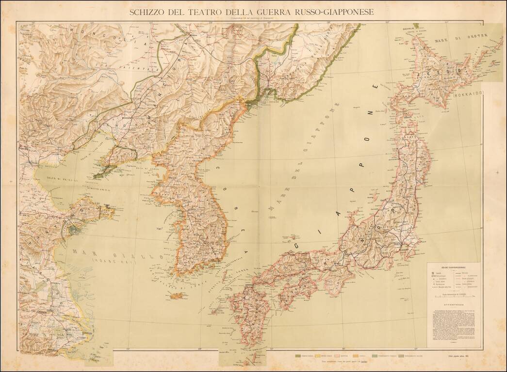
Separately published Italian map of the Theater of the Russo-Japanese War, published in 1904. The map is color coded to show: Russian Domain Imperial Chinese Japan Korea German Possessions English Possessions Additional details include...