
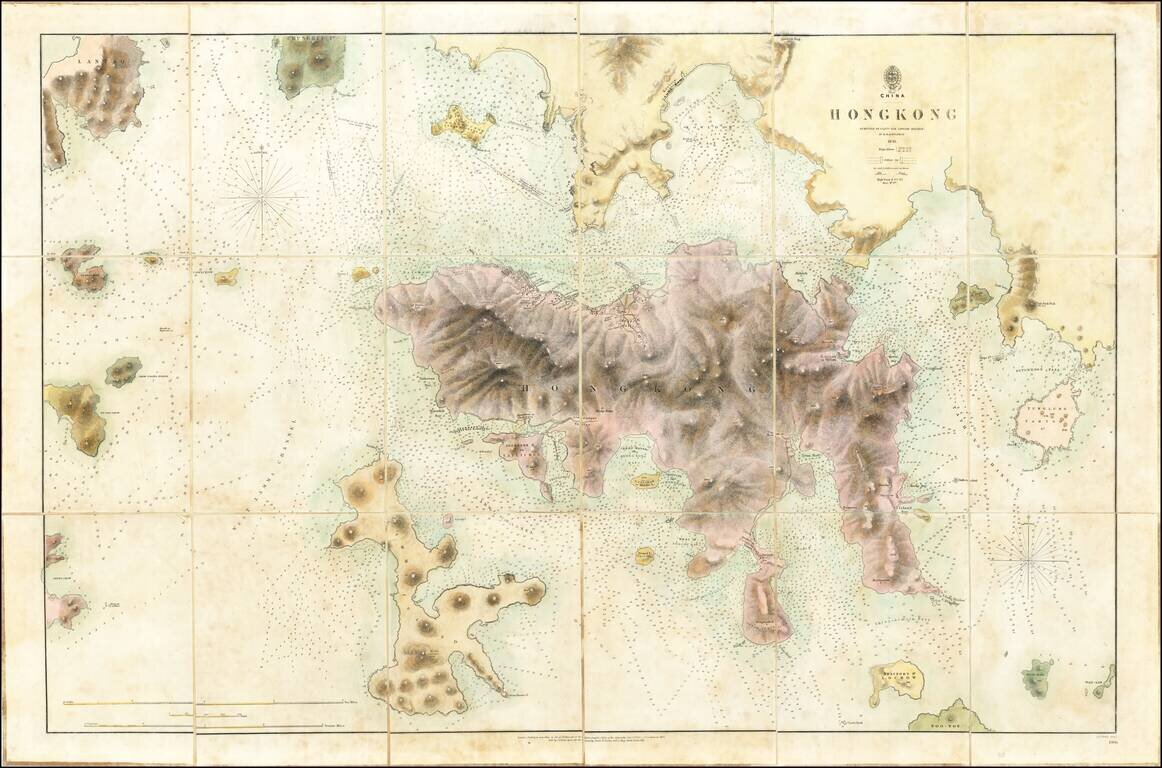
The First Printed Map of Hong Kong Early edition of the first printed map of Hong Kong, first published in 1843 by the British Admiralty Chart of Hong Kong, based upon the surveys of Sir Edward Belcher. Belcher's survey is the first large format map...
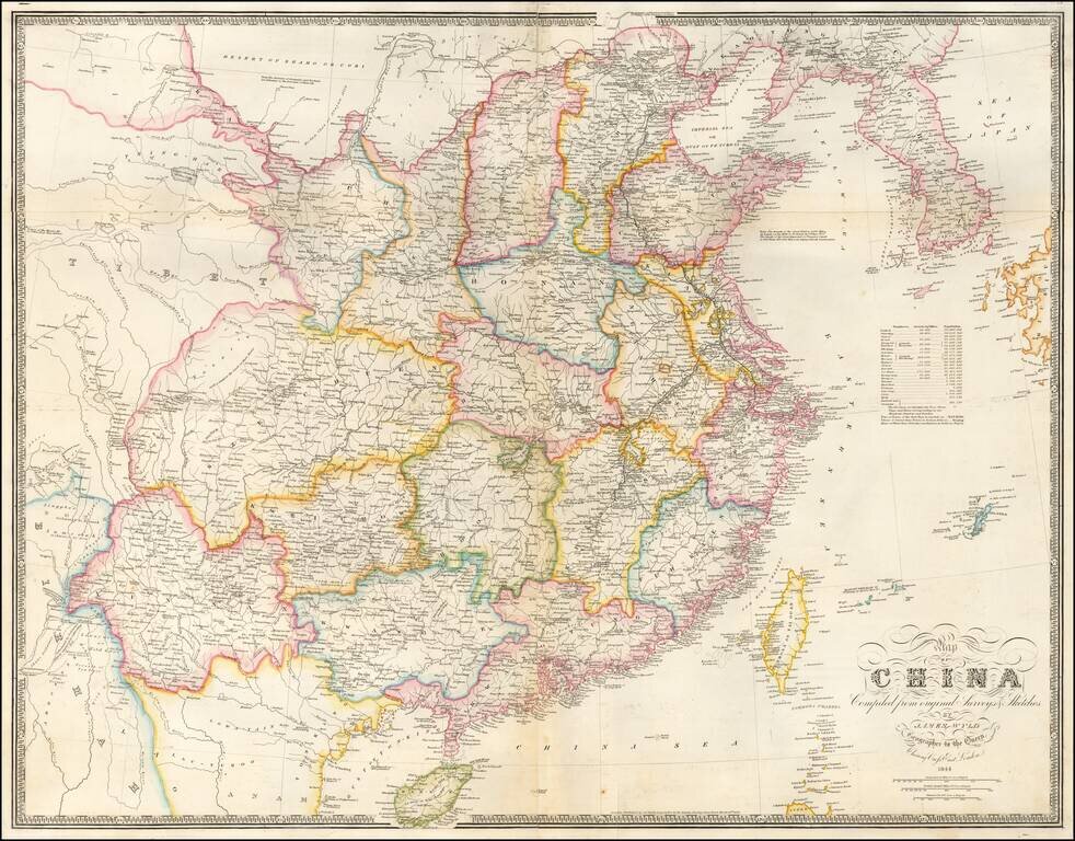
Early State of Wyld's Large Map of China Highly detailed map of China, published shortly after the conclusion of the First Opium War, reflecting Britain's new commercial interest in China. An early state of James Wyld influential map of China,...
![South Eastern Asia Birmah - China - Japan [and Philippines]](/map/small/69678.jpg)
Interesting regional map of Southeast Asia and the Philippines. Hong Kong Island is noted, as is Singapore and a separate Malacca. Nice detail in the Philippines.
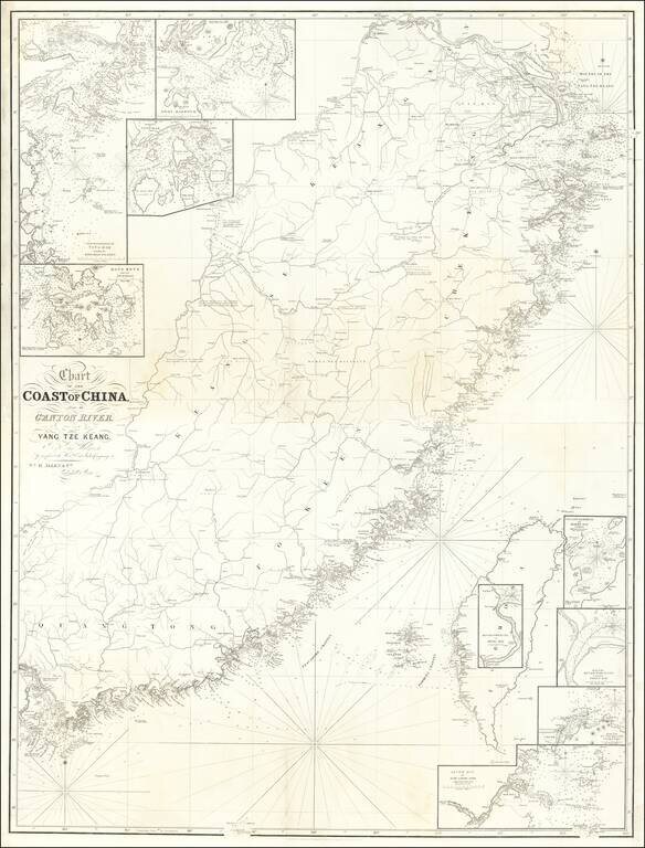
Rare 2 sheet map of Southwestern China, from Shanghai to Hong Kong, Macao and Canton, published in London by William Allen. The map includes a number of smaller insets, including: Hong Kong and its Anchorage River Woo-sung to Shang-Hae Mouth of...
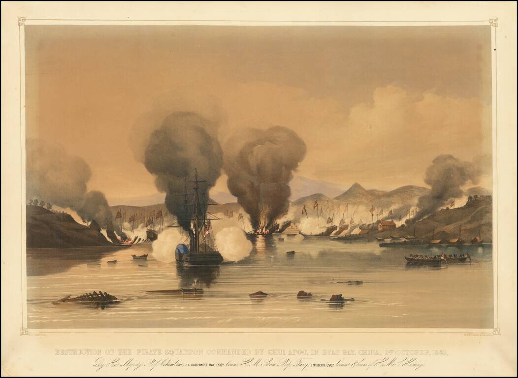
Finely-Executed Lithograph of a Battle Between the British Royal Navy and Chinese Pirates This lithographic view depicts the engagement between the British Royal Navy and Chinese pirates at Bias Bay, China, just northeast of Hong Kong. It shows a...
![(China) КАРТА КИТАЙСКAГО ГОСУДАРСТВА. [Map of the Chinese State.]](/map/small/56505.jpg)
Rare, separately issued hand-colored lithographed map of China, published in Russian, probably around 1850. The map presents a circumscribed view of Chinese territory, with much of the west and north of modern-day China not included. Much of Inner...
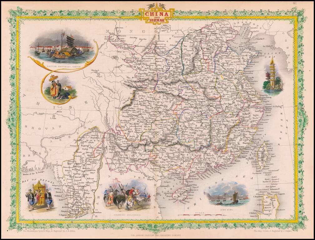
Gorgeous full color example of Tallis' map of China & Birmah, with decorative vignettes showing British factories in Canton, a birdseye view of Hong Kong, Chinese soldiers, and two other decorative vignettes. Engraved for R. Montgomery Martin's...
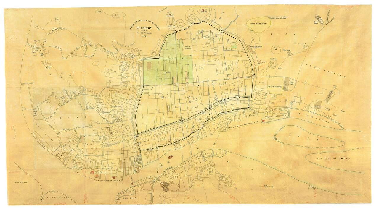
The Earliest Known Example of Rev. Daniel Vrooman's Monumental Manuscript Map of Canton, China. Vrooman's exceedingly rare manuscript plan offers a little-seen view of Canton on the eve of the Second Opium War. Constructed by Vrooman using Chinese...
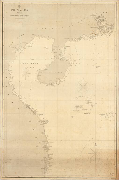
The authoritative sea chart of the southwestern coasts of China and northern Vietnam showing the main shipping route into Hong Kong during the era of the Second Opium War. This important work was part of a series of charts of the South China Sea first...
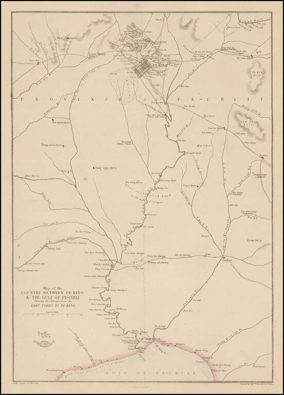
Detailed map of the area around Beijing, showing roads, rivers, towns, etc. 'The Weekly Dispatch' newspaper between the years 1856 and 1862 included in each edition a map of a part of the world. During this period a total of 118 maps were issued. The...
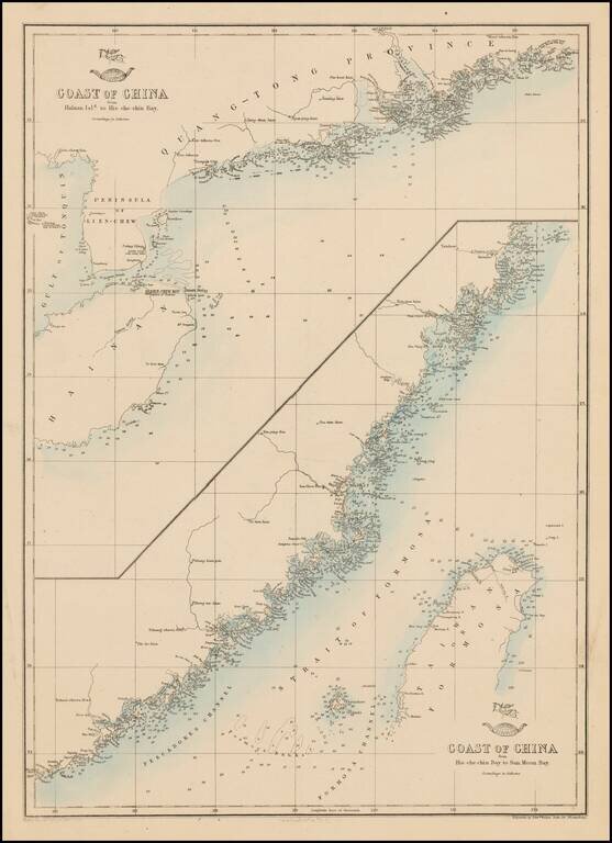
Fine pair of charts of the Chinese coast on one sheet. 'The Weekly Dispatch' newspaper between the years 1856 and 1862 included in each edition a map of a part of the world. During this period a total of 118 maps were issued. The maps bear the...
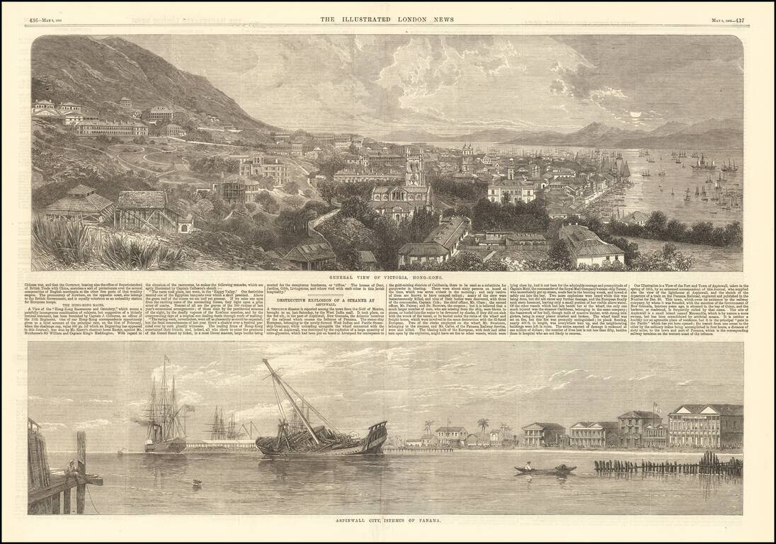
Fine early view of Victoria, Hong Kong, published by the Illustrated London News. The short article below notes that the view illustrates the Race Course and Cemetary, based upon an image furnished by Captain J. Colborne, an officer of the 11th...
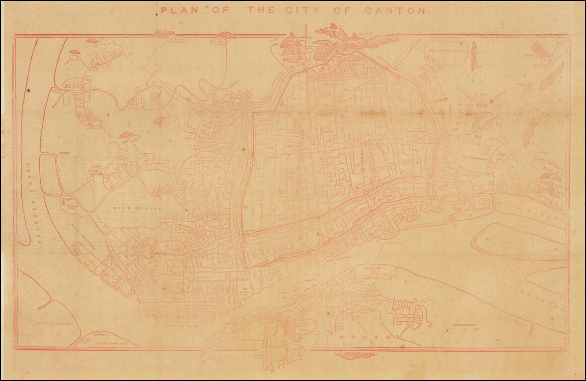
Rare Early Copy of Daniel Vrooman's Monumental Manuscript Map of Canton, China. Interesting early plan of Canton, based upon Daniel Vrooman's manuscript map of Canton. Vrooman's manuscript plan offered a little-seen view of Canton on the eve of the...
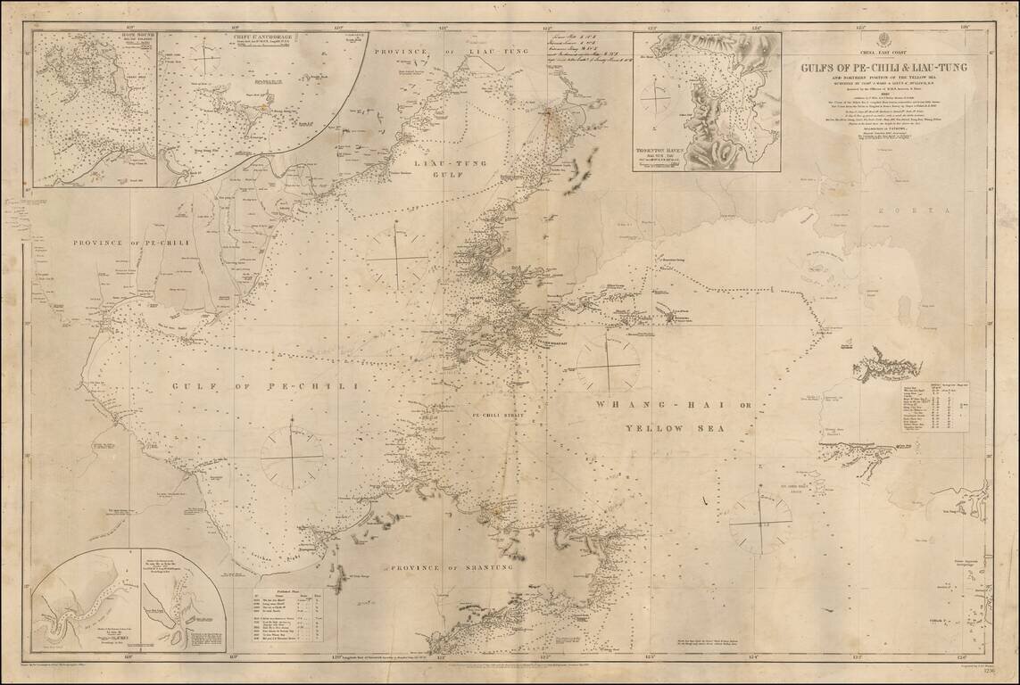
Detailed sea chart of the Coast of Northerneastern China and part of Korea, published by the British Admiralty. The map extends from the Shantung Province and Pechili Province in the west, including the river extending from Tianjin to Beijing in the...
![(China) Карта Чжилійской Губерніи No. 1 [Map of the Zhili Province No. 1]](/map/small/58914.jpg)
Russia Explores the Possibility of Invading China. Fascinating Russian-language lithographed map of Zhili Province (the home of Beijing), with inset maps of Beijing, Tongzhou, Kalanga, and Tianjin. The map was produced in 1871, when there was a very...
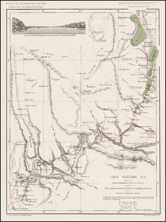
Detailed map of the route from Yun-nan to Poi Eul and southward, from l'Exploration de l'Indo-Chine, dirigée par Doudart de Lagrée. Highly detailed route map, with vignette of Tchin-Kiang.