![[Wales] Cambriae Typus Auctore Humfredo Lhuydo . . .](/map/small/45077.jpg)
Map size in jpg-format: 1.20898MiB
Click to open in high resolution (open in new tab).
![[Wales] Cambriae Typus Auctore Humfredo Lhuydo . . .](/prevmap/prev_45077/45077.jpg)
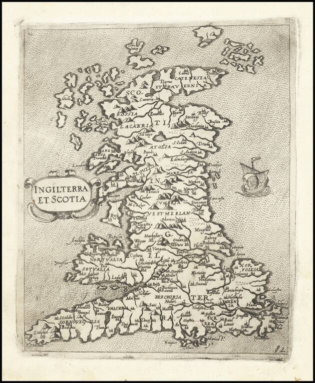
Ortelius' map is the first printed map of Wales.
The map appeared in Ortelius' Theatrum Orbis Terrarum, the first modern atlas of the world. Ornate cartouche and many sailing ships and sea monster. The map is based upon Mercator's 1564 wall map of the British Isles in 8 sheets and Lhuyd's manuscript map of 1568.
If you are a student, write to us in telegram: @antiquemaps and indicate what material you need and for what work you need a map in high detail. We are ready to provide material on special terms. For students only!
![[Two Sheet Detailed Agricultural Map] Great Britain](/map/small/68080.jpg)