logo

1573. Oost ende West Vrieslandts beschryvinghe Utriusque Frisiorum Regionis Noviss Descriptio 1568

  • Oost ende West Vrieslandts beschryvinghe Utriusque Frisiorum Regionis Noviss Descriptio 1568

Oost ende West Vrieslandts beschryvinghe Utriusque Frisiorum Regionis Noviss Descriptio 1568 information:

Year of creation: 
Resolution size (pixels): 
 12745x8794 px
Disk Size: 
 31.9198MiB
Number of pages: 
 1
Place: 
 Antwerp
Author: 

Print information. Print size (Width x height in inches):
Printing at 72 dpi 
  177.01 х 122.14
Printing at 150 dpi 
 84.97 х 58.63
Printing at 300 dpi 
 42.48 х 29.31

An example of detailing the file of this map of in a printable high-resolution:

Click to open in high resolution (open in new tab).
Attention! this is just the central piece (central area 960x960 px) of the map file!
This is an example, so that you can see and study the level of detail of a given map. The entire Map will be fully available after payment!

Oost ende West Vrieslandts beschryvinghe Utriusque Frisiorum Regionis Noviss Descriptio 1568

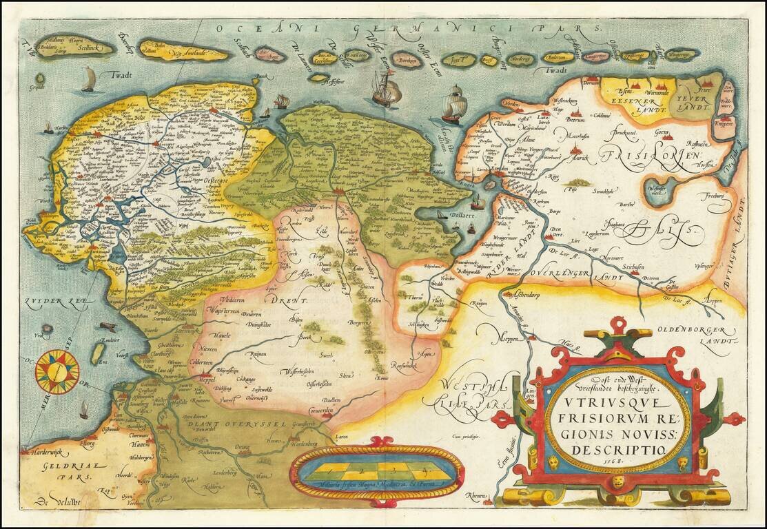
A nice old color example of Ortelius' map of Friesland, including a larger compass rose, sailing ships and an elaborate cartouche.

The map appeared in Ortelius' Theatrum Orbis Terrarum, the first modern Atlas, first issued in 1584.

Van Den Broecke 80.

Special conditions for students!

If you are a student, write to us in telegram: @antiquemaps and indicate what material you need and for what work you need a map in high detail. We are ready to provide material on special terms. For students only!

Item information:

Year of creation:
Size:
12745x8794 px
Disk:
31.9198MiB
Number of pages:
1
Place:
Antwerp
Author:
Abraham Ortelius.
$14.99

Related item