Map size in jpg-format: 36.2042MiB
Click to open in high resolution (open in new tab).
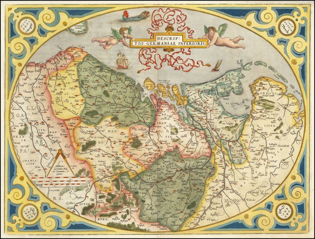
Old color example of the Low Countries set in an ornate decorative border, from Ortelius' Theatrum Orbis Terrarum, the first modern atlas of the world.
Two cherubs hold an ornate banner cartouche aloft, with sailing ships and a sea monster.
Koeman (1964) attributes this map to Jan van Hoirne's 1556 map of the Oosterscherzee, which only covers one eighth of the present map. Van der Heijden in The oldest maps of the Netherlands, Utrecht 1987, p. 20, map 14, thinks that another, unknown map by this cartographer, as mentioned in the Catalogus is more likely. Karrow (88/8, p. 619-620) attributes this map to the 1568 map of the Low Countries by Matthias Zuendt (1498-1571). Finally, Meurer (p. 91) makes a convincing case for de Jode's 12 sheet map of 1566, itself based primarily on Jacob van Deventer's province maps.
If you are a student, write to us in telegram: @antiquemaps and indicate what material you need and for what work you need a map in high detail. We are ready to provide material on special terms. For students only!


