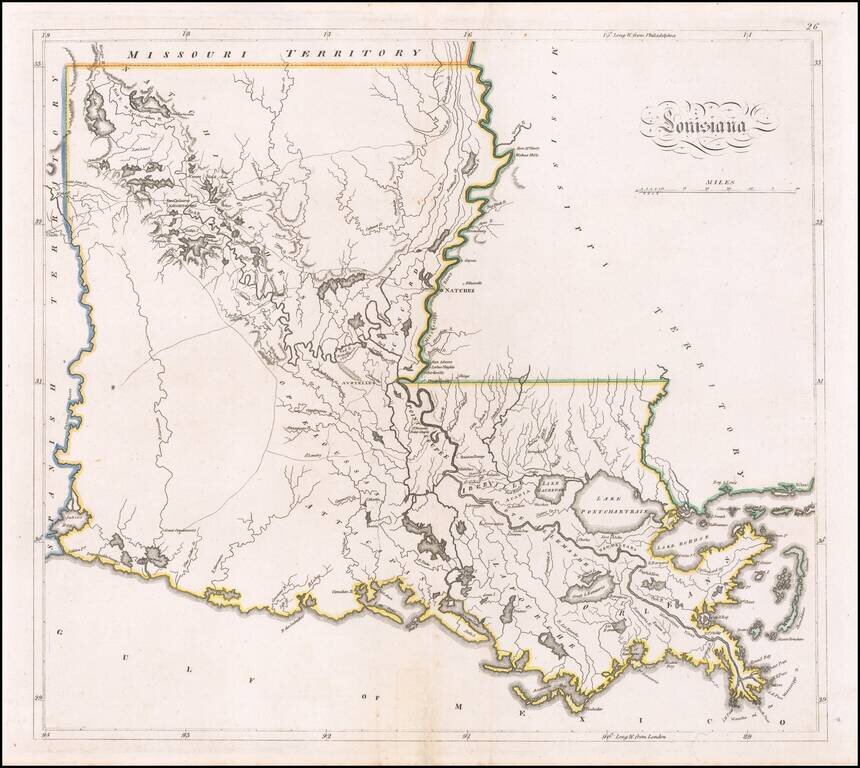
Louisiana on the Eve of the Battle of New Orleans A fine example of Mathew Carey's map of Louisiana, one of the earliest large format maps of the state to appear in a commercial atlas. Includes roads, towns, rivers, lakes, and a host of other...
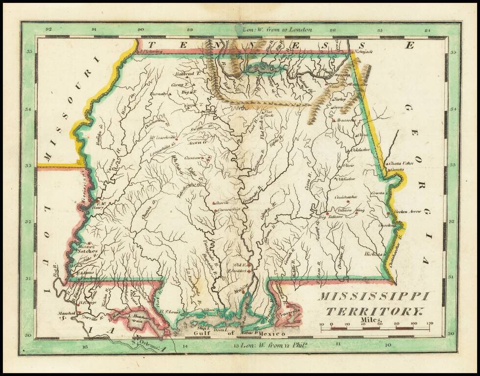
Nice example of Carey's small map of Mississippi Territory, illustrating the region prior to the creation of Alabama Territory. A highly detailed map, which includes towns, roads, rivers, mountains, and many other details.
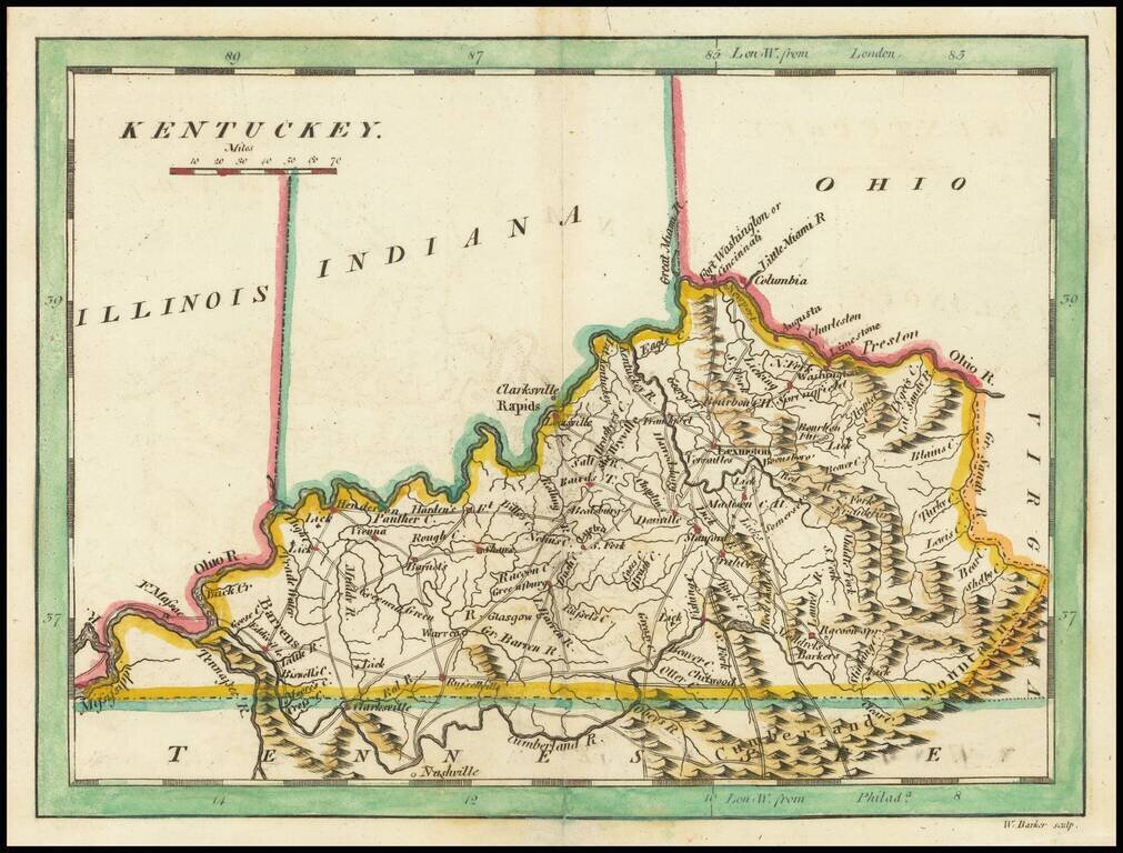
Scarce early map of Kentucky, published by Mathew Carey. This later 1814 edition references Ohio, Illinois and Indiana above. The prior state showed only the "Northwestern Territory.
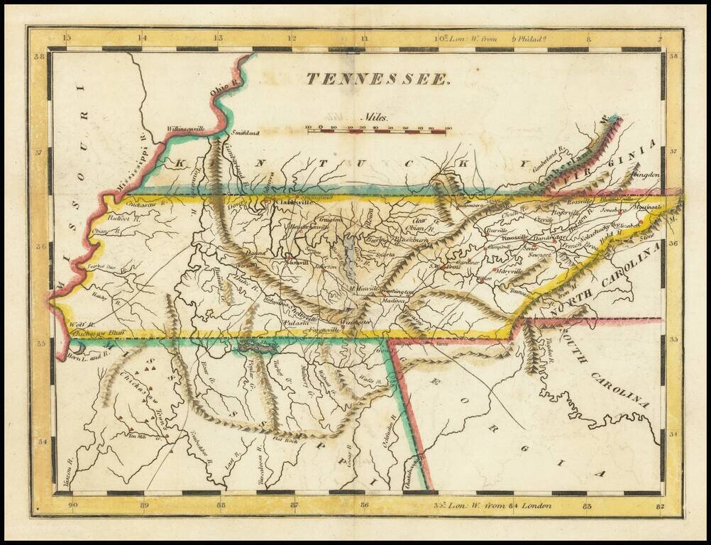
Nice example of Matthew Carey's early map of Tennessee. A highly detailed map, which includes towns, roads, rivers, mountains, and many other details.
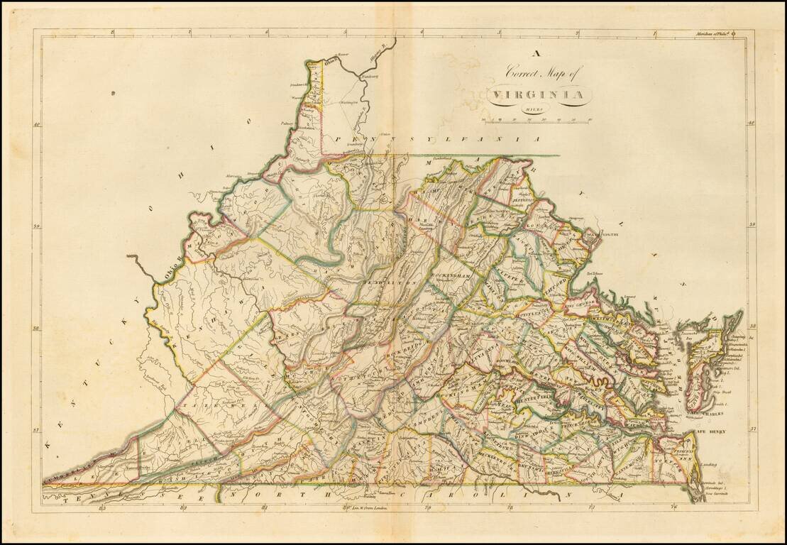
Nice example of the 1814 edition of Carey's map of Virginia, one of the best large format maps of the state to appear in a Commercial Atlas. The map is attractively hand colored by counties and shows, towns, roads, mountains, rivers, lakes, islands,...
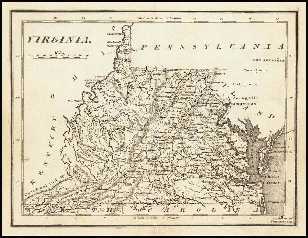
Nice example of Carey's map of Virginia. A highly detailed map, which includes towns, roads, rivers, mountains, and many other details.
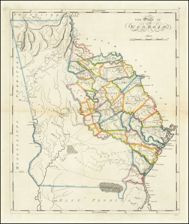
One of the Earliest Obtainable Maps of Georgia in its Modern Configuration. Rare full wash color example of Matthew Carey's second map of Georgia, first issued in 1814. Following the creation of Mississippi Territory in 1798, the borders between...
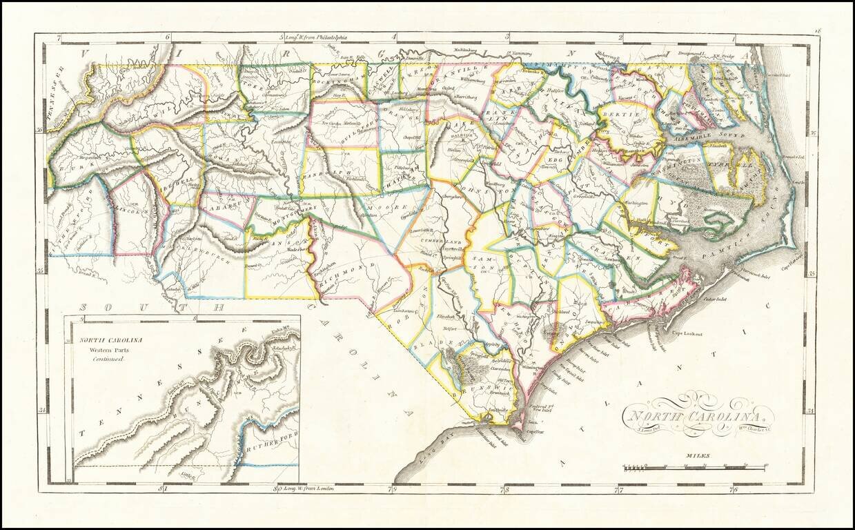
Striking example of Mathew Carey's map of North Carolina, one of the earliest large format maps of the State after independence. Includes the topography of North Carolina, as well as roads, towns, rivers, lakes, and a host of other details. The map...
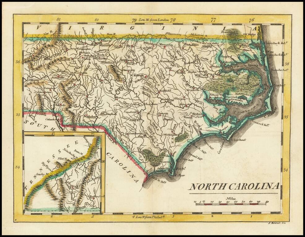
Scarce early map of the North Carolina, published by Mathew Carey. As noted on the North Carolina Map Blog: Although slightly smaller than the 1796-1810 map, it is most easily distinguished from the earlier plate by the presence of an inset of...
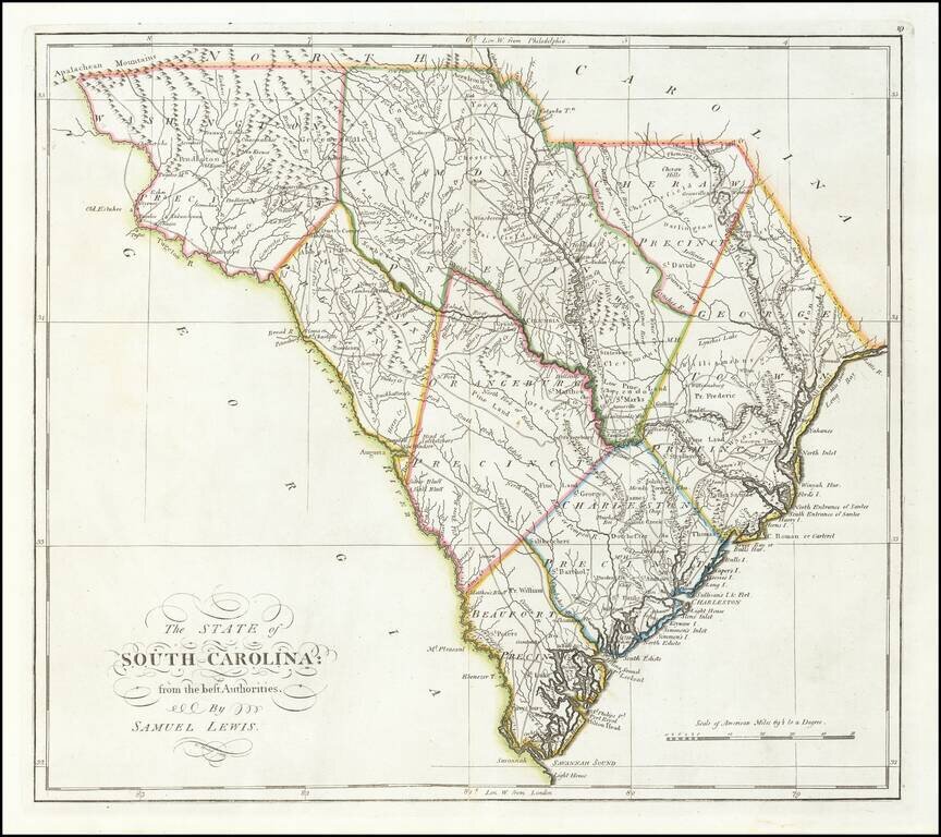
Finely colored example of Carey's map of South Carolina, hand colored by counties, from the rare 1816 edition of Mathew Carey's General Atlas. The map provided a large format and highly detailed map of the state, showing towns, roads, rivers,...
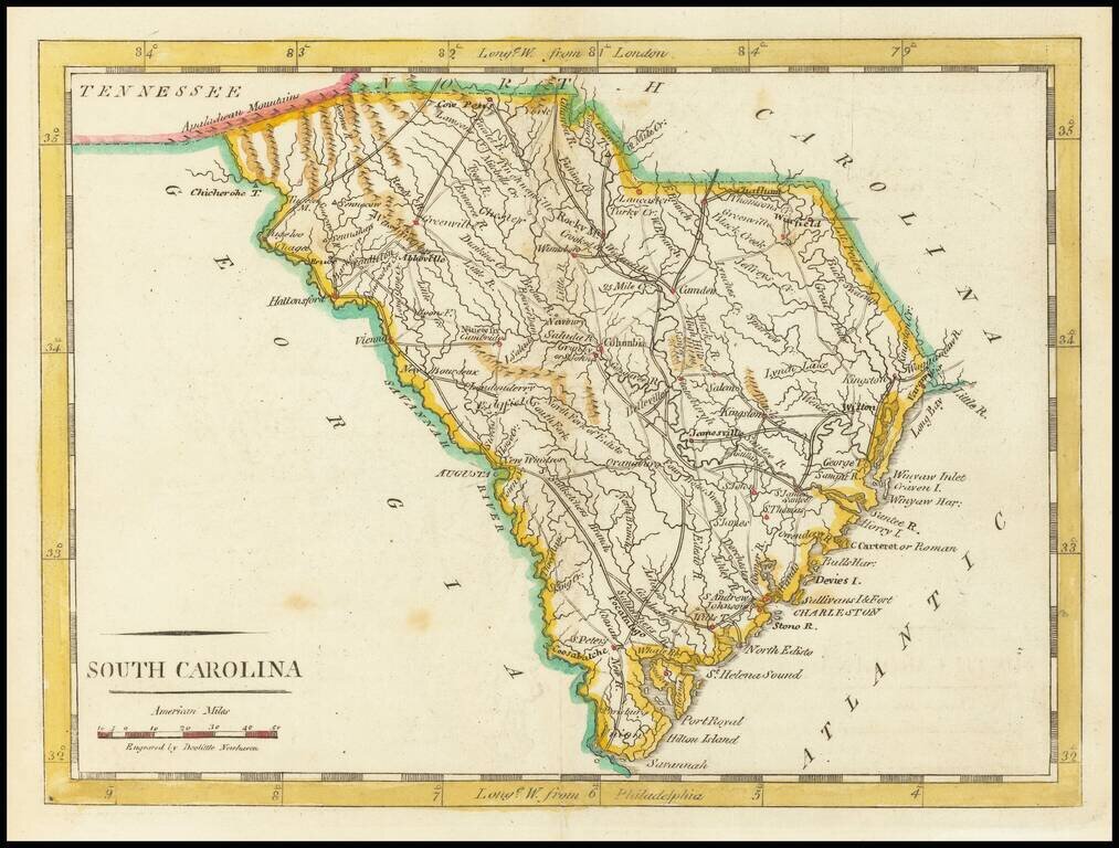
Nice early map of South Carolina from Carey's American Pocket Atlas. The map shows towns, roads, rivers, mountains and other topographical features. Following the publication of Carey's American Atlas in 1795, there were a small group of 18th Century...
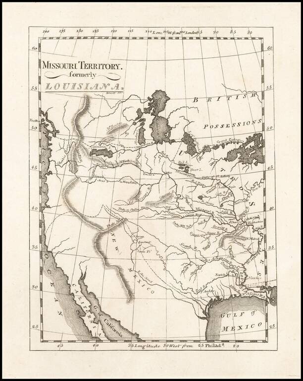
One of the Earliest Maps To Incorporate Lewis & Clark's Reports From Their Expedition Across America To The Pacific Reduced size example of Matthew Carey's map of Missouri Territory, published shortly after the return of Lewis & Clark and in...
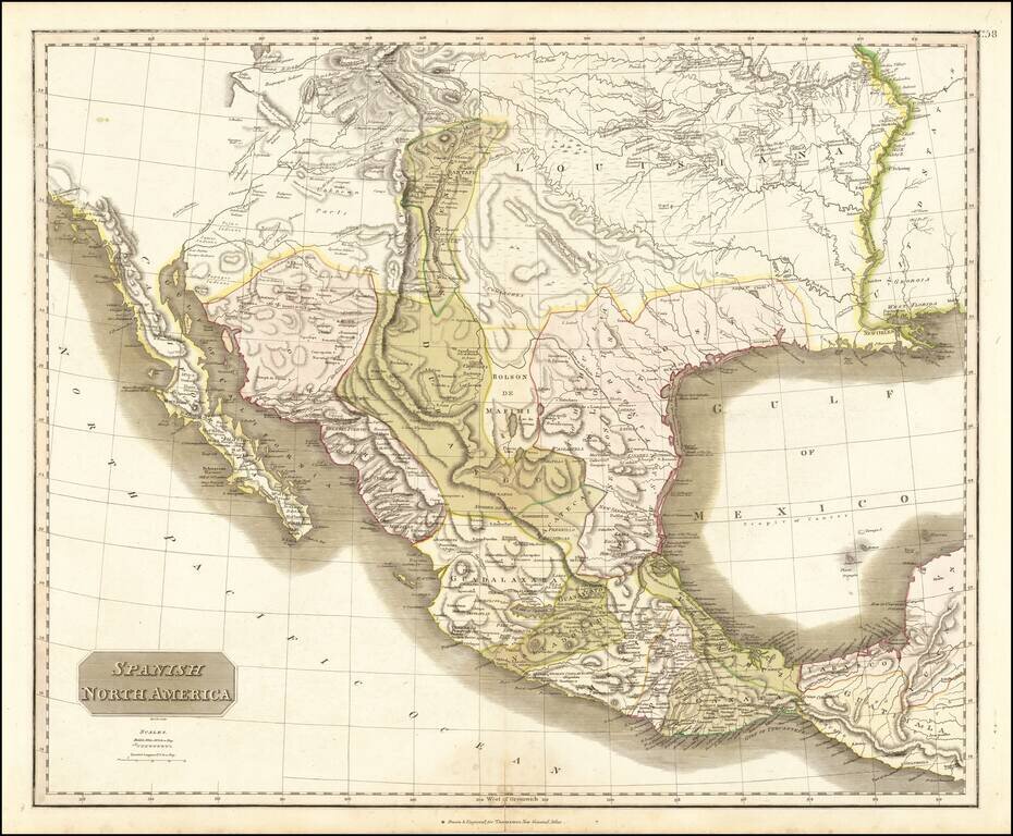
Large detailed English language map of Texas and the Southwest, published in Edinburgh by Thomson. The map is largely based upon the explorations of Humboldt and Long in the Rocky Mountains and the West. It includes extensive notes along the lower...
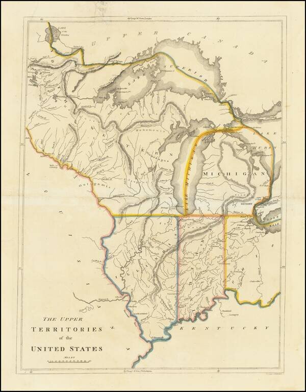
An Early American Map of the Old Northwest Nice example of the rare 1814 edition of Mathew Carey's map of the old Northwest. The map reflects a very early appearance of Michigan Territory (organized 1805), which had not yet appeared separately on any...
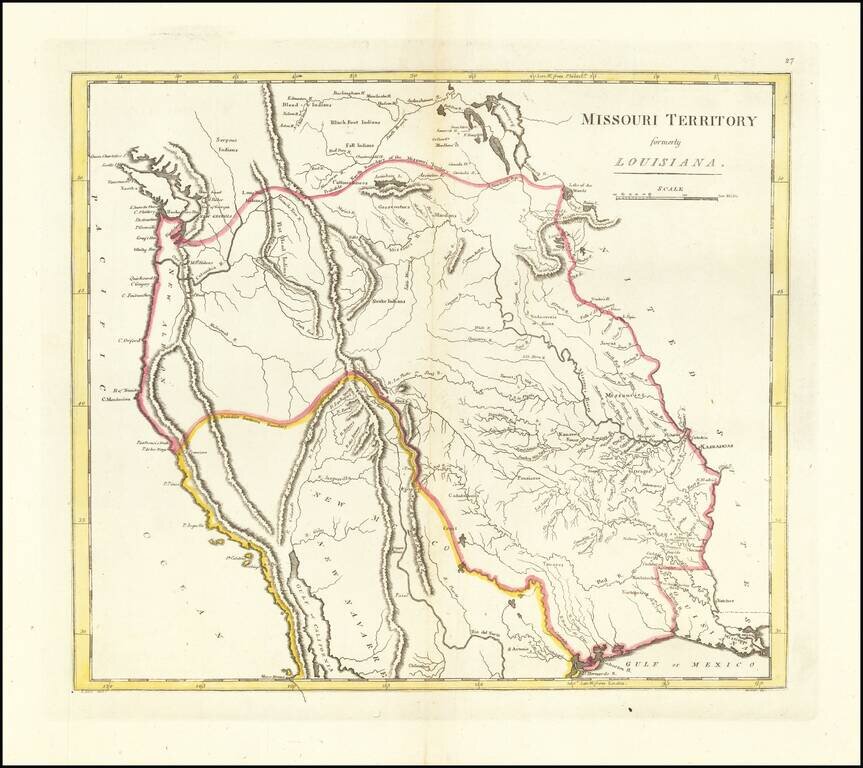
The First American Atlas Map of the Transmississippi West -- Based Upon Lewis & Clark's Reports Nice example of Mathew Carey's highly important map of Missouri Territory. Published shortly after the return of Lewis & Clark, Mathew Carey's...
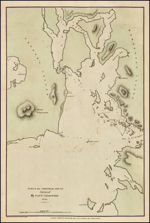
Fine example of the English edition of Lisiansky's map of the area around Sitka and Sitka Sound in Alaska, based upon the surveys of Captain Yuri Federovich Lisiansky in the region at the beginning of the 19th Century. The map is one of the earliest...