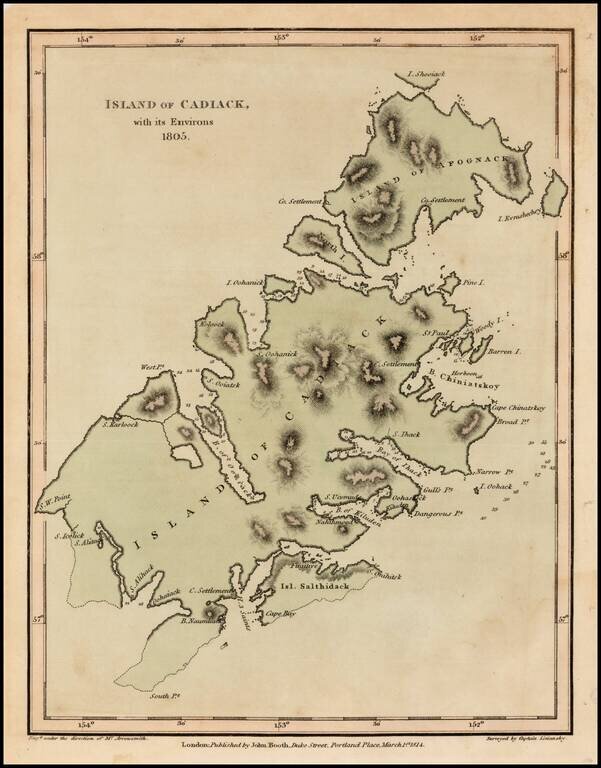
Fine example of the English edition of Lisiansky's map of Kodiak Island, in Alaska, based upon the surveys of Captain Yuri Federovich Lisiansky in the region at the beginning of the 19th Century. The map is one of the earliest obtainable maps of the...
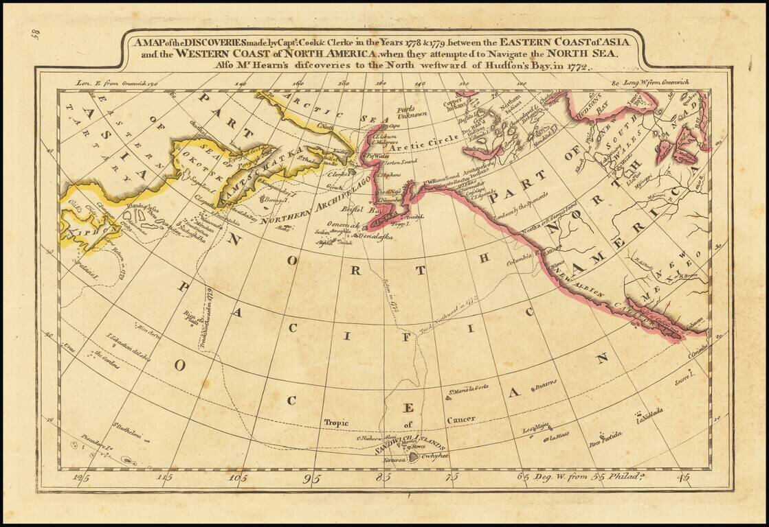
Outline color example of Carey's map of Cook's Discoveries in the Pacific and Hearn's discoveries west of the Hudson, in search of the Arctic Sea. This is one of the earliest appearances of a Cook map to be published in America. Excellent conjectural...
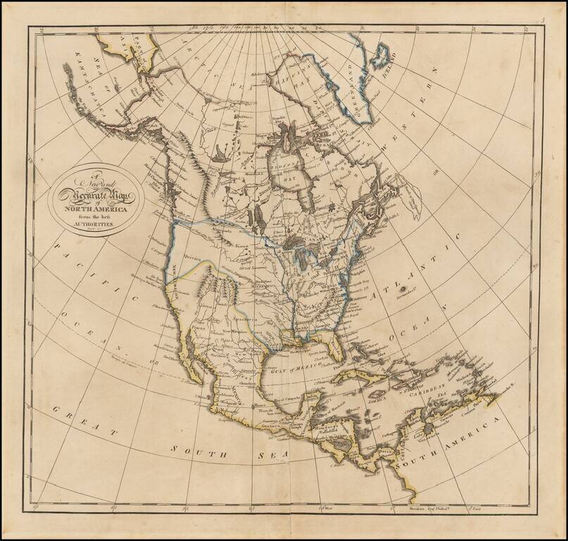
Columbia or River of the West! Fine example of Matthew Carey's map of North America, from his General Atlas. The map includes nice pre-Lewis & Clark information in the Transmississippi West. The "Columbia or River of the West" flows to the R....
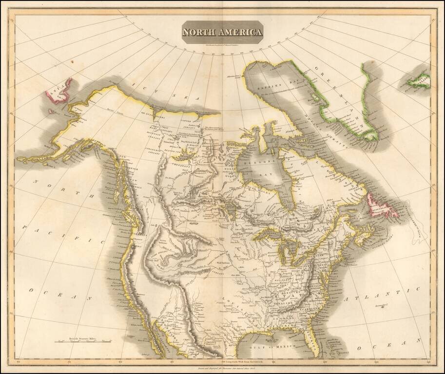
A Fine Lewis & Clark era Map of North America Fine large format map of North America, reporting on some of the discoveries of Lewis & Clark, published by Thomson in 1814. West of the Rocky Mountains, the map shows pre-Lewis & Clark...
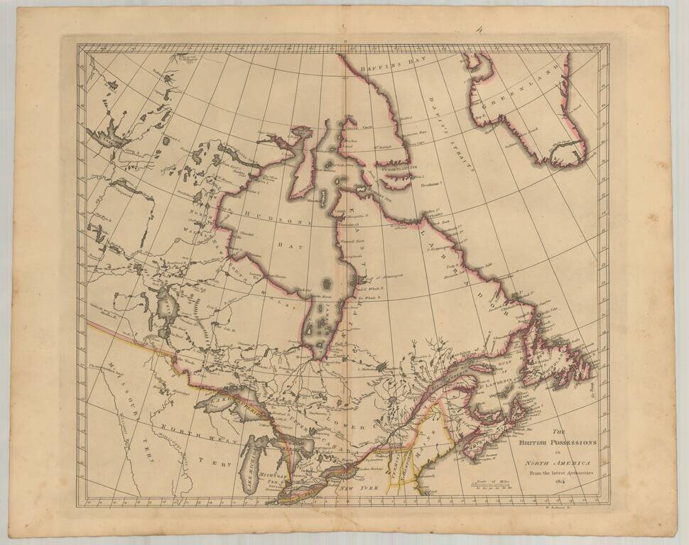
Early American published map of Canada, New England, the Great Lakes and Old Northwest Territory, from a late edition of Carey's General Atlas. Extends North to Baffin's Bay and the Sea as Seen By Hearne in 1771, West to Slave Lake, Buffalo Lake, Ft....
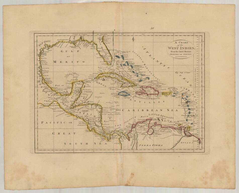
Interesting general map of the Caribbean, published by Matthew Carey in his General Atlas.
![St. Vincent [and] Barbadoes](/map/small/47045.jpg)
Detailed maps of the islands of Jamaica and St. Vincent, published by John Thomson in Edinburg. The map includes topographical details, parishes, towns, rivers, bays, points, etc. Among the best obtainable large format maps of the two islands during...
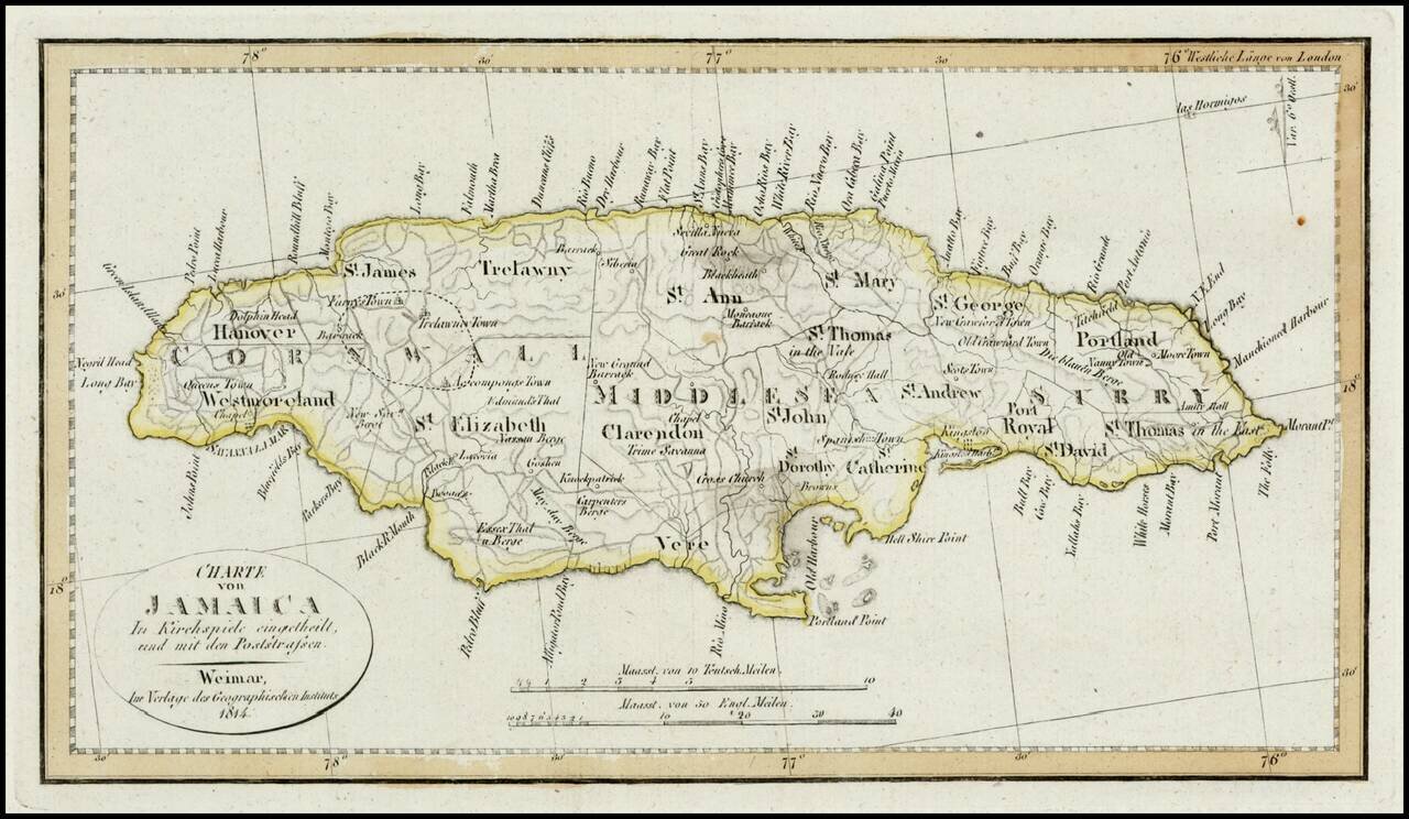
Detailed map of Jamaica, colored by Parishes. Shows Postal Roads, churches, towns, harbors, rivers, mountains and many other details. One of the earliest obtainable maps of Jamaica to locate postal roads.
Detailed early map of the coast of Venezuela and contiguous islands (Curacao, Bonaire, Aruba, Tortuga, Trinidad, Tobago, etc.) The map was issued 3 years after 7 of the 10 provinces of the Captaincy General of Venezuela declared its indendence from...
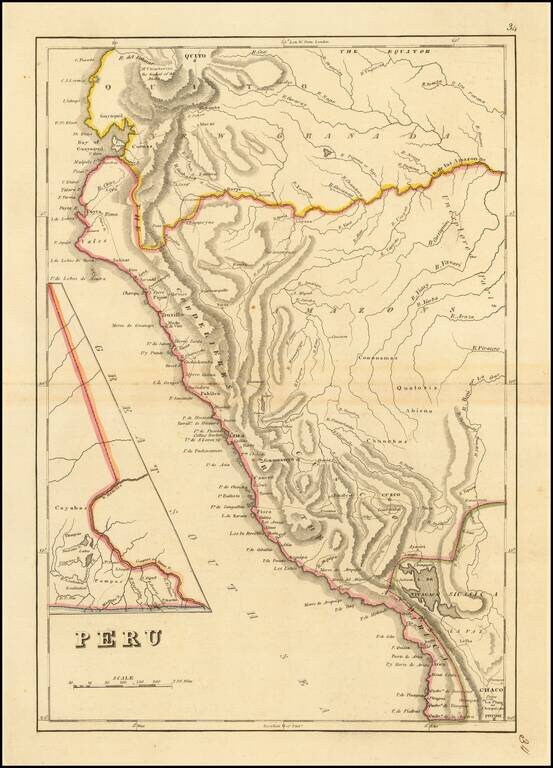
Peru at the Dawn of Its Indpendence Movement Detailed map of Peru, from a scarce late edition of Mathew Carey's General Atlas, the first atlas published in America. In 1808, Napoleon invaded the Iberian Peninsula and took the king, Ferdinand VII,...
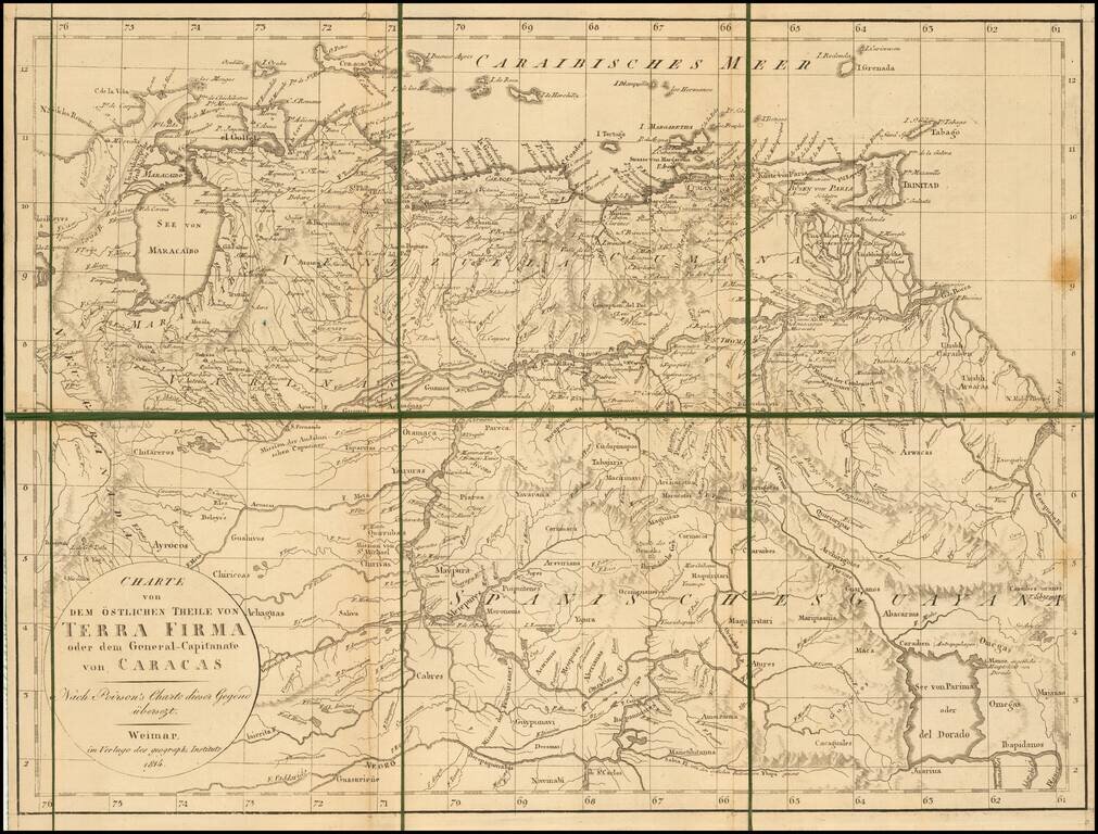
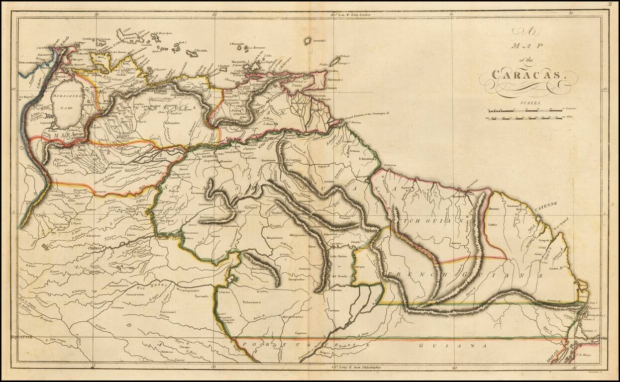
Rare separately published map of the northern part of South America. The map is focused on Venezuela and "Spanische Guyana." The map depicts the region in the year that Dutch Guyana was taken from the Netherlands by Britain.
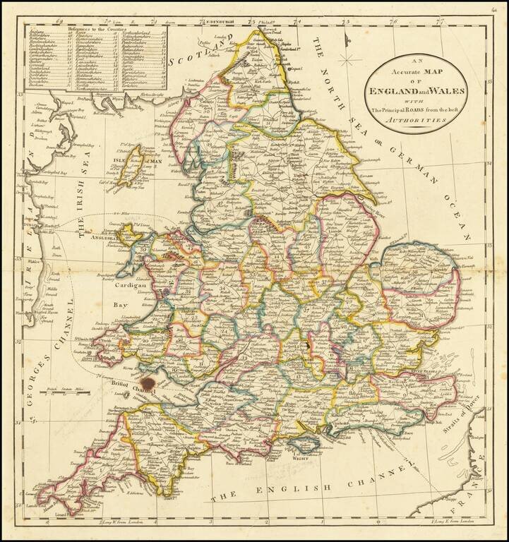
Detailed map of England, showing towns, roads, rivers mountains, lakes, etc. Nice detail. From the 1814 edition of Carey's American Atlas.
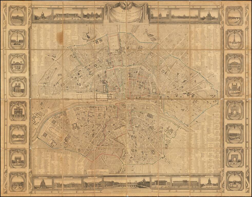
Rare wall map of Paris, issued at the beginning of the 19th Century, several decades before the major projects to re-design Paris under Georges-Eugène Haussmann commenced planning. The map divides Paris nto 12 arrondissements and 48 districts,...
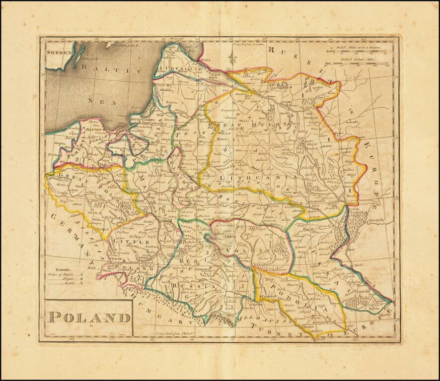
Second edition of the first map of Poland published in the United States. Published by Matthew Carey in 1814. Title revised and shortened from the first edition, although the content is unchanged.
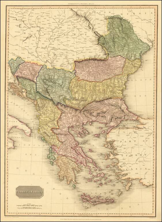
An excellent detailed regional map of the Balkans, Turkey and Greece, showing towns, roads, rivers, mountains, lakes, and other items of interest. Hand colored by regions.
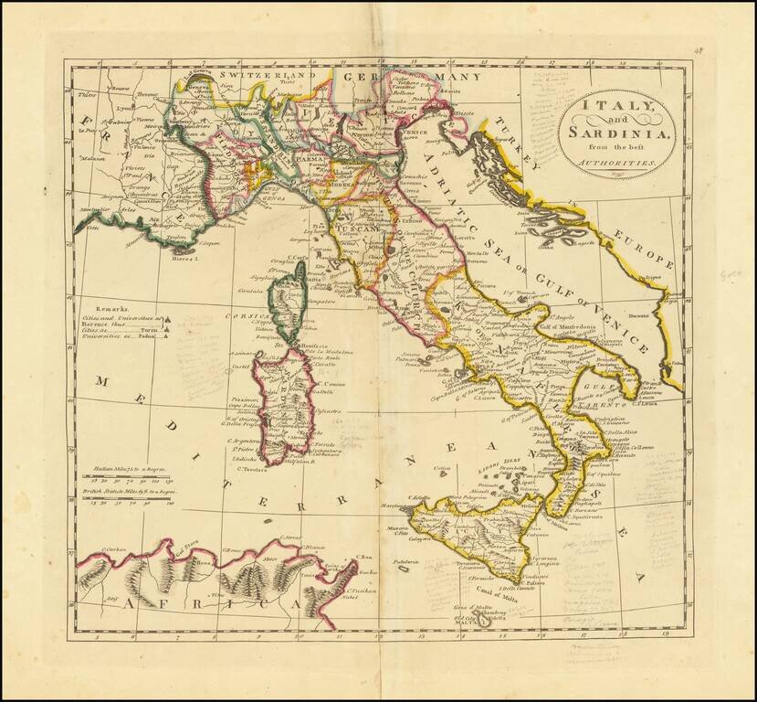
Interesting map of Italy, Sicily, Corsica and Sardinia, from the 1814 edition of Matthew Carey's General Atlas.