Map size in jpg-format: 18.524MiB
Click to open in high resolution (open in new tab).
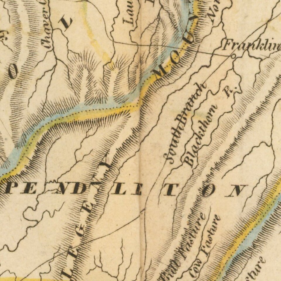
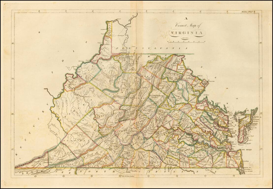
Nice example of the 1814 edition of Carey's map of Virginia, one of the best large format maps of the state to appear in a Commercial Atlas.
The map is attractively hand colored by counties and shows, towns, roads, mountains, rivers, lakes, islands, bays and a host of other early important details.
Carey's General Atlas was first published in 1796, with periodic revisions up to 1818. It was the first American Atlas to be offered for sale with hand coloring on the maps.
If you are a student, write to us in telegram: @antiquemaps and indicate what material you need and for what work you need a map in high detail. We are ready to provide material on special terms. For students only!