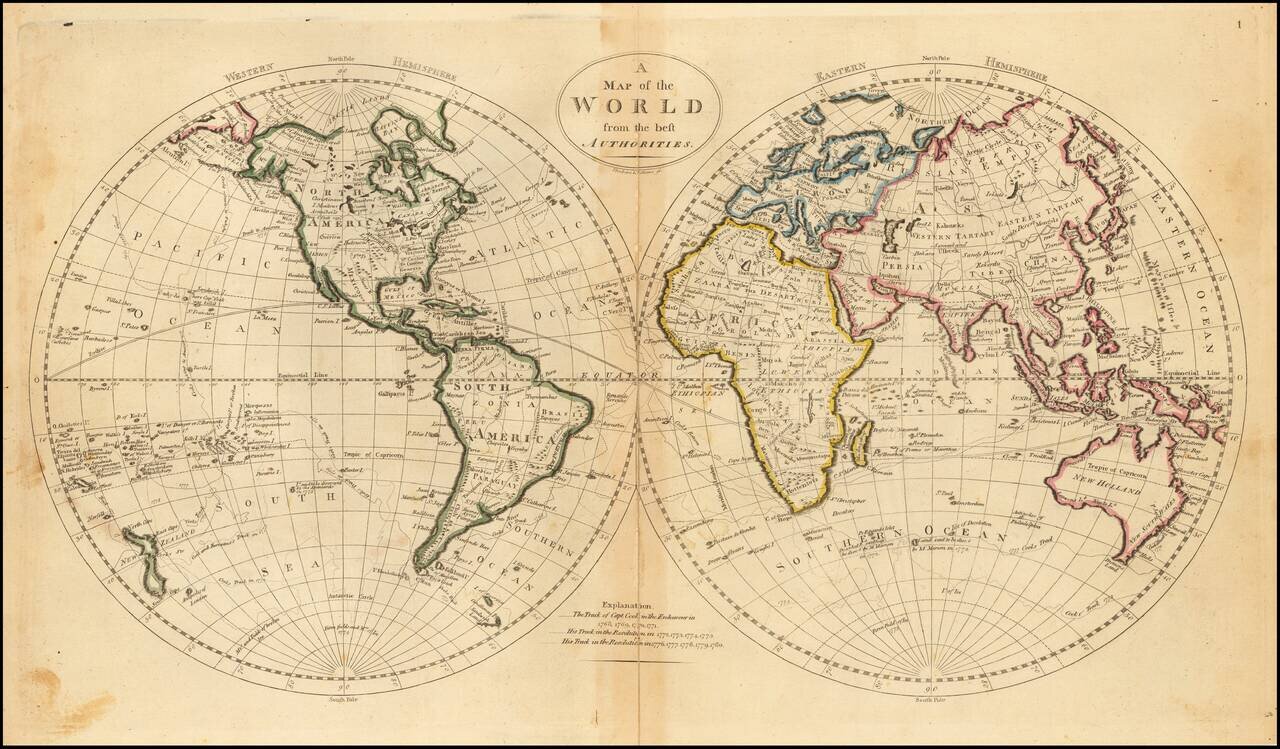
Decorative double hemisphere map of the World, which appeared in Carey's General Atlas. The map shows some of the tracks of Captain James Cook in the Antarctic Regions and an interesting Northwest Coast of America, New Zealand and Australia.
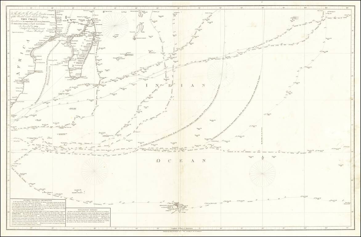
Provides one of the First Accurate Descriptions of Bouvetøya A detailed and fascinating chart of the South Indian Ocean, showing some of the most important journeys of the late 18th and early 19th centuries. This includes Cook's 1776 voyage and du...
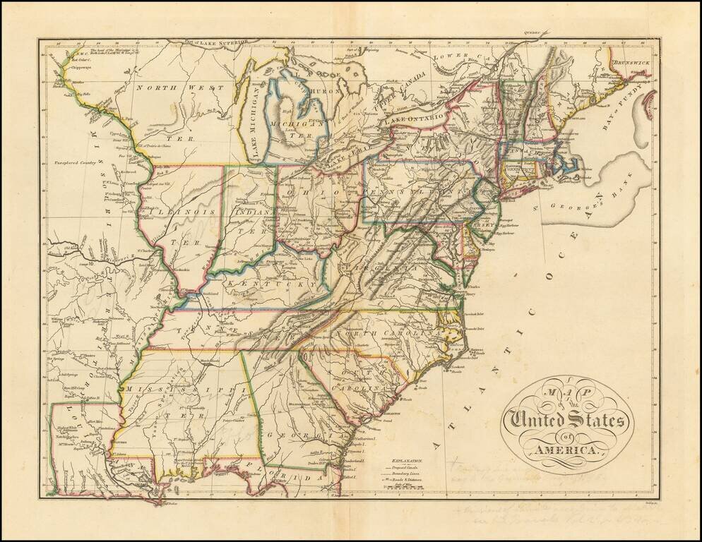
Nice example of Mathew Carey's map of the United States, which first appeared in his 1814 General Atlas, published in Philadelphia. The map reflects a fascinating period in the geo-political evolution of the U.S. Mississippi Territory still appears,...
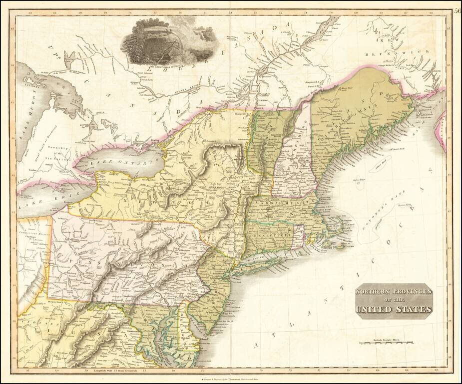
Interesting map of the Northeastern part of the United States, bounded by New England, New York, Pennsylvania, Virginia, Delaware, Maryland, New Jersey, etc. Indiana appears in northern Virginia. Connecticut reserve appears on the Cuyahoga River. The...
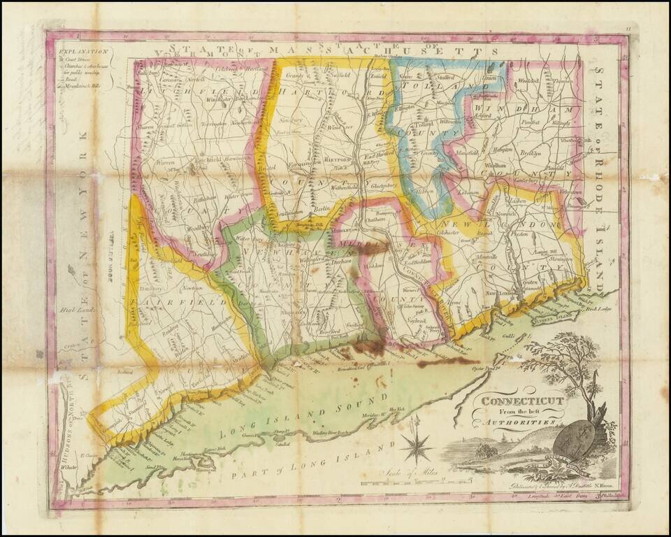
Inscribed to a Top Student! Nice example of the Mathew Carey's map of Connecticut, engraved by Amos Doolittle, which first appeared the 1795 edition of Carey's American Atlas. Carey's American Atlas was the first atlas published in the United States,...
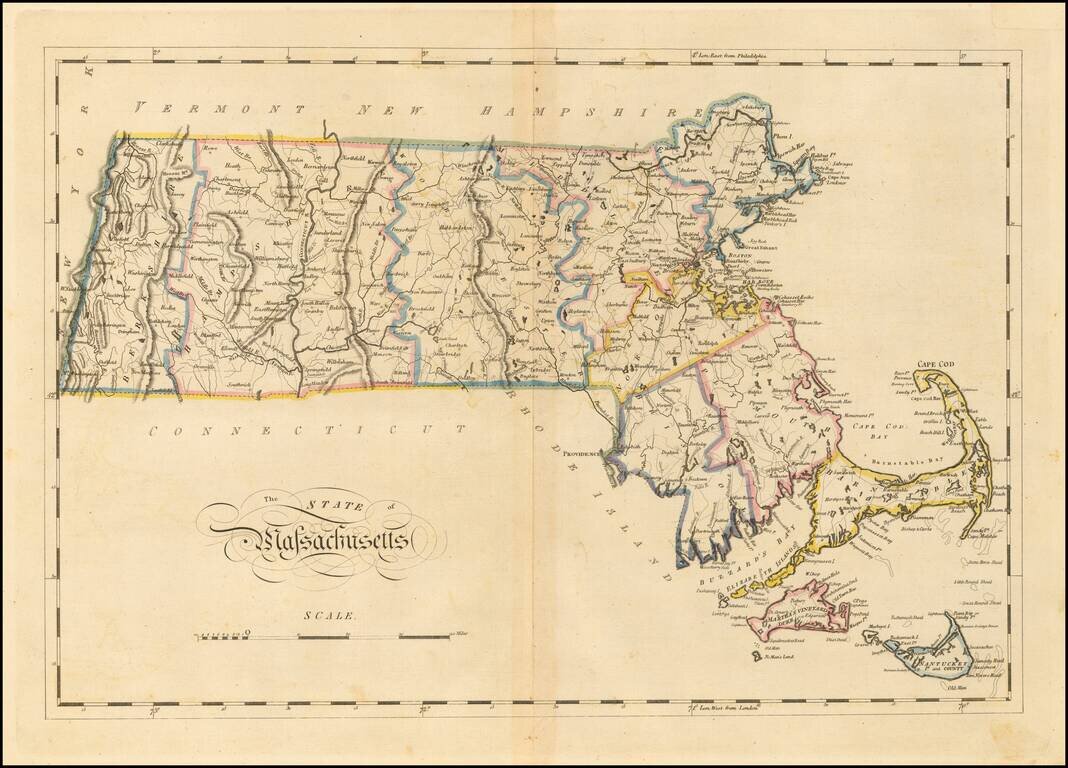
Matthew Carey's double-page engraved map of Massachusetts, from Carey's General Atlas. The map is hand colored by counties and shows towns, rivers, lakes, mountains, roads, islands, bays, shoals, and a host of other details. Carey published the first...
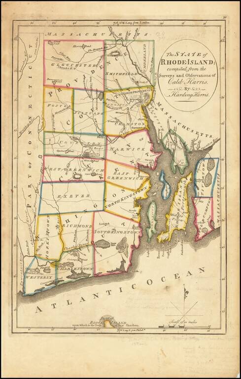
Important early map of Rhode Island, from Carey's American Atlas, one of the earliest separate maps of Rhode Island printed in the US. Includes towns, travel routes, topographical detail and waterways shown. Carey published his American Atlas in 1795,...
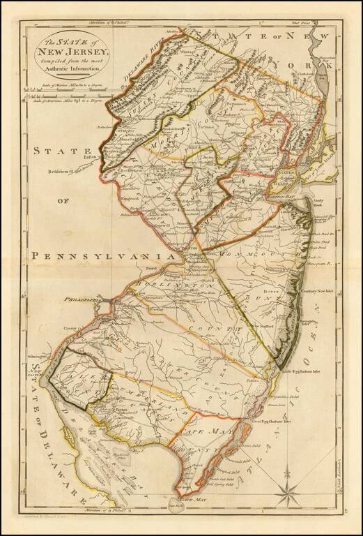
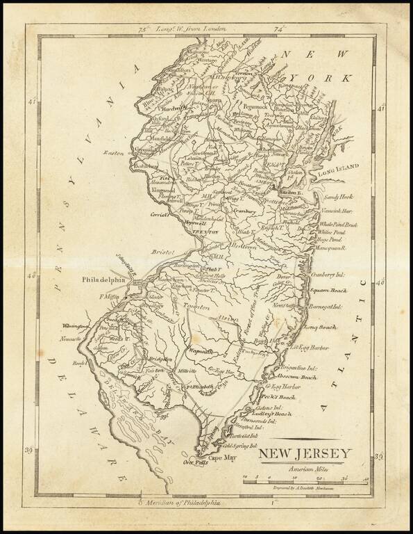
Fine Early Map of the State of New Jersey Nice example of Mathew Carey's map of New Jersey, first published in Carey's General Atlas in 1814. The map is exceptionally detailed for the period, being one of the earliest maps to show in detail the road...
Nice example of Mathew Carey's map of New Jersey. A highly detailed map, which includes towns, roads, rivers, mountains, and many other details.
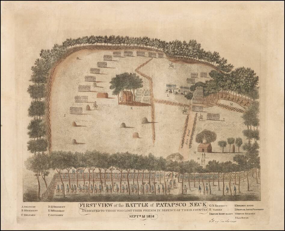
Previously Unrecorded First State of the Battle of North Point, Maryland -- A Contemporary American view of the Battle of North Point, which saved Baltimore from British invasion A contemporary view, by an American participant, of the September 1814...
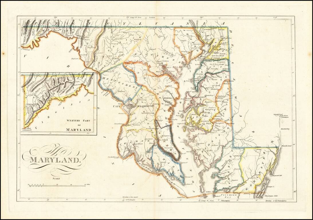
Antique Map of Maryland from the Early 19th Century Nice example of Carey's map of Maryland, one of the best large format maps of the state to appear in a Commercial Atlas. The map is attractively hand-colored by counties and shows, towns, roads,...
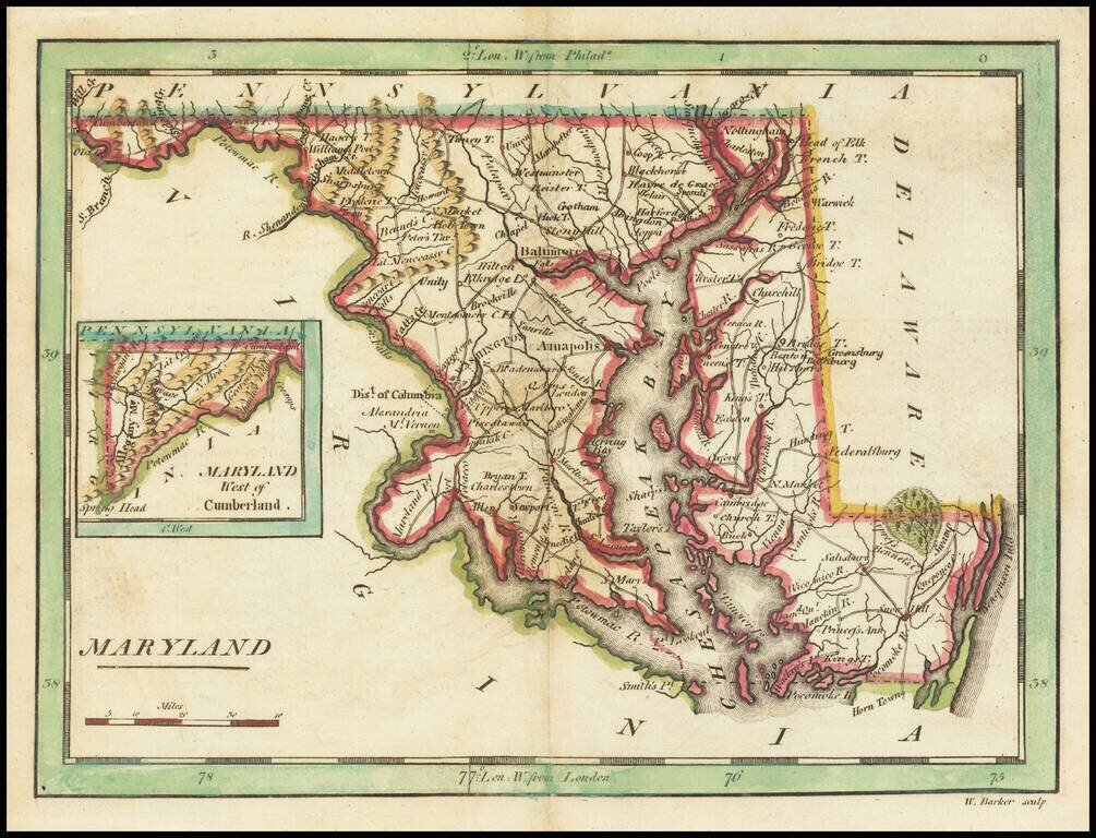
Nice example of Carey's map of Maryland. A highly detailed map, which includes towns, roads, rivers, mountains, and many other details.
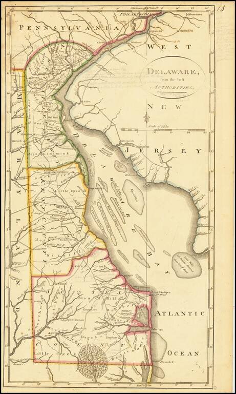
Including Extensive Early Pencil Annotations Annotated example of Matthew Carey's map of the State of Delaware, from the scarce 1816 edition of Carey's General Atlas. The map shows counties, early roads, towns and other details. One of the earliest...
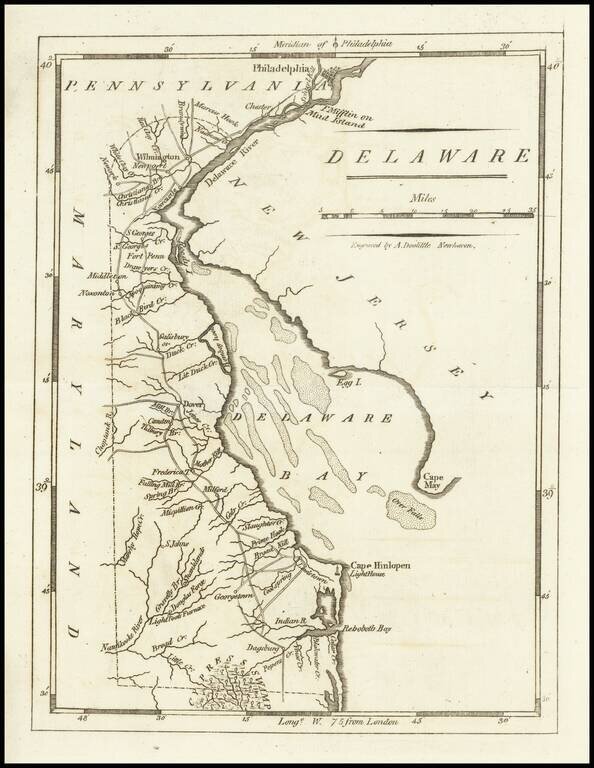
Nice example of Matthew Carey's early map of Delaware. A highly detailed map, which includes towns, roads, rivers and many other details.
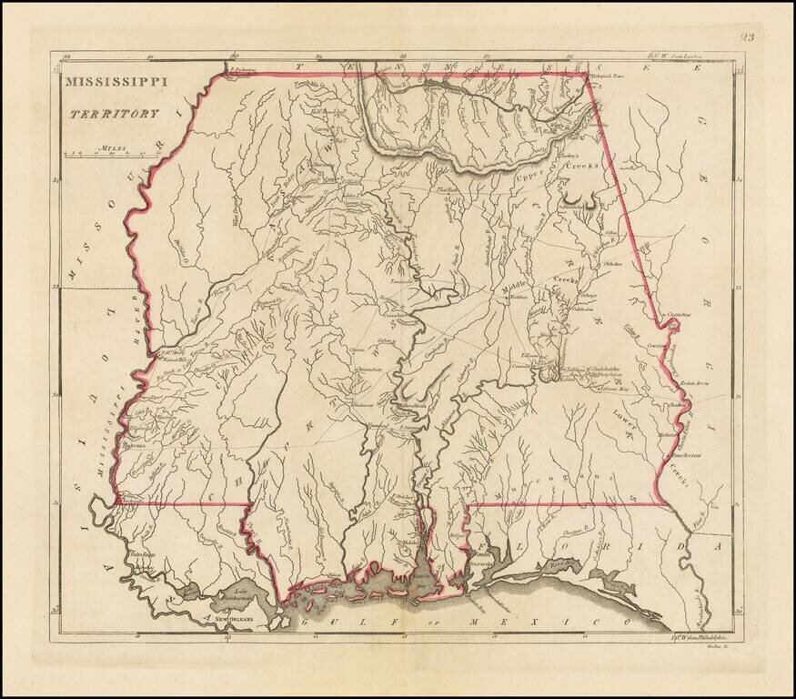
The earliest obtainable large map of Mississippi Territory Fine example of this important early map of Mississippi Territory, from the 1814 edition of Matthew Carey's General Atlas. The map pre-dates the creation of Alabama Territory, extending from...
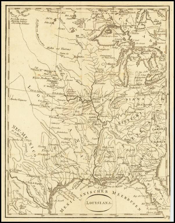
An Early Louisiana Purchase Map Extremely rare little map centered on the Mississippi, apparently based upon the map used to illustrate Berquin-Duvallon's Vue de la Colonie Espagnole du Mississippi, ou des Provinces de Louisiane et Floride...