logo

1814. Kentucky

  • Kentucky

Map size in jpg-format: 4.76761MiB

Download "Kentucky", in high resolution.

Kentucky information:

Year of creation: 
Resolution size (pixels): 
 4960x3768 px
Disk Size: 
 4.76761MiB
Number of pages: 
 1
Place: 
 Philadelphia
Author: 

Print information. Print size (Width x height in inches):
Printing at 72 dpi 
  68.89 х 52.33
Printing at 150 dpi 
 33.07 х 25.12
Printing at 300 dpi 
 16.53 х 12.56

An example of detailing the file of this map of in a printable high-resolution:

Click to open in high resolution (open in new tab).
Attention! this is just the central piece (central area 960x960 px) of the map file!
This is an example, so that you can see and study the level of detail of a given map. The entire Map will be fully available after payment!

Kentucky

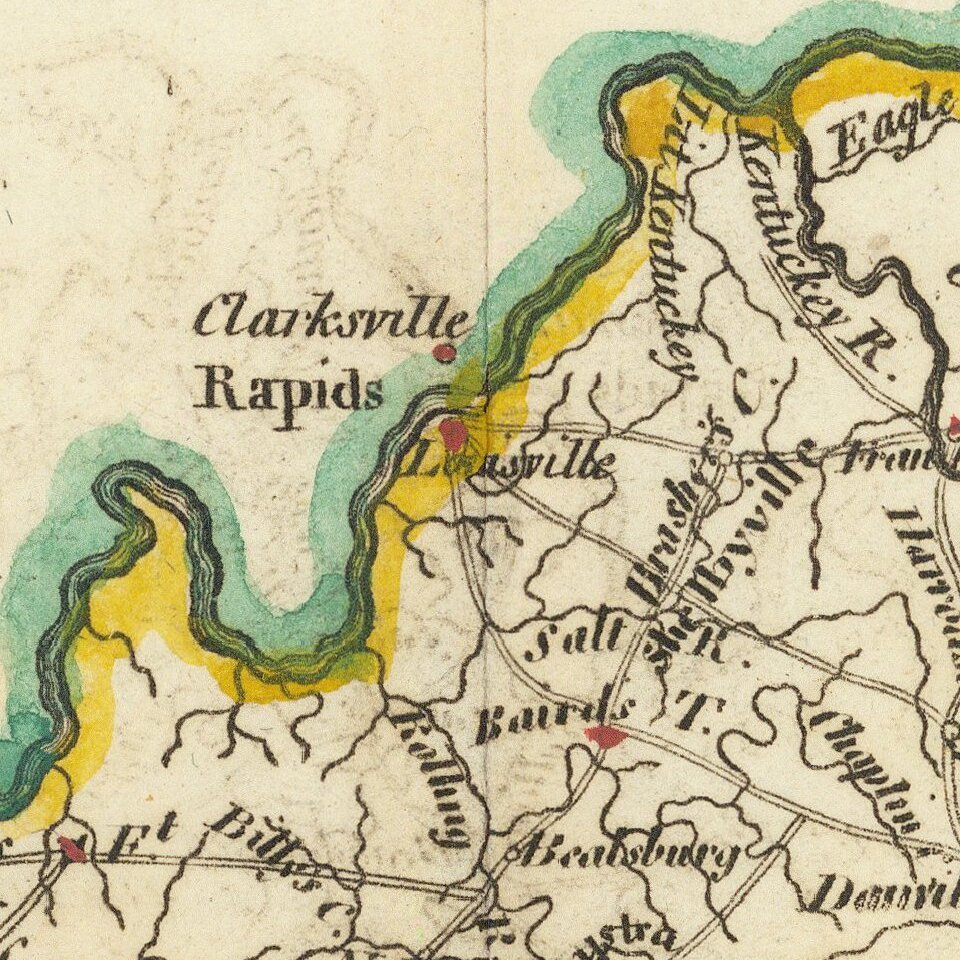
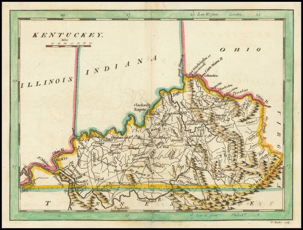
Scarce early map of Kentucky, published by Mathew Carey.

This later 1814 edition references Ohio, Illinois and Indiana above. The prior state showed only the "Northwestern Territory.


Special conditions for students!

If you are a student, write to us in telegram: @antiquemaps and indicate what material you need and for what work you need a map in high detail. We are ready to provide material on special terms. For students only!

Item information:

Year of creation:
Size:
4960x3768 px
Disk:
4.76761MiB
Number of pages:
1
Place:
Philadelphia
Author:
Mathew Carey.
$14.99

Related item