Map size in jpg-format: 732581B
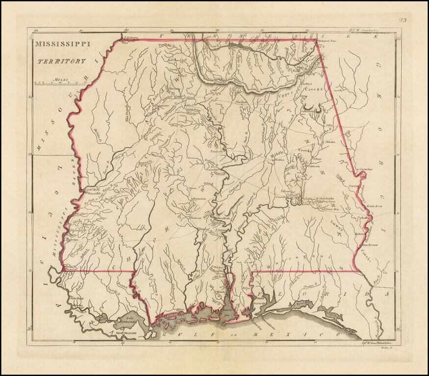
The earliest obtainable large map of Mississippi Territory
Fine example of this important early map of Mississippi Territory, from the 1814 edition of Matthew Carey's General Atlas.
The map pre-dates the creation of Alabama Territory, extending from Georgia to the Mississippi River. Includes a number of early roads, towns, rivers, Indian tribes, settlements, etc. A number of early forts also appear, including Fort McHenry, Fort Stevens, Fort Pickering, etc. Many early Indian villages also named.
Full color examples of this map are very rare on the market.
If you are a student, write to us in telegram: @antiquemaps and indicate what material you need and for what work you need a map in high detail. We are ready to provide material on special terms. For students only!


