logo

1814. A Map of the World from the best Authorities

  • A Map of the World from the best Authorities

A Map of the World from the best Authorities information:

Year of creation: 
Resolution size (pixels): 
 7455x4364 px
Disk Size: 
 7.03248MiB
Number of pages: 
 1
Place: 
 Philadelphia

Print information. Print size (Width x height in inches):
Printing at 72 dpi 
  103.54 х 60.61
Printing at 150 dpi 
 49.7 х 29.09
Printing at 300 dpi 
 24.85 х 14.55

An example of detailing the file of this map of in a printable high-resolution:

Click to open in high resolution (open in new tab).
Attention! this is just the central piece (central area 960x960 px) of the map file!
This is an example, so that you can see and study the level of detail of a given map. The entire Map will be fully available after payment!

A Map of the World from the best Authorities

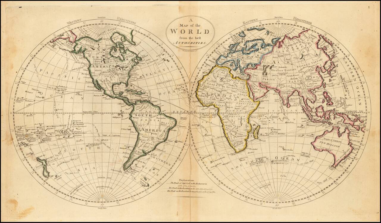
Decorative double hemisphere map of the World, which appeared in Carey's General Atlas.

The map shows some of the tracks of Captain James Cook in the Antarctic Regions and an interesting Northwest Coast of America, New Zealand and Australia.


Special conditions for students!

If you are a student, write to us in telegram: @antiquemaps and indicate what material you need and for what work you need a map in high detail. We are ready to provide material on special terms. For students only!

Item information:

Year of creation:
Size:
7455x4364 px
Disk:
7.03248MiB
Number of pages:
1
Place:
Philadelphia
Author:
John Vallance. James Thackara.
$14.99

Related item