Map size in jpg-format: 42.4104MiB
Click to open in high resolution (open in new tab).
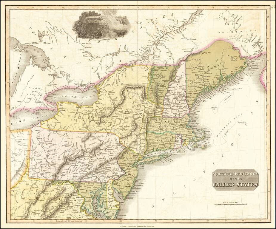
Interesting map of the Northeastern part of the United States, bounded by New England, New York, Pennsylvania, Virginia, Delaware, Maryland, New Jersey, etc.
Indiana appears in northern Virginia. Connecticut reserve appears on the Cuyahoga River. The shapes of Vermont and Rhode Island are very odd.
A number of forts are shown south of Lake Erie and Lake Ontario. The "Township of the Six Nations" is shown north of Lake Erie. A distorted District of Main is shown, with little exploration into its northern interior.
Decorative vignette of Niagara Falls. A marvelous early map.
John Thomson (1777-ca. 1840) was a commercial map publisher active in Edinburgh. He specialized in guide books and atlases and is primarily known for his Atlas of Scotland (1832) and the New General Atlas, first published in 1817 and reissued for the next quarter century. The New General Atlas was a commercial success—it was also published in Dublin and London—and it compiled existing geographic knowledge in compelling ways for a wide audience.
His Atlas of Scotland introduced new geographic information and was the first large-scale atlas of Scotland to be organized by county. It provided the most-accurate view of Scotland available before the Clearances. Work on the atlas began in 1820 and led to Thomson’s bankruptcy in 1830 due to the high costs of gathering the latest surveys and reviewing the required materials. Despite the publication of the atlas, Thomson declared bankruptcy again in 1835.
If you are a student, write to us in telegram: @antiquemaps and indicate what material you need and for what work you need a map in high detail. We are ready to provide material on special terms. For students only!
![[The First Maps in a la poupée Printed Color] Cartes en Couleur des Lieux Sujets aux tremblements de Terre Dans toutes les parties du Monde Selon le Sisteme de l’impulsion Solaire](/map/small/52293op.jpg)

