Map size in jpg-format: 15.0798MiB
Click to open in high resolution (open in new tab).
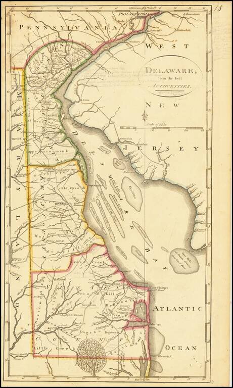
Including Extensive Early Pencil Annotations
Annotated example of Matthew Carey's map of the State of Delaware, from the scarce 1816 edition of Carey's General Atlas.
The map shows counties, early roads, towns and other details.
One of the earliest obtainable maps of the State of Delaware.
If you are a student, write to us in telegram: @antiquemaps and indicate what material you need and for what work you need a map in high detail. We are ready to provide material on special terms. For students only!


![A New Map of Virginia [and the Chesapeake]](/map/small/48950.jpg)