Map size in jpg-format: 15.8334MiB
Click to open in high resolution (open in new tab).
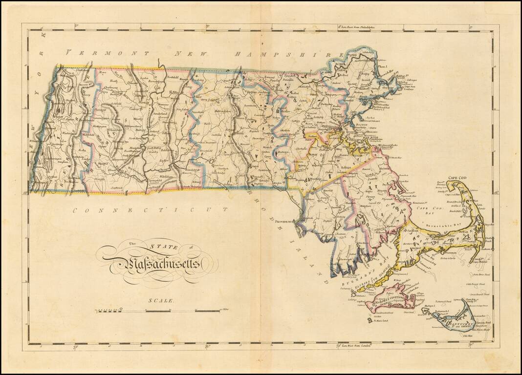
Matthew Carey's double-page engraved map of Massachusetts, from Carey's General Atlas.
The map is hand colored by counties and shows towns, rivers, lakes, mountains, roads, islands, bays, shoals, and a host of other details.
Carey published the first American atlas to be published in the United States, compiling a number of excellent maps from indigenous sources in the first compilation of American maps. It is one of the best maps of Massachusetts to appear in a commercial atlas in the first half of the century.
If you are a student, write to us in telegram: @antiquemaps and indicate what material you need and for what work you need a map in high detail. We are ready to provide material on special terms. For students only!