Map size in jpg-format: 39.3591MiB
Click to open in high resolution (open in new tab).
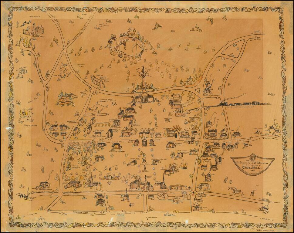
Impressive manuscript pictorial map of the University of North Carolina at Chapel Hill, drawn by Mary C. Dirnberger in 1933.
The view is oriented with south at the top, at the bottom of the map it is bounded by Rosemary Street, at the top (south) of the map it extends as far as the old Tarheels football stadium. Fraternity Court and the Greek houses are labeled. Most of the landmark buildings that existed on campus at the time are rendered pictorially and labeled.
Dirnberger evidently had a method for producing multiple hand-drawn copies of the same map, probably by tracing them from a master copy. The University of North Carolina has another example of this 1933 manuscript; that example can be seen here: dc.lib.unc.edu/cdm/ref/collection/ncmaps/id/3440
This view was produced during the Golden Age of Pictorial Mapmaking. This era applied particularly to maps of American college campuses, for which there was a great outpouring of creative effort to document the rapidly expanding higher education system.
If you are a student, write to us in telegram: @antiquemaps and indicate what material you need and for what work you need a map in high detail. We are ready to provide material on special terms. For students only!
![The United States of North America with the British Territories And Those of Spain, according to the Treaty of 1784 . . . 1793 [shows Franklinia!]](/map/small/64978.jpg)

