Map size in jpg-format: 9104680B
Click to open in high resolution (open in new tab).
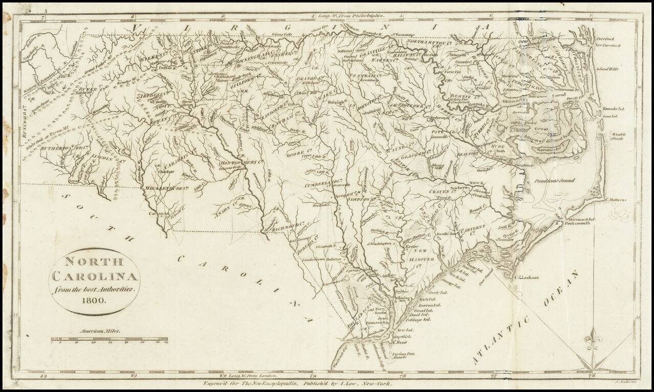
One of the earliest obtainable maps of the state of North Carolina.
Shows counties, towns, roads, rivers, lakes, islands, swamps, court houses, and other early details. This map appeared in Volume IV of John Payne's New and Complete Universal Geography… published in New York by John Low at the Shakespeare Head, No. 332 Water-Street, in 1799. One of the curious elements of the map is that it is dated 1800 on the map, although Payne's title page bears the date 1799, suggesting that Payne was anxious to have his maps appear to be as modern as possible.
If you are a student, write to us in telegram: @antiquemaps and indicate what material you need and for what work you need a map in high detail. We are ready to provide material on special terms. For students only!
![The United States of North America with the British Territories And Those of Spain, according to the Treaty of 1784 . . . 1793 [shows Franklinia!]](/map/small/64978.jpg)

