Map size in jpg-format: 21.2435MiB
Click to open in high resolution (open in new tab).
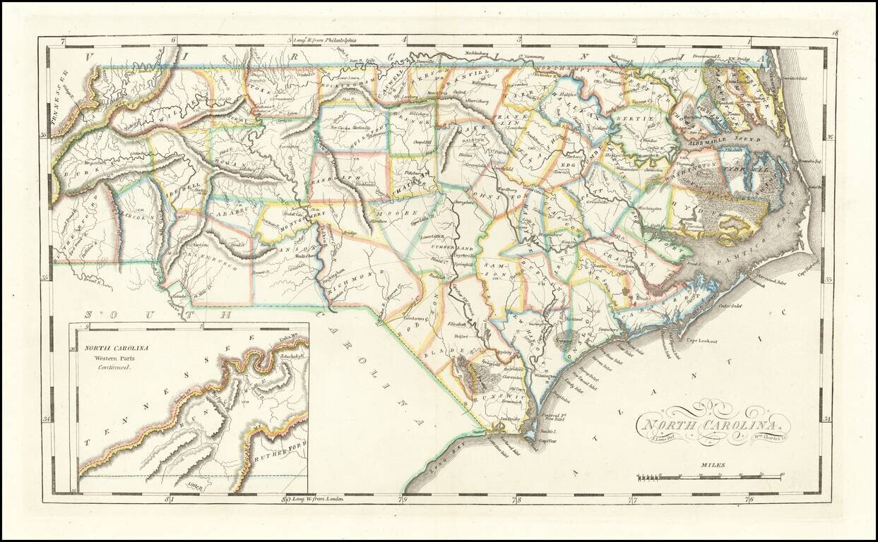
Rare Final State From 1818
Striking example of the edition of Mathew Carey's map of North Carolina, one of the earliest large format maps of the State after independence.
Includes the topography of North Carolina, as well as roads, towns, rivers, lakes, and a host of other details.
The map shows the growth of the State in the early 19th Century. Meticulous details shown to the inclusion of the growing road system in the State Court houses, in each county, are noted, as are the major towns.
This is the second state of the map, described by Jay Lester in his January 14, 2015 essay posted on the North Carolina Map Blog -- http://blog.ncmaps.org/index.php/unrecorded-map-of-north-carolina/
The differences are as follows:
The final state, issued in 1818, is quite rare on the market.
If you are a student, write to us in telegram: @antiquemaps and indicate what material you need and for what work you need a map in high detail. We are ready to provide material on special terms. For students only!
![The United States of North America with the British Territories And Those of Spain, according to the Treaty of 1784 . . . 1793 [shows Franklinia!]](/map/small/64978.jpg)

