Map size in jpg-format: 19.9301MiB
Click to open in high resolution (open in new tab).
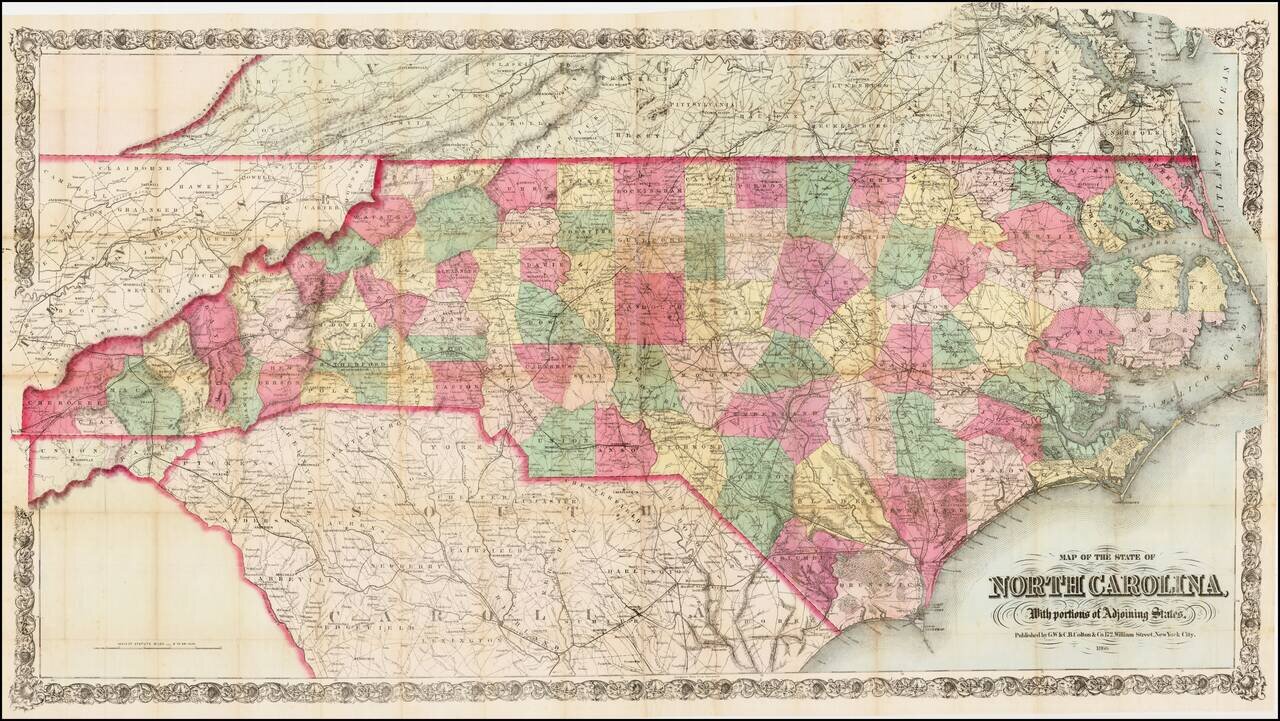
First edition of this scarce large format map of North Carolina, colored by counties, published by GW & CB Colton in New York, on a scale of 6 inches = 50 miles.
Colton's map of North Carolina is one of the most detailed and largest commercial published maps of North Carolina during the period following the Civil War.
Shows counties, cities and towns, principal roads, plank roads, railroads, and natural features plus points of economic interest, such as mines, fisheries, stores, and mills.
One of the largest and most detailed maps of North Carolina published in the middle of the 19th Century.
G. W. & C. B. Colton was a prominent family firm of mapmakers who were leaders in the American map trade in the nineteenth century. The business was founded by Joseph Hutchins Colton (1800-1893) who bought copyrights to existing maps and oversaw their production. By the 1850s, their output had expanded to include original maps, guidebooks, atlases, and railroad maps. Joseph was succeeded by his sons, George Woolworth (1827-1901) and Charles B. Colton (1831-1916). The firm was renamed G. W. & C. B. Colton as a result. George is thought responsible for their best-known work, the General Atlas, originally published under that title in 1857. In 1898, the brothers merged their business and the firm became Colton, Ohman, & Co., which operated until 1901, when August R. Ohman took on the business alone and dropped the Colton name.
If you are a student, write to us in telegram: @antiquemaps and indicate what material you need and for what work you need a map in high detail. We are ready to provide material on special terms. For students only!
![The United States of North America with the British Territories And Those of Spain, according to the Treaty of 1784 . . . 1793 [shows Franklinia!]](/map/small/64978.jpg)

