Map size in jpg-format: 11.6122MiB
Click to open in high resolution (open in new tab).
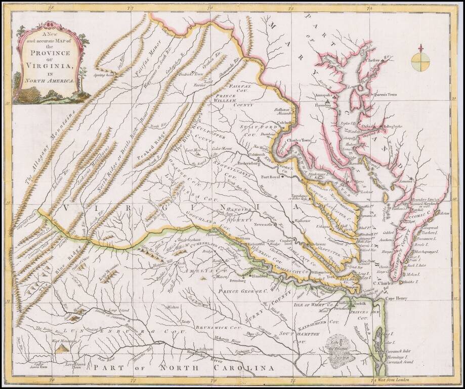
Scarce map of Virginia based largely on the Fry Jefferson map, as revised in 1775.
The map is one of the first large format maps of Virginia to have appeared in a British serial publication ( Universal Magazine). It provides an excellent depiction of Virginia at the mid-point in the American Revolution.
Shows towns, counties, rivers, lakes, mountains, etc.
If you are a student, write to us in telegram: @antiquemaps and indicate what material you need and for what work you need a map in high detail. We are ready to provide material on special terms. For students only!


![[The First Maps in a la poupée Printed Color] Cartes en Couleur des Lieux Sujets aux tremblements de Terre Dans toutes les parties du Monde Selon le Sisteme de l’impulsion Solaire](/map/small/52293op.jpg)