
Detailed map of the Caribbean and Southeastern US, extending to Texas, Mexico, Central America and South America. Numerous annotations throughout.
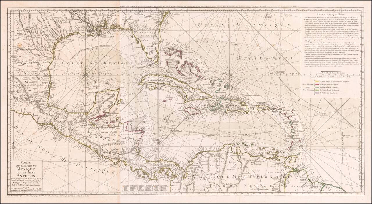
Striking, Intricate Map of the Caribbean Region Scarce and highly-detailed map of the Gulf Coast, Florida, Central America and the Caribbean from J.A. Dezauche, successor to Philippe Buache and Guillaume De L'Isle. The map is incredibly detailed, not...
Antique Map of the Southeast United States During The American Revolution. Scarce Revolutionary War period map of the Southeastern part of the British Colonies in North America, Gulf Coast and Caribbean, illustrating the course of the Spanish Galleon...
John Cary's First Printed Map Nice example of John Cary's map of the Southeastern United States, Florida and the Caribbean, published on August 1, 1783. Published in August, 1783, the map was issued one month prior to the signing of the Treaty of...
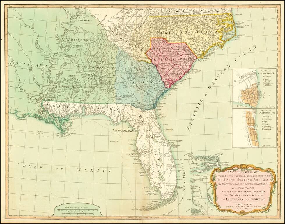
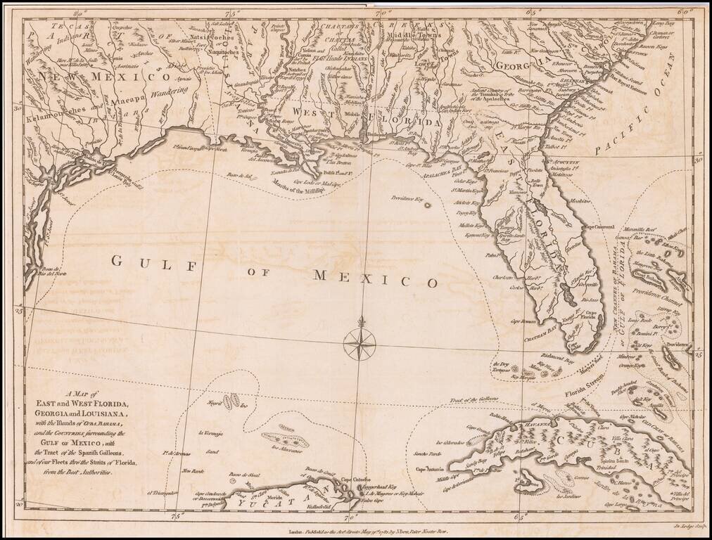
A Fine 18th Century Map of the Southern United States & Florida with Early Plans of Charleston and St. Augustine Laurie & Whittle's edition of this scarce map of the Southern States and Florida, originally compiled by Bernard Romans for the...
The foundational Spanish sea chart of the Gulf Coast, Florida, Texas, etc. -- One of the six most important maps of Texas (Streeter). This is the first large-scale printed chart of the Texas coast based upon actual soundings and explorations. The map...
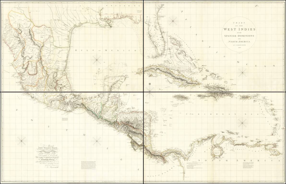
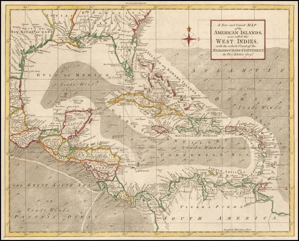
A Seminal Map of Florida, The Caribbean and Texas! First edition of Arrowsmith's map of Mexico & the West Indies, and the only edition to extend to the Pacific, thereby showing modern Texas and parts of New Mexico and Arizona. The map is...
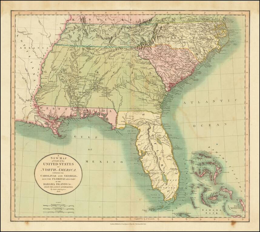
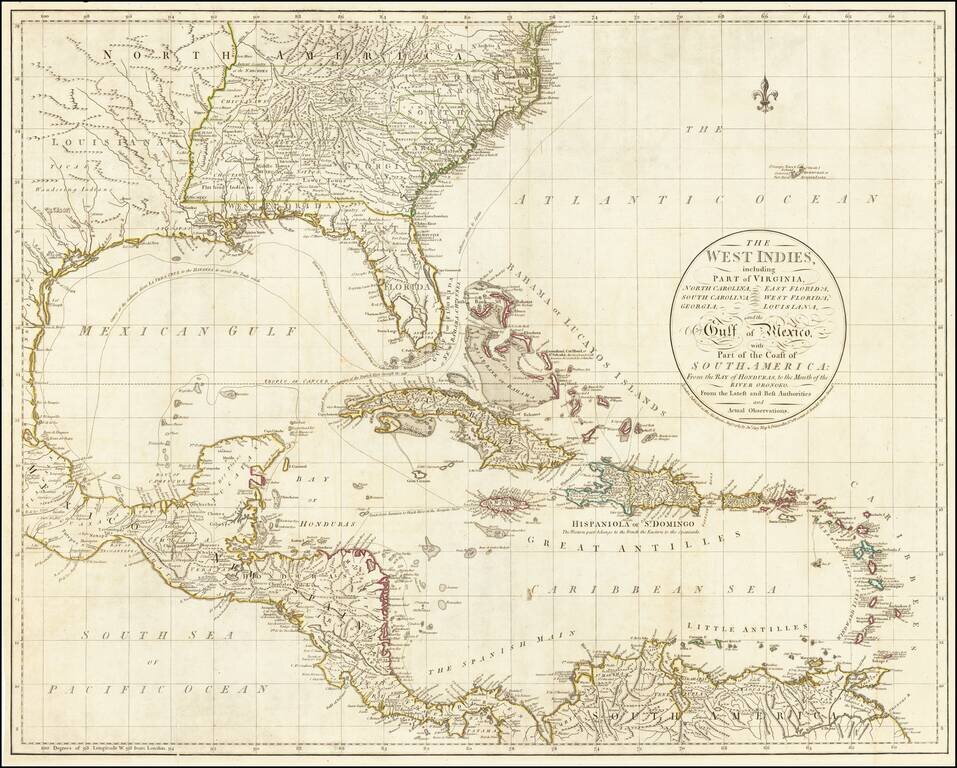
Fine example of the first edition of Cary's map of the Southern United States and Bahama Islands, extending the East Coast to the Mississippi River and from Tennessee and the Carolinas to Florida, the Bahamas and the Gulf Coast. A massive Georgia...
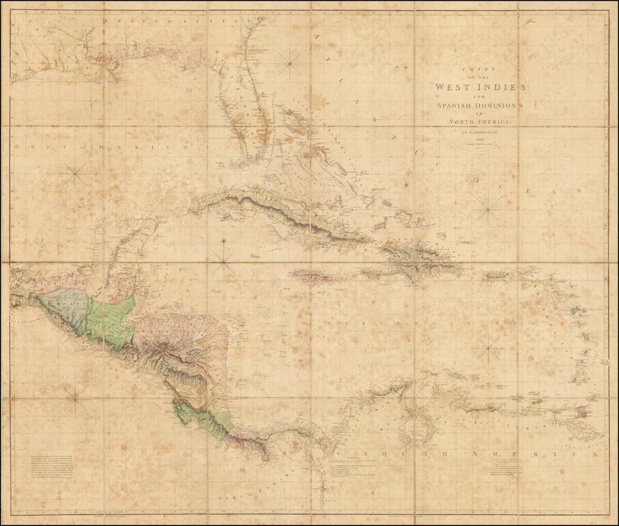
The Best Early 19th-Century Map of Central America and the Caribbean. Large hand-colored engraved antique map of Florida, the Gulf Coast, West Indies, and Central America, published by Aaron Arrowsmith in London in 1810. The map contains a detailed...
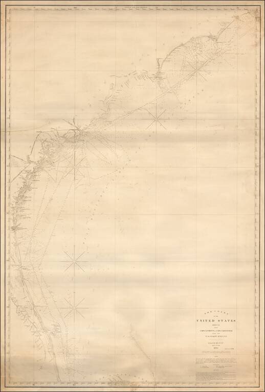
Fine large format sea chart of the coastline from the Outer Banks of North Carolina to central Florida, published by Blunt in New York City, the most famous of American Chart makers of the period. Includes an early pencil annotation near Savannah,...
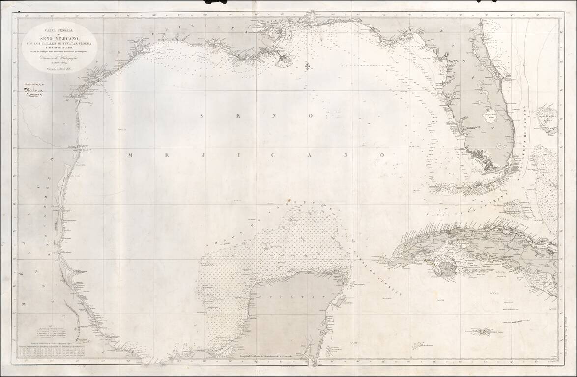
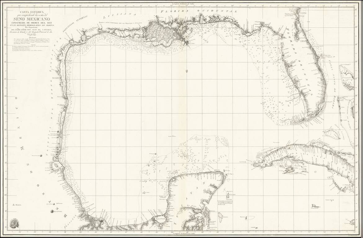
Scarce Spanish Sea Chart of the Gulf of Mexico, from Texas and the Yucatan to Florida and Cuba. Includes notes on the direction of the currents. A note opposite the Florida keys states that "Within these limit the current is directed strongly over...
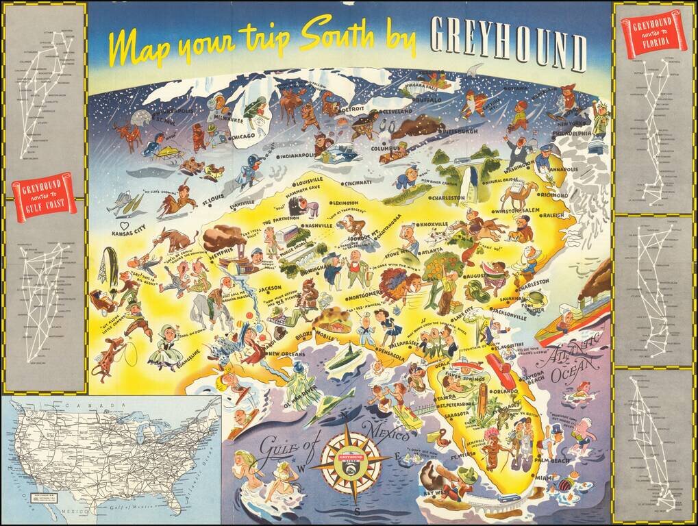
Whimsical map of the American South, promoting Greyhound's routes to Florida and the Gulf Coast in 1938. The image is dominated images of Florida tourist attractions, as well as other southern sites. Further north, the residents of the Midwest,...
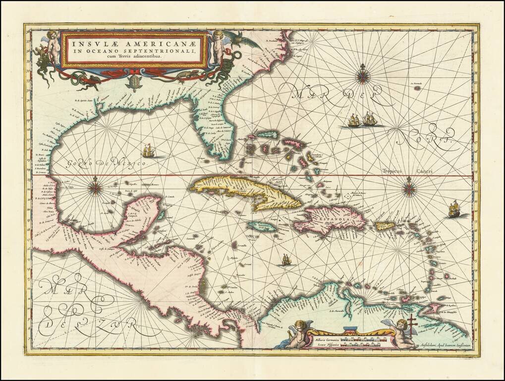
Finely colored example of Jansson's edition of Hessel Gerritsz' rare chart of 1631. The area covered is exactly the same as the original Gerritsz map, except for the addition of the west coat of Central America. The nomenclature in North America is...
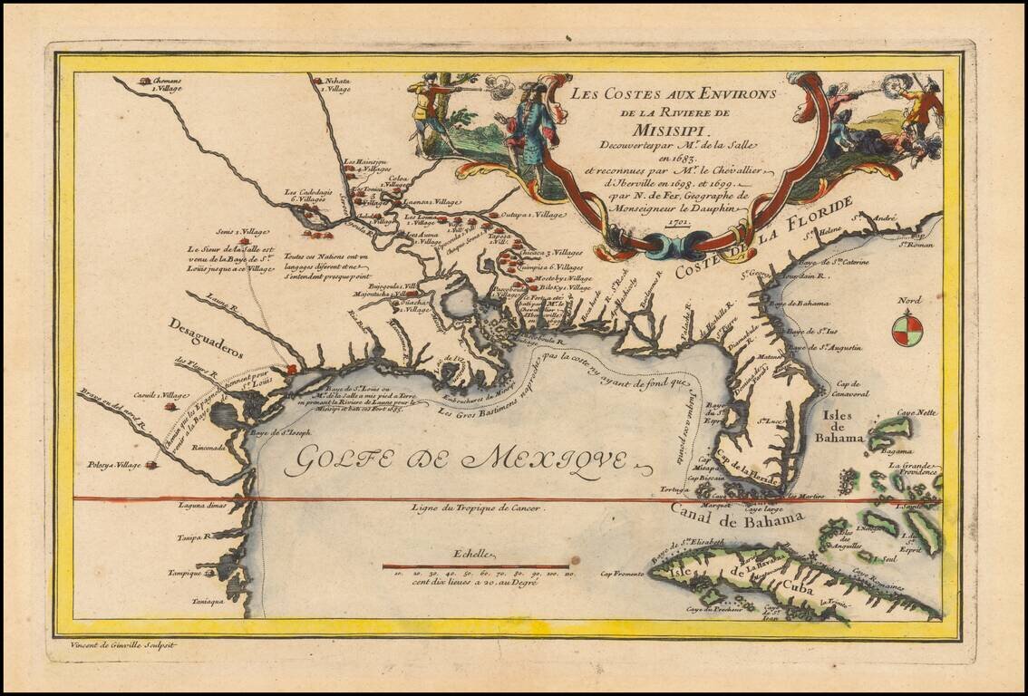
Rare 1701 First Edition Nice example of this historically important and fascinating map of the Gulf Coast and Mississippi River region, from Nicolas De Fer's Atlas Curieux. In preparing this fine map, the leading French cartographer Nicolas De Fer...
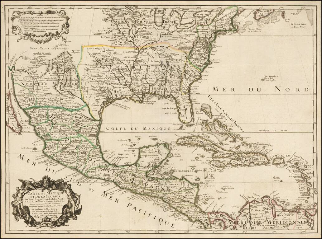
Rare Second State. Fine example of the second state of Guillaume De L'Isle's landmark map, the first printed map to accurately depict the course and mouth of the Mississippi River. De L'Isle's Carte du Mexique . . . is drawn from the reports brought...
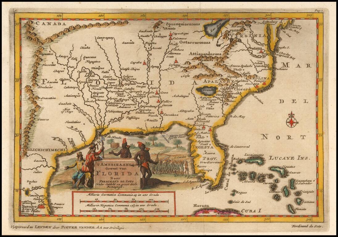
Fascinating map of the Southeastern part of the future United States, based largely upon Sanson's map of Florida from 1657. The map is intended to illustrate the expedition of Ferdinand de Soto in 1534, based upon his original accounts. Fine...