Map size in jpg-format: 13.3023MiB
Click to open in high resolution (open in new tab).
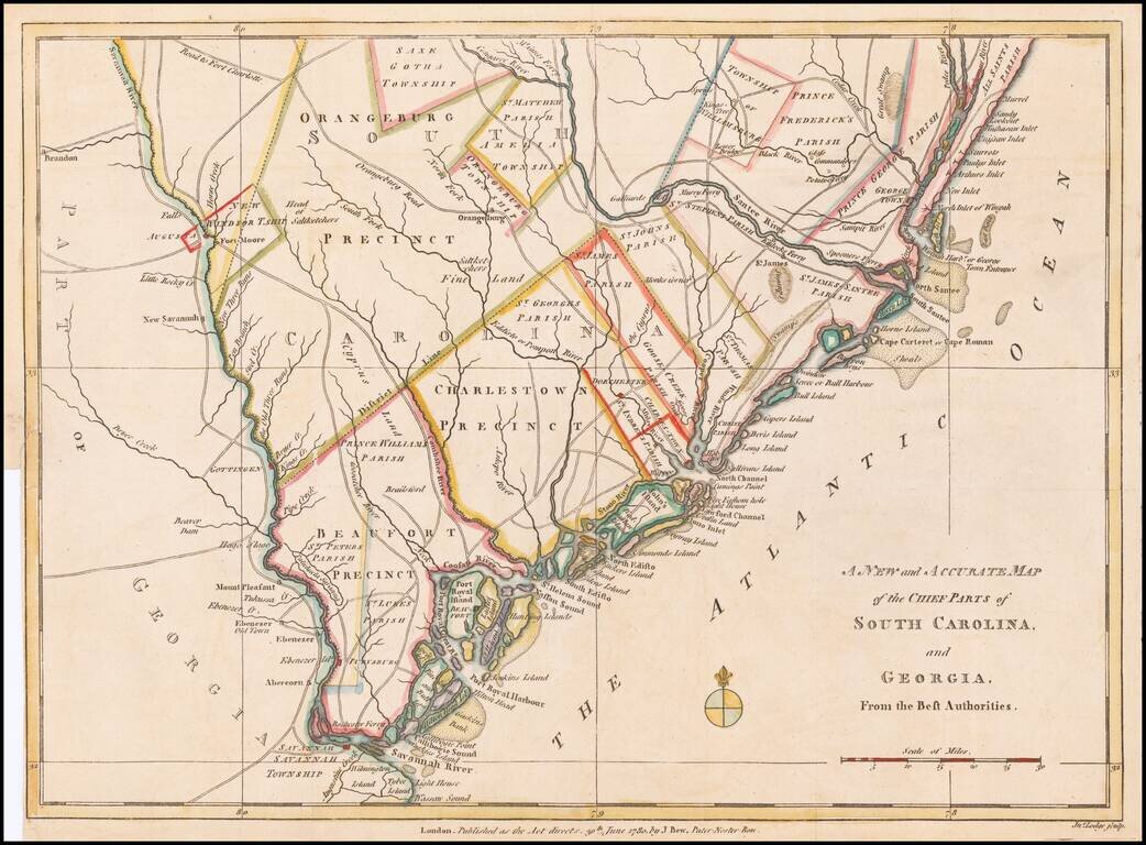
Fine early Revolutionary War map of South Carolina and part of Georgia, engraved by Jonathan Lodge for the Political Magazine of June 1780.
The map shows early southern forts, counties, townships, parishes, precincts, towns, roads, rivers, and many other detailed features. The map illustrates the Theater of War during the American Revolution relevant to the taking of Charlestown with the whole Rebel Army.
The map extends to Savannah and Augusta and includes significant detail during this fascinating period in American history.
If you are a student, write to us in telegram: @antiquemaps and indicate what material you need and for what work you need a map in high detail. We are ready to provide material on special terms. For students only!


![[The First Maps in a la poupée Printed Color] Cartes en Couleur des Lieux Sujets aux tremblements de Terre Dans toutes les parties du Monde Selon le Sisteme de l’impulsion Solaire](/map/small/52293op.jpg)