
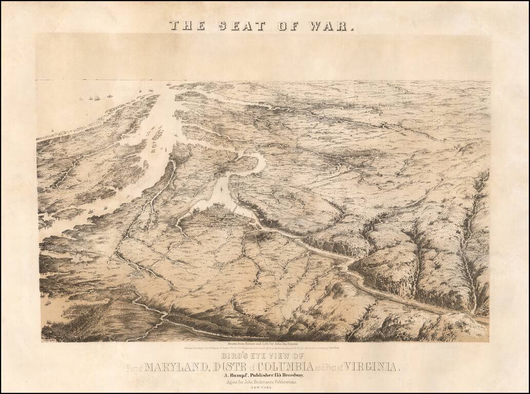
John Bachmann's celebrated series of bird-eye views of the U.S. Civil War, depicting the Virginia-Maryland theatre on the eve of conflict. This magnificent bird's eye view captures the Virginia-Maryland theater of the United States Civil War...
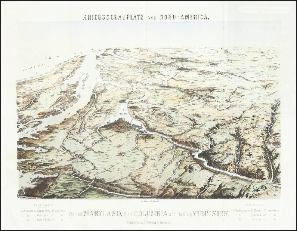
Rare Birdseye View of the Theater of War in the Chesapeake Region Extremely rare birdseye view of the Chesapeake region, centered on Washington DC and the Potomac. The view is very reminiscent of John Bachmann's views of the same region and were...

Fine example of Alexander Bache's map of the Eastern Virginia, published by Philip & Solomons of Washington, D.C. Detailed map of Eastern Virginia and Delaware, engraved by Charles Krebs and compiled by W.L. Nicholson, under the direction of A.D....
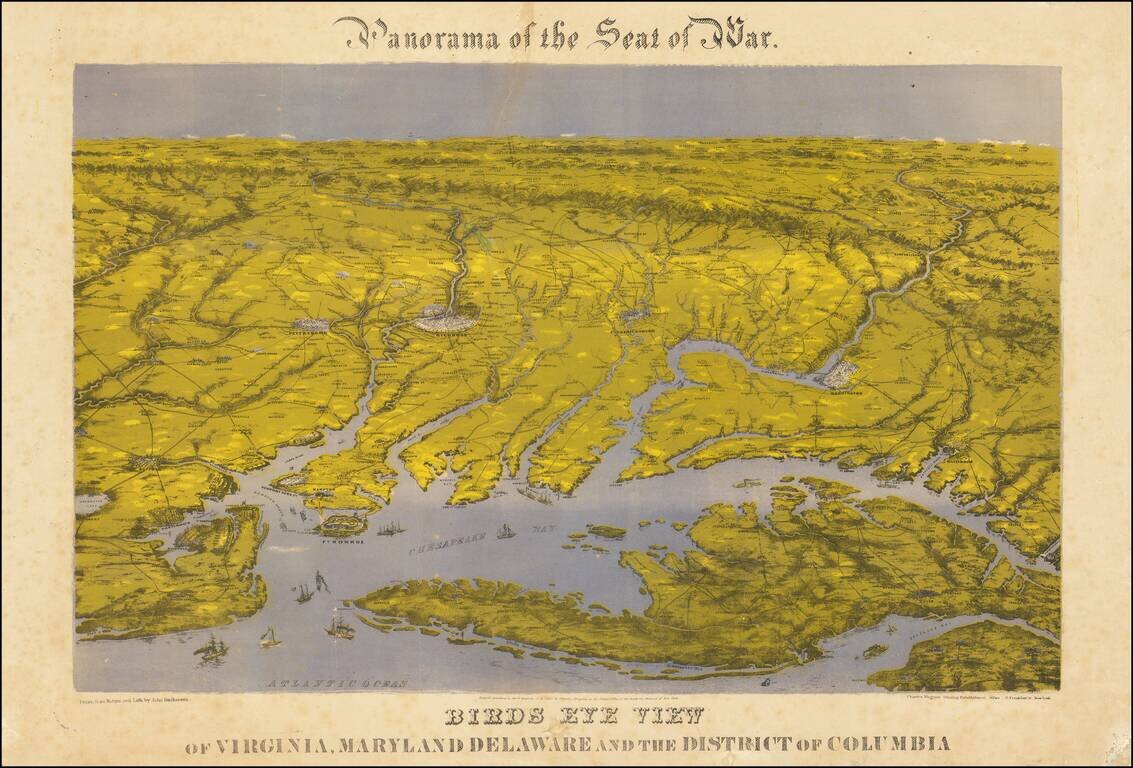
Bachman's Panorama of the Chesapeake Region Striking combination map and view of the northernmost part of the east coast of the Confederacy, and the southernmost areas of the Union, including Washington: this third issue, printed after the smoke that...
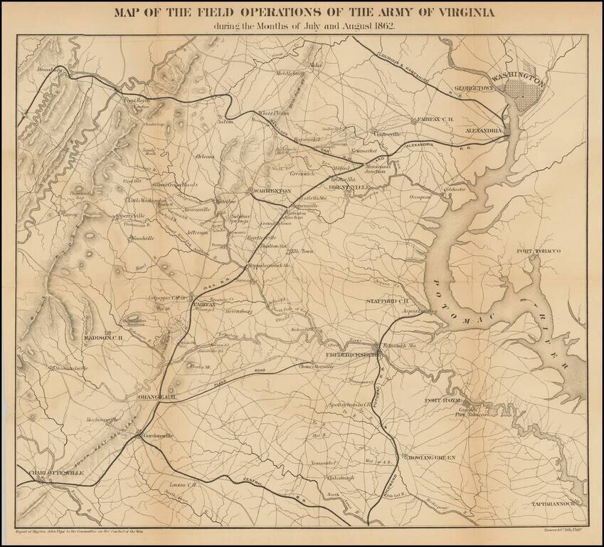
Detailed map of the Theater of War in Virginia. Washington D. C. is at the upper right. Charlottesville, Virginia is at the lower left. Shows roads, railroads, place names and terrain features. General Pope was the new commander of Federal forces in...
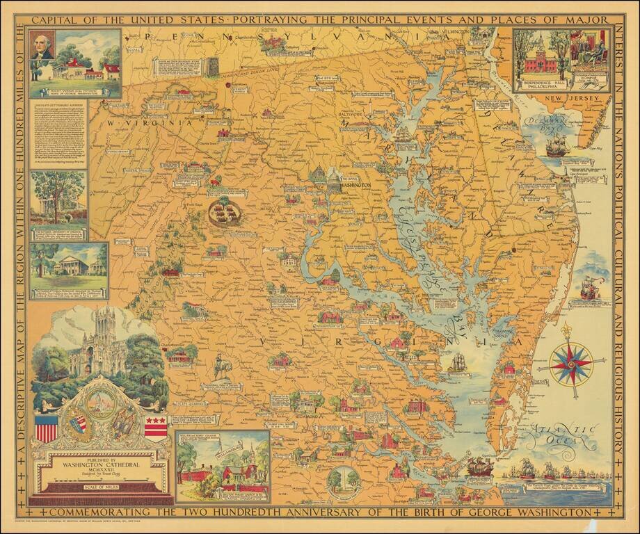
Beautiful color-printed vintage pictorial map of "the region within one hundred miles of the capital of the United States", showing Northern Virginia, Maryland, and Delaware. The title cartouche illustrates Washington Cathedral, the publisher of the...
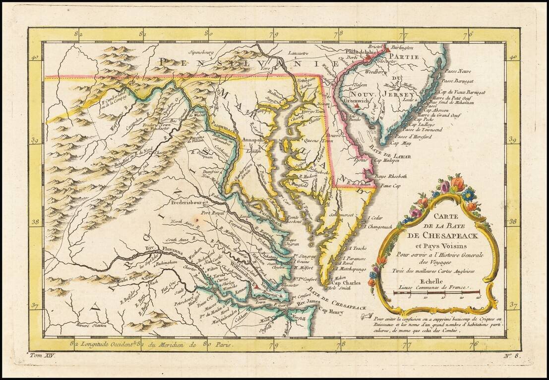
An excellent map of Virginia, Maryland, Delaware, and part of New Jersey. Extends west to the Applachians and shows towns, roads, mountains, rivers, islands, capes, ports and other nice details. A nice French & Indian War map of the Southern...
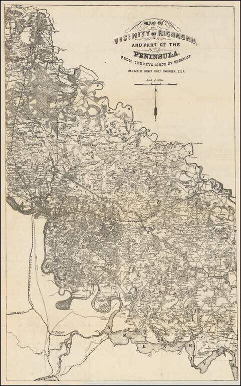
Rare map of the area between the Pamunkey and Ames Rivers, showing the Vicinity of Richmond, Virginia, as surveyed by Jeremy Francis Gilmer, surveyor for the Confederate States of America. The map bears some relationship to Albert H. Campbell's Map of...
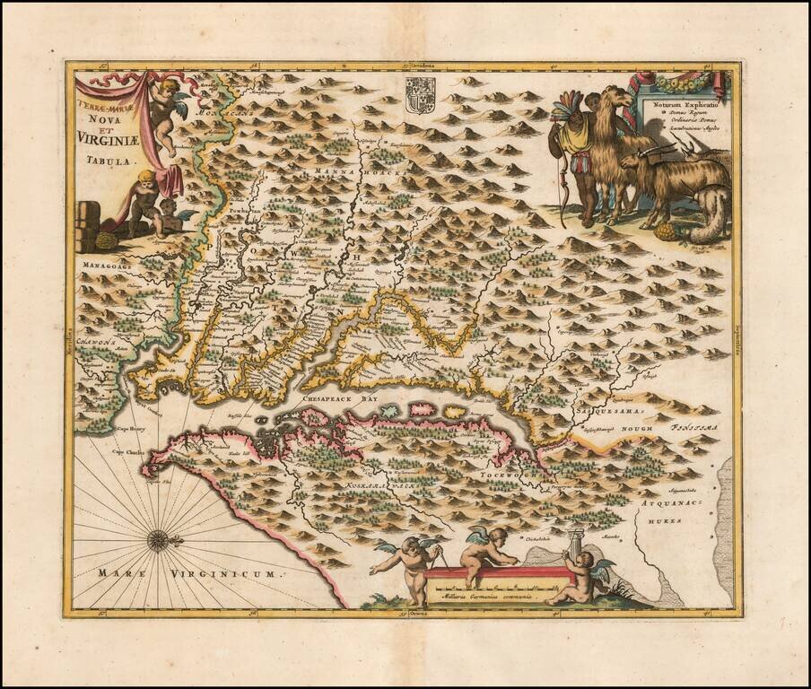
Nice example of Ogilby's edition of Smith's map of the Virginia & Chesapeake region. The map is based upon the earlier maps by Hondius and Blaeu, a bit smaller, but with 3 large cartouches, one of which includes fascinating indigenous animals,...
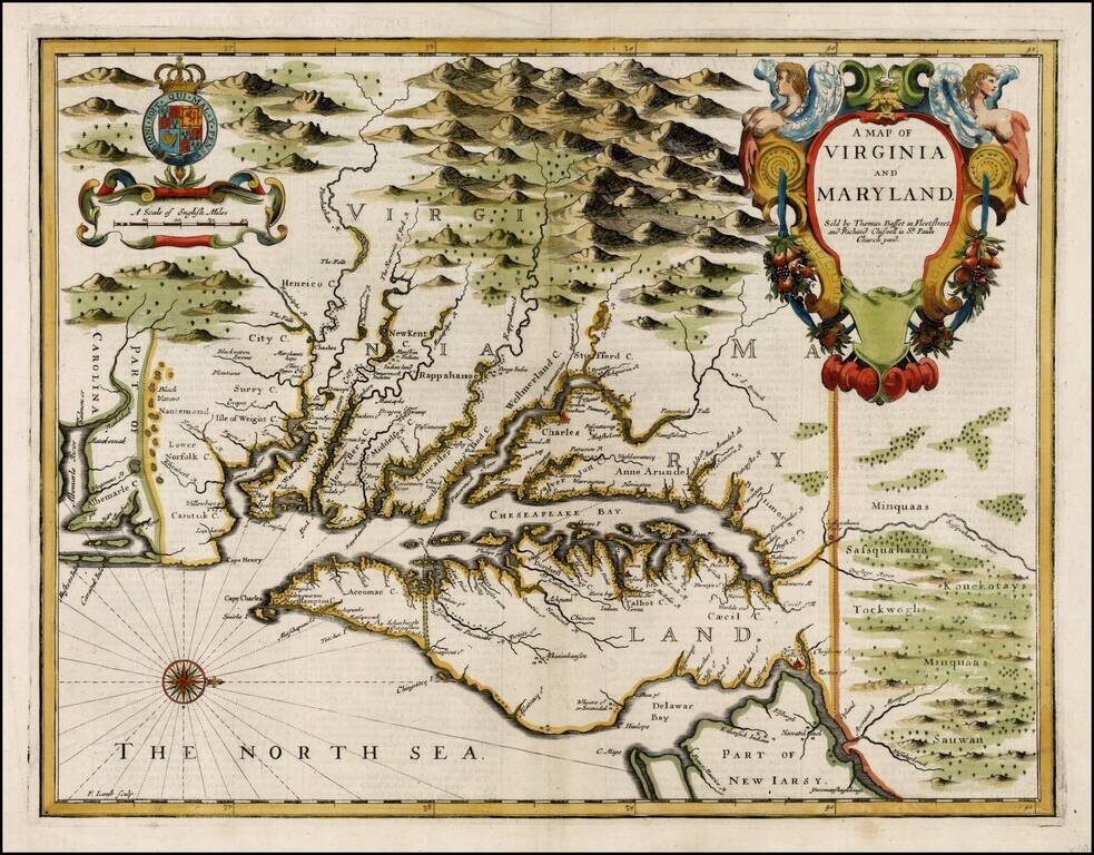
John Speed's Edition of John Smith's Seminal Map of Virginia. Nice example of John Speed's map of Virginia and Maryland, which was engraved by Francis Lamb and first appeared in the enlarged edition of Speed's Atlas in 1676. Speed's map of Virginia...
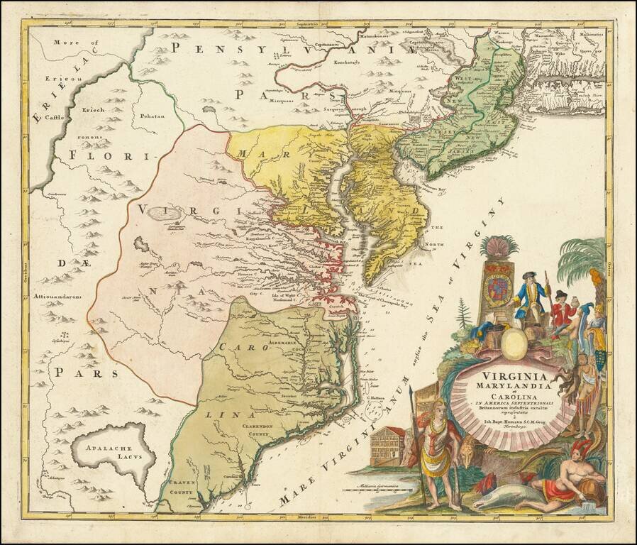
A nice example of JB Homann's map of Virginia, Maryland, New Jersey, North Carolina and South Carolina. Cartouche shows the splendor of the new world and the riches it provides. One of the most decorative maps of the area, intended to promote German...
Scarce map of the Chesapeake region, based upon Augustine Hermann's map of 1673 and Henry Popple's map of 1733. The map includes a number of interesting annotations and place names, including Indian House and Plantations, English Plantations, Black...
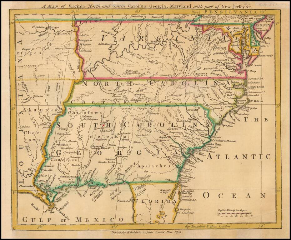
Scarce map of the Southeastern portion of the British Colonies, extending tothe Mississippi River and lower Missouri River, based upon John Mitchell's Map of the British Colonies, also issued in 1755. The map extends to West of the Mississippi River...
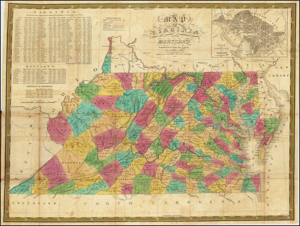
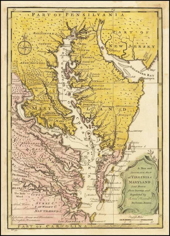
An Early American Map of Virginia & Maryland - Includes White, Free Black & Slave Population Table Second edition of Samuel Augustus Mitchell's separately published map of Virginia and Maryland (with a large inset of Washington DC). The map...
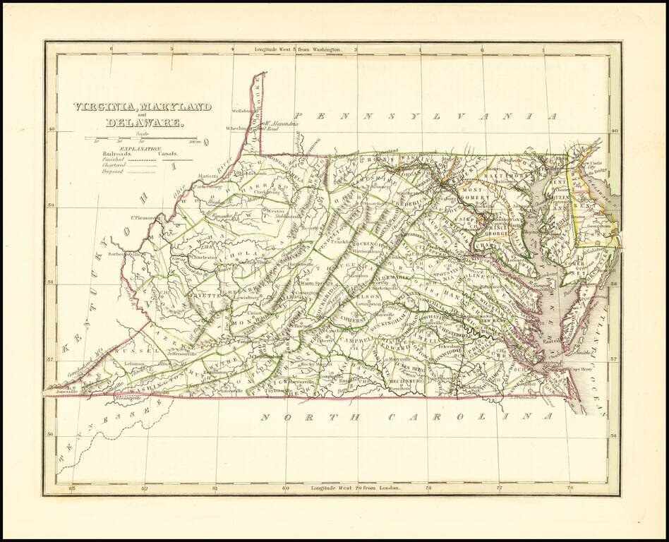
Scarce full original color map of Virginia, Maryland and Delaware from Bradford's Comprehensive Atlas. Shows counties, towns, rivers, and other details. Bradford's Comprehensive Atlas was one of the most successful commercial atlases of the 1830s, at...
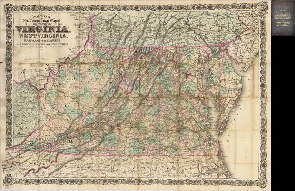
Fine large scale map of Virginia, West Virginia, Maryland and Delaware, published by Colton. This is the second edition of a map originally published in 1866 to supply a detailed representation of the area of the civil war. The geographical data was...