

Fine large map illustrating the route of the Richmond & Louisville Railroad. Exceptionally detailed Railroad map of portions of Virginia, West Virginia, Kentucky and Tennessee, on a scale of 12 miles per inch. Timber and coal regions are noted,...
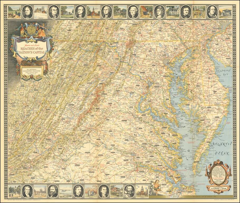
Entertaining map of the the Chesapeake Region, topped with portraits of 8 of the founding fathers and vignettes of important places in American history.
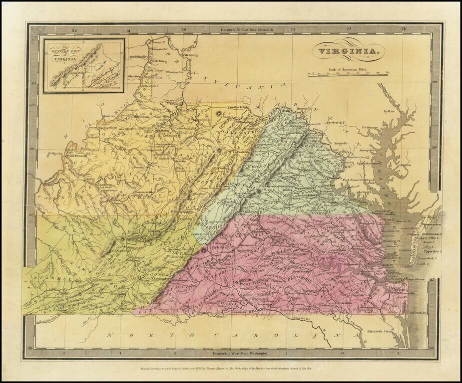
Striking full color map of Virginia, which first appeared in David Burr's Universal Atlas, in 1836. Burr is widely regarded as one of the most important names in American Cartographic history. Burr's Atlas was perhaps the most elegant American...
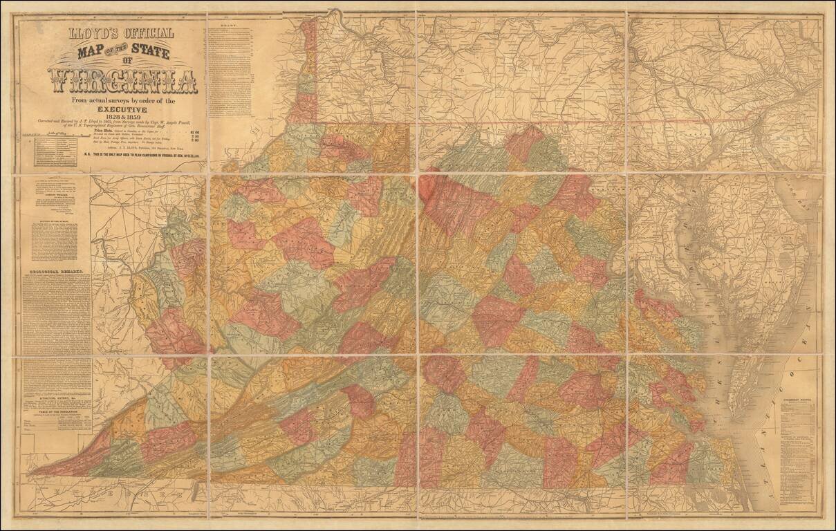
Important Large Map of Virginia With A Vitriolic Testimonial Added Nice example of the 1862 edition of JT Lloyd's large map of Virginia, the most widely distributed and influential map of Virginia during the Civil War period. Lloyd's map of Virginia...
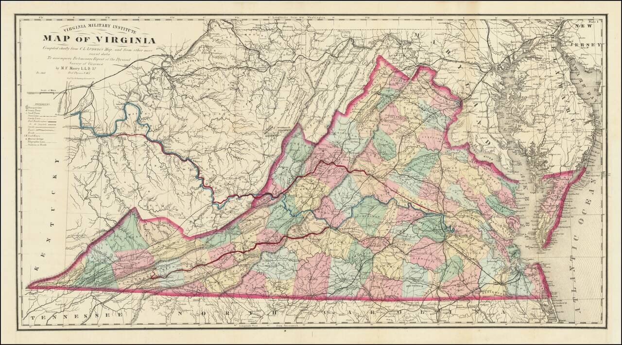
A Mathew Fontaine Maury - VMI - Rarity Nice example of the extremely rare third edition of the so-called Bucholtz-Ludwig map of Virginia. The Bucholtz-Ludwig map was originally based upon work done by Ludwig von Bucholtz, in connection with his...
![La Florida [with] Guastecan [with] Peruviae Auriferae Regionis Typus](/map/small/61587.jpg)
Ortelius’ Map of Florida—The First Separately Printed Map of Florida! An excellent example of Abraham Ortelius’ seminal map of Florida and the North American South, shown within a trio arrangement of maps focused on Central and South America....

Jacques Le Moyne's Landmark Map of Florida & The Southeast, Based On The Expedition of Laudonniere to Florida in 1564 Jacques Le Moyne's map of Florida and the Southeastern portion of the United States is one of the most important 16th Century...

Nice example of the second edition of Herrera's map of Florida and the Caribbean, which first appeared in Herrera's Descripcion de las Indias Ocidentales, first published in Madrid in 1601. In describing the map, Burden notes: Of interest to us on...

The earliest obtainable maps of the Southeastern United States. De Laet's description of America is arguably the finest of the 17th Century. The map was almost certainly engraved by Hessel Gerritsz, based upon the work of Claesz in 1602, and Jacques...
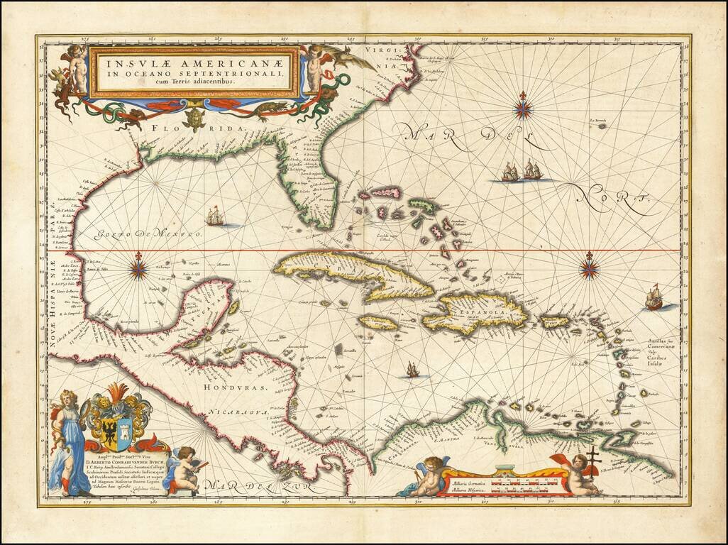
Blaeu's Chart of the Caribbean Nice example of Blaeu's chart of the Caribbean, based on a section of Blaeu's own West Indische Paskaert (ca. 1630) and Hessel Gerritsz' rare chart of 1631. The chart was the most accurate for its time and was used...

First Edition of Sanson's Map of Florida and the Southern parts of North America Striking example of Sanson's important early map of Florida and the Southeast, illustrating a number of early and important cartographic features. The first atlas map...

Rare regional map of Florida, the Gulf Coast and Southeastern United States, from Du Val's Le Monde Terrestre. Du Val's map is based upon Sanson's 1657 map. The major difference is the prominence given the Rio del Spiritu Santu (Mississippi River),...

Scarce chart of the Caribbean, Florida, Gulf Coast and Southeastern part of North America, with inset of the north coast of Cuba. Goos based his general chart of the West Indies, Gulf Coast and Southeast on the manuscript maps of Hessel Gerritsz,...
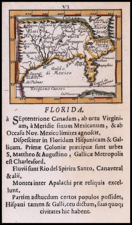
Rare Southeast regional American map, published by Johann Ulrich Muller. Highly coveted miniature map of Florida, the Gulf Coast, Texas, the Mississippi Valley and the Mid-Atlantic, extending northward to Lac du Chat (Ontario?). Excellent detail...
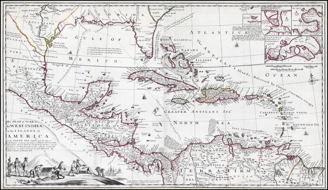
Striking old color example of this rare separately issued map of the Theater of War during the War of Jenkins Ear, published in London circa 1702, by Robert Morden & Herman Moll. A separately published and very rare English produced map of the War...
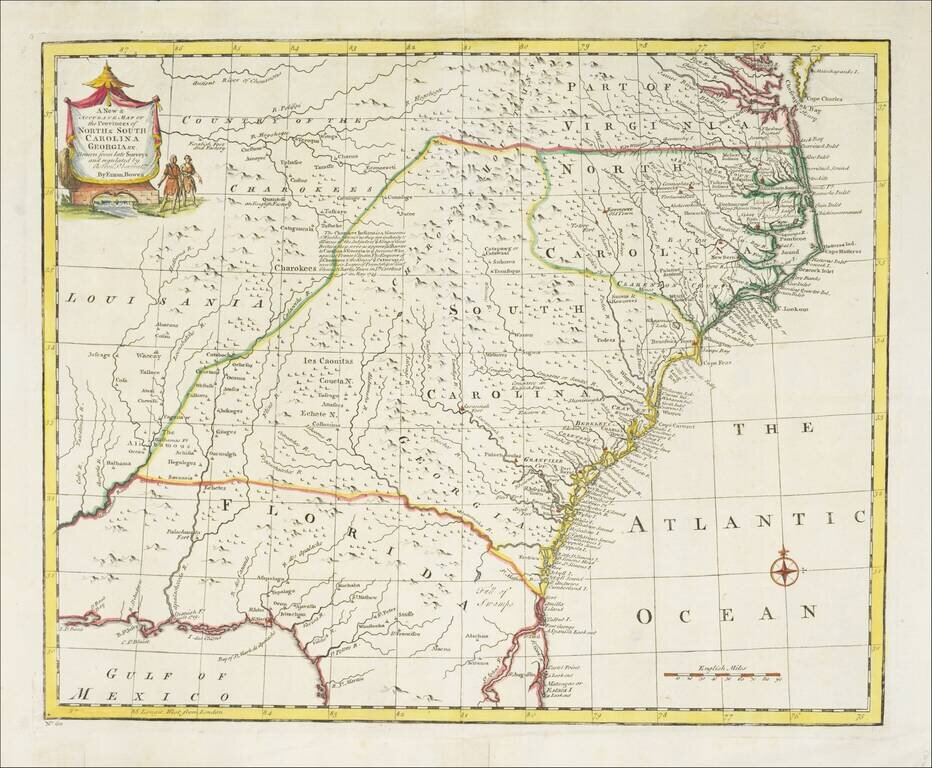
Striking example of Bowen's detailed map of the Carolinas, Georgia and most of Florida, extending west to the Country of the Cherokees and French Louisiana. The map is highly detailed and show many towns, forts, Indian Tribes, mountains, rivers,...